world.wikisort.org - Slovenia
Samotorica (pronounced [samɔˈtoːɾitsa]) is a dispersed settlement in the hills northwest of Horjul in the Inner Carniola region of Slovenia.
Samotorica | |
|---|---|
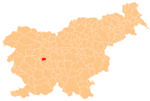
 Samotorica Location in Slovenia | |
| Coordinates: 46°1′47.12″N 14°14′58.12″E | |
| Country | |
| Traditional region | Inner Carniola |
| Statistical region | Central Slovenia |
| Municipality | Horjul |
| Area | |
| • Total | 5.19 km2 (2.00 sq mi) |
| Elevation | 645.4 m (2,117.5 ft) |
| Population (2002) | |
| • Total | 69 |
| [1] | |
Name
Samotorica was first mentioned in written records in 1340 as Zamatůrnicz (and in 1489 as Samotoritz and Samatoritz). The name may be derived from the Slavic common noun *samotvorъ 'natural feature', referring to some striking landscape element, or perhaps from the hypothetical personal name *Samotvor.[2]
Church
The local church in the settlement is dedicated to Saint Michael and belongs to the Parish of Horjul. It contains early 16th-century frescos and a painted wooden ceiling.[3]
References
- Statistical Office of the Republic of Slovenia
- Snoj, Marko (2009). Etimološki slovar slovenskih zemljepisnih imen. Ljubljana: Modrijan. p. 366.
- Horjul municipal site Archived 2009-02-28 at the Wayback Machine
External links
Municipality of Horjul | ||
|---|---|---|
| Settlements | Administrative seat: Horjul
|  |
| Landmarks |
| |
| Notable people |
| |
This article about the Municipality of Horjul in Slovenia is a stub. You can help Wikipedia by expanding it. |
Текст в блоке "Читать" взят с сайта "Википедия" и доступен по лицензии Creative Commons Attribution-ShareAlike; в отдельных случаях могут действовать дополнительные условия.
Другой контент может иметь иную лицензию. Перед использованием материалов сайта WikiSort.org внимательно изучите правила лицензирования конкретных элементов наполнения сайта.
Другой контент может иметь иную лицензию. Перед использованием материалов сайта WikiSort.org внимательно изучите правила лицензирования конкретных элементов наполнения сайта.
2019-2026
WikiSort.org - проект по пересортировке и дополнению контента Википедии
WikiSort.org - проект по пересортировке и дополнению контента Википедии