world.wikisort.org - Slovenia
Mala Štanga (pronounced [ˈmaːla ˈʃtaːŋɡa]; German: Stangenwald,[2] Stangen[3]) is a small dispersed settlement in the Municipality of Šmartno pri Litiji in central Slovenia. It lies in the Sava Hills (Slovene: Posavsko hribovje) west of Litija. The area is part of the historical region of Lower Carniola. The municipality is now included in the Central Slovenia Statistical Region.[4]
Mala Štanga | |
|---|---|
 | |
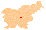
 Mala Štanga Location in Slovenia | |
| Coordinates: 46°3′35.75″N 14°45′14.08″E | |
| Country | |
| Traditional region | Lower Carniola |
| Statistical region | Central Slovenia |
| Municipality | Šmartno pri Litiji |
| Area | |
| • Total | 1.81 km2 (0.70 sq mi) |
| Elevation | 529.1 m (1,735.9 ft) |
| Population (2002) | |
| • Total | 26 |
| [1] | |
An Early Iron Age hillfort has been identified on a hill to the east of the settlement, although the usual associated burial ground has yet to be found.[5]
References
- Statistical Office of the Republic of Slovenia
- Klun, V. F. 1852. Archiv für die Landesgeschichte des Herzogthums Krain. Vol. 1. Ljubljana: Kleinmayr & Bamberg, p. 116
- Leksikon občin kraljestev in dežel zastopanih v državnem zboru, vol. 6: Kranjsko. 1906. Vienna: C. Kr. Dvorna in Državna Tiskarna, p. 96.
- Šmartno pri Litiji municipal site
- "EŠD 19943". Registry of Immovable Cultural Heritage (in Slovenian). Ministry of Culture of the Republic of Slovenia. Retrieved 9 September 2011.
External links
- Mala Štanga at Geopedia
 Media related to Mala Štanga at Wikimedia Commons
Municipality of Šmartno pri Litiji | ||||||
|---|---|---|---|---|---|---|
| Settlements | Administrative seat: Šmartno pri Litiji
|  | ||||
| Landmarks |
| |||||
| Notable people |
| |||||
This article about the Municipality of Šmartno pri Litiji in Slovenia is a stub. You can help Wikipedia by expanding it. |
Текст в блоке "Читать" взят с сайта "Википедия" и доступен по лицензии Creative Commons Attribution-ShareAlike; в отдельных случаях могут действовать дополнительные условия.
Другой контент может иметь иную лицензию. Перед использованием материалов сайта WikiSort.org внимательно изучите правила лицензирования конкретных элементов наполнения сайта.
Другой контент может иметь иную лицензию. Перед использованием материалов сайта WikiSort.org внимательно изучите правила лицензирования конкретных элементов наполнения сайта.
2019-2025
WikiSort.org - проект по пересортировке и дополнению контента Википедии
WikiSort.org - проект по пересортировке и дополнению контента Википедии