world.wikisort.org - Slovenia
Hlaponci (pronounced [ˈxlaːpɔntsi]) is a settlement in the Municipality of Juršinci in northeastern Slovenia. It lies in the valley of a minor left tributary of the Pesnica River in the Slovene Hills (Slovene: Slovenske gorice). The area is part of the traditional region of Styria. It is now included with the rest of the municipality in the Drava Statistical Region.[2]
Hlaponci | |
|---|---|
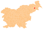
 Hlaponci Location in Slovenia | |
| Coordinates: 46°28′5.07″N 15°58′38.53″E | |
| Country | |
| Traditional region | Styria |
| Statistical region | Drava |
| Municipality | Juršinci |
| Area | |
| • Total | 4.61 km2 (1.78 sq mi) |
| Elevation | 228.4 m (749.3 ft) |
| Population (2002) | |
| • Total | 243 |
| [1] | |
A small chapel-shrine with a belfry in the southwestern part of the settlement was built in the second half of the 19th century.[3]
References
External links
Municipality of Juršinci | ||||||
|---|---|---|---|---|---|---|
| Settlements | Administrative seat: Juršinci
|  | ||||
| Notable people |
| |||||
This article about the Municipality of Juršinci in Slovenia is a stub. You can help Wikipedia by expanding it. |
Текст в блоке "Читать" взят с сайта "Википедия" и доступен по лицензии Creative Commons Attribution-ShareAlike; в отдельных случаях могут действовать дополнительные условия.
Другой контент может иметь иную лицензию. Перед использованием материалов сайта WikiSort.org внимательно изучите правила лицензирования конкретных элементов наполнения сайта.
Другой контент может иметь иную лицензию. Перед использованием материалов сайта WikiSort.org внимательно изучите правила лицензирования конкретных элементов наполнения сайта.
2019-2025
WikiSort.org - проект по пересортировке и дополнению контента Википедии
WikiSort.org - проект по пересортировке и дополнению контента Википедии