world.wikisort.org - Serbia
The Zaječar District (Serbian: Зајечарски округ, romanized: Zaječarski okrug, pronounced [zâjɛtʃarskiː ôkruːɡ]) is one of nine administrative districts of Southern and Eastern Serbia. It expands to the eastern parts of Serbia. It has a population of 119,967 inhabitants, according to the 2011 census results. The administrative center is the city of Zaječar.
Zaječarski okrug Зајечарски округ | |
|---|---|
District of Serbia | |
|
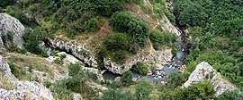
Images from the Zaječar District | |
 Location of the Zaječar District within Serbia | |
| Coordinates: 43°55′N 22°18′E | |
| Country | |
| Region | Southern and Eastern Serbia |
| Administrative center | Zaječar |
| Government | |
| • Commissioner | Vladan Paunović |
| Area | |
| • Total | 3,623 km2 (1,399 sq mi) |
| Population (2011 census) | |
| • Total | 119,967 |
| • Density | 33.1/km2 (86/sq mi) |
| ISO 3166 code | RS-15 |
| Municipalities | 3 and 1 city |
| Settlements | 173 |
| - Cities and towns | 5 |
| - Villages | 168 |
| Website | zajecarski |
Municipalities
It encompasses the municipalities of:
- Boljevac
- Zaječar
- Knjaževac
- Sokobanja
Demographics
| Year | Pop. | ±% |
|---|---|---|
| 1948 | 173,603 | — |
| 1953 | 177,332 | +2.1% |
| 1961 | 178,623 | +0.7% |
| 1971 | 172,424 | −3.5% |
| 1981 | 170,682 | −1.0% |
| 1991 | 158,131 | −7.4% |
| 2002 | 137,561 | −13.0% |
| 2011 | 119,967 | −12.8% |
| Source: [1] | ||
According to the last official census done in 2011, the Zaječar District has 119,967 inhabitants.
Ethnic groups
Ethnic groups of the district according to the 2011 census results:[2]
- Serbs = 105,231 (87.72%)
- Vlachs = 6,561 (5.47%)
- Roma = 2,042 (1.70%)
- Macedonians = 234 (0.20%)
- Bulgarians = 223 (0.19%)
- Montenegrins = 140 (0.12%)
- Croats = 119 (0.10%)
History
Felix Romuliana (Galerius' Palace) in modern Gamzigrad is the birthplace of the Roman Emperor Gaius Galerius Valerius Maxmimianus, in late 3rd century and early 4th century. Because of its archaeological findings, Gamzigrad ranks among the most important late Roman sites in the world. The rich historic material (jewelry, mosaics, coins, tools, arms) found here is a treasure trove of Roman civilization of the 4th century A.D.
Roman Emperors
Three Roman Emperors were born in the Zaječar District:
- Galerius ruled 293–311
- Maximinus II ruled 305–312
- Licinius ruled 308–324
Economy
Trends of economic development of the Zaječar District lead from crafts and semi-industrial processing of agricultural products over coal exploitation (textile factory, leather factory, brewery, quartz sand mine and coal mine) to the modern plants and high output rate.
See also
- Administrative divisions of Serbia
- Districts of Serbia
References
- "2011 Census of Population, Households and Dwellings in the Republic of Serbia" (PDF). stat.gov.rs. Statistical Office of the Republic of Serbia. Retrieved 13 January 2017.
- "Population by ethnicity and sex, by municipalities and cities". Retrieved 14 March 2014.
Note: All official material made by the Government of Serbia is public by law. Information was taken from the official website.
External links
| Wikimedia Commons has media related to Zaječar District. |
- Зајечарски управни округ (Serbian)
Другой контент может иметь иную лицензию. Перед использованием материалов сайта WikiSort.org внимательно изучите правила лицензирования конкретных элементов наполнения сайта.
WikiSort.org - проект по пересортировке и дополнению контента Википедии


