world.wikisort.org - Russia
Ossora (Russian: Оссора; Koryak: Асоран, Asoran) is a selo and the administrative center of Karaginsky District of Koryak Okrug of Kamchatka Krai, Russia.[3] Population: 2,133 (2010 Census);[4] 2,589 (2002 Census);[5] 4,074 (1989 Census).[6]
Ossora
Оссора | |
|---|---|
Selo | |
 Ossora Airport, 2010 | |
Location of Ossora  | |
 Ossora Location of Ossora 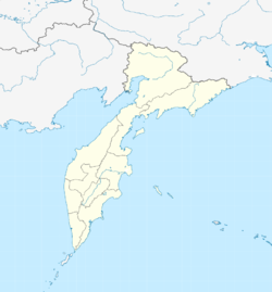 Ossora Ossora (Kamchatka Krai) | |
| Coordinates: 59°14′49″N 163°3′45″E | |
| Country | Russia |
| Federal subject | Kamchatka Krai |
| Administrative district | Karaginsky District |
| Founded | 1937 |
| Elevation | 3 m (10 ft) |
Administrative status | |
| • Capital of | Karaginsky District |
| Time zone | UTC+12 (MSK+9 |
| Postal code(s)[2] | 688700 |
| OKTMO ID | 30824151101 |
Until 2012, Ossora was an urban locality (an urban-type settlement).
Climate
Ossora has a subarctic climate (Köppen: Dfc), The hottest month is July with a monthly mean of 13.4 °C or 56.1 °F, and the coldest month is January with a mean temperature of −15.0 °C or 5.0 °F. While there is a substantial maritime influence vis-à-vis inland areas of the Russian Far East and even vis-à-vis the Sea of Okhotsk coast, the climate is much colder than the western coasts of Europe and North America on similar latitudes, for instance being 6.9 °C (12.4 °F) colder than Juneau and 8.1 °C (14.6 °F) colder than Oslo.
| Climate data for Ossora (Climate ID:32246) | |||||||||||||
|---|---|---|---|---|---|---|---|---|---|---|---|---|---|
| Month | Jan | Feb | Mar | Apr | May | Jun | Jul | Aug | Sep | Oct | Nov | Dec | Year |
| Record high °C (°F) | 2.8 (37.0) |
2.5 (36.5) |
2.7 (36.9) |
10.0 (50.0) |
18.6 (65.5) |
28.3 (82.9) |
29.2 (84.6) |
26.3 (79.3) |
24.0 (75.2) |
14.4 (57.9) |
7.3 (45.1) |
3.4 (38.1) |
29.2 (84.6) |
| Average high °C (°F) | −10.6 (12.9) |
−9.8 (14.4) |
−5.3 (22.5) |
−1.2 (29.8) |
4.6 (40.3) |
12.3 (54.1) |
17.5 (63.5) |
16.6 (61.9) |
12.7 (54.9) |
5.0 (41.0) |
−2.0 (28.4) |
−7.8 (18.0) |
2.7 (36.8) |
| Daily mean °C (°F) | −15.0 (5.0) |
−14.6 (5.7) |
−9.8 (14.4) |
−5.1 (22.8) |
1.6 (34.9) |
8.2 (46.8) |
13.4 (56.1) |
12.2 (54.0) |
9.0 (48.2) |
1.4 (34.5) |
−5.6 (21.9) |
−11.6 (11.1) |
−1.3 (29.6) |
| Average low °C (°F) | −19.9 (−3.8) |
−19.8 (−3.6) |
−14.8 (5.4) |
−9.9 (14.2) |
−1.3 (29.7) |
4.6 (40.3) |
10.0 (50.0) |
10.0 (50.0) |
5.2 (41.4) |
−2.1 (28.2) |
−9.6 (14.7) |
−16.2 (2.8) |
−5.3 (22.4) |
| Record low °C (°F) | −41.1 (−42.0) |
−40.5 (−40.9) |
−40.3 (−40.5) |
−29.7 (−21.5) |
−16.9 (1.6) |
−4.4 (24.1) |
2 (36) |
−0.9 (30.4) |
−6.1 (21.0) |
−17.4 (0.7) |
−32.2 (−26.0) |
−39.4 (−38.9) |
−41.1 (−42.0) |
| Average precipitation mm (inches) | 42 (1.7) |
39 (1.5) |
41 (1.6) |
33 (1.3) |
42 (1.7) |
45 (1.8) |
57 (2.2) |
78 (3.1) |
73 (2.9) |
86 (3.4) |
64 (2.5) |
44 (1.7) |
644 (25.4) |
| Source: Roshydromet[7] | |||||||||||||
References
- "Об исчислении времени". Официальный интернет-портал правовой информации (in Russian). 3 June 2011. Retrieved 19 January 2019.
- Почта России. Информационно-вычислительный центр ОАСУ РПО. (Russian Post). Поиск объектов почтовой связи (Postal Objects Search) (in Russian)
- "Камчатский Край" (in Russian). Government of Kamchatka Krai. 2013. Retrieved 29 June 2018.
- Russian Federal State Statistics Service (2011). Всероссийская перепись населения 2010 года. Том 1 [2010 All-Russian Population Census, vol. 1]. Всероссийская перепись населения 2010 года [2010 All-Russia Population Census] (in Russian). Federal State Statistics Service.
- Russian Federal State Statistics Service (21 May 2004). Численность населения России, субъектов Российской Федерации в составе федеральных округов, районов, городских поселений, сельских населённых пунктов – районных центров и сельских населённых пунктов с населением 3 тысячи и более человек [Population of Russia, Its Federal Districts, Federal Subjects, Districts, Urban Localities, Rural Localities—Administrative Centers, and Rural Localities with Population of Over 3,000] (XLS). Всероссийская перепись населения 2002 года [All-Russia Population Census of 2002] (in Russian).
- Всесоюзная перепись населения 1989 г. Численность наличного населения союзных и автономных республик, автономных областей и округов, краёв, областей, районов, городских поселений и сёл-райцентров [All Union Population Census of 1989: Present Population of Union and Autonomous Republics, Autonomous Oblasts and Okrugs, Krais, Oblasts, Districts, Urban Settlements, and Villages Serving as District Administrative Centers]. Всесоюзная перепись населения 1989 года [All-Union Population Census of 1989] (in Russian). Институт демографии Национального исследовательского университета: Высшая школа экономики [Institute of Demography at the National Research University: Higher School of Economics]. 1989 – via Demoscope Weekly.
- "Climate of Ossora" (in Russian). Weather and Climate (Погода и климат). Retrieved 1 November 2019.
This Kamchatka Krai location article is a stub. You can help Wikipedia by expanding it. |
На других языках
[de] Ossora
Ossora (russisch Оссо́ра) ist eine Siedlung städtischen Typs in der Region Kamtschatka (Russland) mit 2133 Einwohnern (Stand 14. Oktober 2010).[1]- [en] Ossora
[ru] Оссора (посёлок)
Оссо́ра — посёлок (в 1949—2012 — посёлок городского типа), административный центр Карагинского района Камчатского края (до 1 июля 2007 в составе Корякского автономного округа, ныне в составе особой административно-территориальной единицы Камчатского края — Корякского округа) России.Другой контент может иметь иную лицензию. Перед использованием материалов сайта WikiSort.org внимательно изучите правила лицензирования конкретных элементов наполнения сайта.
WikiSort.org - проект по пересортировке и дополнению контента Википедии