world.wikisort.org - Russia
Mayminsky District (Russian: Ма́йминский райо́н; Altay: Майма аймак) is an administrative[1] and municipal[5] district (raion), one of the ten in the Altai Republic, Russia. It is located in the northwest of the republic. The area of the district is 1,285 square kilometers (496 sq mi).[2] Its administrative center is the rural locality (a selo) of Mayma.[1] As of the 2010 Census, the total population of the district was 28,642, with the population of Mayma accounting for 56.5% of that number.[3]
Mayminsky District
Майминский район | |
|---|---|
District | |
| Other transcription(s) | |
| • Altay | Майма аймак |
 The Katun River near the settlement of Barangol in Mayminsky District | |
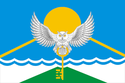 Flag  Coat of arms | |
 Location of Mayminsky District in the Altai Republic | |
| Coordinates: 52°01′N 85°55′E | |
| Country | Russia |
| Federal subject | Altai Republic[1] |
| Established | February 15, 1938 |
| Administrative center | Mayma[1] |
| Area | |
| • Total | 1,285 km2 (496 sq mi) |
| Population (2010 Census)[3] | |
| • Total | 28,642 |
| • Estimate (2018)[4] | 33,939 (+18.5%) |
| • Density | 22/km2 (58/sq mi) |
| • Urban | 0% |
| • Rural | 100% |
| Administrative structure | |
| • Administrative divisions | 6 Rural settlements |
| • Inhabited localities[1] | 25 Rural localities |
| Municipal structure | |
| • Municipally incorporated as | Mayminsky Municipal District[5] |
| • Municipal divisions[5] | 0 Urban settlements, 6 Rural settlements |
| Time zone | UTC+6 (MSK+3 |
| OKTMO ID | 84615000 |
| Website | http://www.maima-altai.ru |
| 2010 Census | 28,642[3] |
|---|---|
| 2002 Census | 26,306[7] |
| 1989 Census | 22,396[8] |
| 1979 Census | 26,955[9] |
History
The district was established on February 15, 1938.[citation needed]
Administrative and municipal status
Within the framework of administrative divisions, Mayminsky District is one of the ten in the Altai Republic.[1] As a municipal division, the district is incorporated as Mayminsky Municipal District.[5] Both administrative[1] and municipal[5] districts are divided into the same six rural settlements, comprising twenty-five rural localities.[1][5] The selo of Mayma serves as the administrative center of both the administrative[1] and municipal[5] district.
Economy
The district's economy is agricultural in nature, with developed beekeeping and the cultivation of hops.
References
Notes
- Law #101-RZ
- "General Information" (in Russian). Mayminsky District. Retrieved August 31, 2016.
- Russian Federal State Statistics Service (2011). Всероссийская перепись населения 2010 года. Том 1 [2010 All-Russian Population Census, vol. 1]. Всероссийская перепись населения 2010 года [2010 All-Russia Population Census] (in Russian). Federal State Statistics Service.
- "26. Численность постоянного населения Российской Федерации по муниципальным образованиям на 1 января 2018 года". Federal State Statistics Service. Retrieved January 23, 2019.
- Law #10-RZ
- "Об исчислении времени". Официальный интернет-портал правовой информации (in Russian). June 3, 2011. Retrieved January 19, 2019.
- Russian Federal State Statistics Service (May 21, 2004). Численность населения России, субъектов Российской Федерации в составе федеральных округов, районов, городских поселений, сельских населённых пунктов – районных центров и сельских населённых пунктов с населением 3 тысячи и более человек [Population of Russia, Its Federal Districts, Federal Subjects, Districts, Urban Localities, Rural Localities—Administrative Centers, and Rural Localities with Population of Over 3,000] (XLS). Всероссийская перепись населения 2002 года [All-Russia Population Census of 2002] (in Russian).
- Всесоюзная перепись населения 1989 г. Численность наличного населения союзных и автономных республик, автономных областей и округов, краёв, областей, районов, городских поселений и сёл-райцентров [All Union Population Census of 1989: Present Population of Union and Autonomous Republics, Autonomous Oblasts and Okrugs, Krais, Oblasts, Districts, Urban Settlements, and Villages Serving as District Administrative Centers]. Всесоюзная перепись населения 1989 года [All-Union Population Census of 1989] (in Russian). Институт демографии Национального исследовательского университета: Высшая школа экономики [Institute of Demography at the National Research University: Higher School of Economics]. 1989 – via Demoscope Weekly.
- Всесоюзная перепись населения 1979 г. Национальный состав населения по регионам России [All Union Population Census of 1979. Ethnic composition of the population by regions of Russia] (XLS). Всесоюзная перепись населения 1979 года [All-Union Population Census of 1979] (in Russian). 1979 – via Demoscope Weekly (website of the Institute of Demographics of the State University—Higher School of Economics.
Sources
- Государственное Собрание —Эл Курултай Республики Алтай. Закон №101-РЗ от 10 ноября 2008 г. «Об административно-территориальном устройстве Республики Алтай», в ред. Закона №51-РЗ от 6 октября 2015 г. «О внесении изменений в Закон Республики Алтай "Об административно-территориальном устройстве Республики Алтай"». Вступил в силу по истечении 10 дней после дня официального опубликования. Опубликован: Приложение к газете "Звезда Алтая", 14 ноября 2008 г. (State Assembly of the Altai Republic—El Kurultai. Law #101-RZ of November 10, 2008 On the Administrative and Territorial Structure of the Altai Republic, as amended by the Law #51-RZ of October 6, 2015 On Amending the Law of the Altai Republic "On the Administrative and Territorial Structure of the Altai Republic". Effective as of after 10 days after the official publication day.).
- Государственное Собрание —Эл Курултай Республики Алтай. Закон №10-РЗ от 13 января 2005 г. «Об образовании муниципальных образований, наделении соответствующим статусом и установлении их границ», в ред. Закона №12-РЗ от 31 марта 2015 г. «О преобразовании муниципальных образований на территории Майминского района Республики Алтай и о внесении изменений в Закон Республики Алтай "Об образовании муниципальных образований, наделении соответствующим статусом и установлении их границ"». Опубликован: "Звезда Алтая", №7–8, №23–24, 18 января 2005 г., 5 февраля 2005 г. (State Assembly of the Altai Republic—El Kurultai. Law #10-RZ of January 13, 2005 On Establishing the Municipal Formations, on Granting Them an Appropriate Status, and on Establishing Their Borders, as amended by the Law #12-RZ of March 31, 2015 On the Transformation of the Municipal Formations on the Territory of Mayminsky District of the Altai Republic and on Amending the Law of the Altai Republic "On Establishing the Municipal Formations, on Granting Them an Appropriate Status, and on Establishing Their Borders". ).
Administrative divisions of the Altai Republic | ||
|---|---|---|
Administrative center: Gorno-Altaysk • Rural localities | ||
| Districts |
| |
| Urban okrugs | ||
Rural localities in Mayminsky District | |||
|---|---|---|---|
| |||
| Authority control |
|
|---|
На других языках
- [en] Mayminsky District
[ru] Майминский район
Ма́йминский район или аймак (южно-алт. Майма аймак) — административно-территориальная единица и муниципальное образование (муниципальный район) в составе Республики Алтай Российской Федерации.Другой контент может иметь иную лицензию. Перед использованием материалов сайта WikiSort.org внимательно изучите правила лицензирования конкретных элементов наполнения сайта.
WikiSort.org - проект по пересортировке и дополнению контента Википедии