world.wikisort.org - Russia
Maloyaroslavets (Russian: Малояросла́вец) is a town and the administrative center of Maloyaroslavetsky District in Kaluga Oblast, Russia, located on the right bank of the Luzha River (Oka's basin), 61 kilometers (38 mi) northeast of Kaluga, the administrative center of the oblast. Population: 30,392 (2010 Census);[2] 31,606 (2002 Census);[7] 26,582 (1989 Census);[8] 21,200 (1970).
Maloyaroslavets
Малоярославец | |
|---|---|
Town[1] | |
 A town square in Maloyaroslavets | |
 Flag  Coat of arms | |
Location of Maloyaroslavets  | |
 Maloyaroslavets Location of Maloyaroslavets 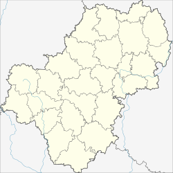 Maloyaroslavets Maloyaroslavets (Kaluga Oblast) | |
| Coordinates: 55°01′N 36°28′E | |
| Country | Russia |
| Federal subject | Kaluga Oblast[1] |
| Administrative district | Maloyaroslavetsky District[1] |
| Founded | late 14th century |
| Elevation | 190 m (620 ft) |
| Population | |
| • Total | 30,392 |
| • Estimate (2018)[3] | 27,448 (−9.7%) |
Administrative status | |
| • Capital of | Maloyaroslavetsky District[1] |
Municipal status | |
| • Municipal district | Maloyaroslavetsky Municipal District[4] |
| • Urban settlement | Maloyaroslavets Urban Settlement[4] |
| • Capital of | Maloyaroslavetsky Municipal District[4], Maloyaroslavets Urban Settlement[4] |
| Time zone | UTC+3 (MSK |
| Postal code(s)[6] | 249091–249094, 249096 |
| OKTMO ID | 29623101001 |
| Website | www |
History
It was founded in the late 14th century by Vladimir the Bold and named Yaroslavets after his son Yaroslav.[9] In 1485, the town was annexed by the Grand Duchy of Moscow and renamed Maloyaroslavets to distinguish it from Yaroslavl.[citation needed] During the French invasion of Russia, the Battle of Maloyaroslavets took place near this town on October 12 (24) of 1812. The battle was commemorated by a roomy cathedral built at the Black Island (Chyornoostrovsky) Convent of Maloyaroslavets by 1843.

A number of fierce battles were also fought near Maloyaroslavets during the Battle of Moscow in 1941–1942. The town was under German occupation from 18 October 1941 until 2 January 1942. It was liberated by troops of the Western Front of the Red Army.[10]
Administrative and municipal status
Within the framework of administrative divisions, Maloyaroslavets serves as the administrative center of Maloyaroslavetsky District, to which it is directly subordinated.[1] As a municipal division, the town of Maloyaroslavets is incorporated within Maloyaroslavetsky Municipal District as Maloyaroslavets Urban Settlement.[4]
Twin towns and sister cities
Maloyaroslavets is twinned with:
Gallery
 Inside the Cathedral in the Convent of Saint Nicholas
 A neighborhood
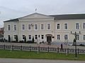 Administration building
 Street view
 Railroad station


References
Notes
- Государственный комитет Российской Федерации по статистике. Комитет Российской Федерации по стандартизации, метрологии и сертификации. №ОК 019-95 1 января 1997 г. «Общероссийский классификатор объектов административно-территориального деления. Код 29 223», в ред. изменения №278/2015 от 1 января 2016 г.. (State Statistics Committee of the Russian Federation. Committee of the Russian Federation on Standardization, Metrology, and Certification. #OK 019-95 January 1, 1997 Russian Classification of Objects of Administrative Division (OKATO). Code 29 223, as amended by the Amendment #278/2015 of January 1, 2016. ).
- Russian Federal State Statistics Service (2011). Всероссийская перепись населения 2010 года. Том 1 [2010 All-Russian Population Census, vol. 1]. Всероссийская перепись населения 2010 года [2010 All-Russia Population Census] (in Russian). Federal State Statistics Service.
- "26. Численность постоянного населения Российской Федерации по муниципальным образованиям на 1 января 2018 года". Federal State Statistics Service. Retrieved January 23, 2019.
- Law #7-OZ
- "Об исчислении времени". Официальный интернет-портал правовой информации (in Russian). June 3, 2011. Retrieved January 19, 2019.
- Почта России. Информационно-вычислительный центр ОАСУ РПО. (Russian Post). Поиск объектов почтовой связи (Postal Objects Search) (in Russian)
- Russian Federal State Statistics Service (May 21, 2004). Численность населения России, субъектов Российской Федерации в составе федеральных округов, районов, городских поселений, сельских населённых пунктов – районных центров и сельских населённых пунктов с населением 3 тысячи и более человек [Population of Russia, Its Federal Districts, Federal Subjects, Districts, Urban Localities, Rural Localities—Administrative Centers, and Rural Localities with Population of Over 3,000] (XLS). Всероссийская перепись населения 2002 года [All-Russia Population Census of 2002] (in Russian).
- Всесоюзная перепись населения 1989 г. Численность наличного населения союзных и автономных республик, автономных областей и округов, краёв, областей, районов, городских поселений и сёл-райцентров [All Union Population Census of 1989: Present Population of Union and Autonomous Republics, Autonomous Oblasts and Okrugs, Krais, Oblasts, Districts, Urban Settlements, and Villages Serving as District Administrative Centers]. Всесоюзная перепись населения 1989 года [All-Union Population Census of 1989] (in Russian). Институт демографии Национального исследовательского университета: Высшая школа экономики [Institute of Demography at the National Research University: Higher School of Economics]. 1989 – via Demoscope Weekly.
- "Ярослав (Афанасий) Владимирович". Brockhaus and Efron Encyclopedic Dictionary: In 86 Volumes (82 Volumes and 4 Additional Volumes). St. Petersburg. 1890–1907.
- Освобождение городов
Sources
- Законодательное Собрание Калужской области. Закон №7-ОЗ от 28 декабря 2004 г. «Об установлении границ муниципальных образований, расположенных на территории административно-территориальных единиц "Бабынинский район", "Боровский район", "Дзержинский район", "Жиздринский район", "Жуковский район", "Износковский район", "Козельский район", "Малоярославецкий район", "Мосальский район", "Ферзиковский район", "Хвастовичский район", "город Калуга", "город Обнинск", и наделении их статусом городского поселения, сельского поселения, городского округа, муниципального района», в ред. Закона №620-ОЗ от 29 сентября 2014 г. «О внесении изменений в Закон Калужской области "Об установлении границ муниципальных образований, расположенных на территории административно-территориальных единиц "Бабынинский район", "Боровский район", "Дзержинский район", "Жиздринский район", "Жуковский район", "Износковский район", "Козельский район", "Малоярославецкий район", "Мосальский район", "Ферзиковский район", "Хвастовичский район", "город Калуга", "город Обнинск", и наделении их статусом городского поселения, сельского поселения, городского округа, муниципального района"». Вступил в силу после официального опубликования, за исключением положений о муниципальном образовании "Город Калуга", для которых установлены иные сроки вступления в силу. Опубликован: "Весть", №402–404, 29 декабря 2004 г. (Legislative Assembly of Kaluga Oblast. Law #7-OZ of December 28, 2004 On Establishing the Borders of the Municipal Formations Located on the Territory of the Administrative-Territorial Units of "Babyninsky District", "Borovsky District", "Dzerzhinsky District", "Zhizdrinsky District", "Zhukovsky District", "Iznoskovsky District", "Kozelsky District", "Maloyaroslavetsky District", "Mosalsky District", "Ferzikovsky District", "Khvastovichsky District", "City of Kaluga", "City of Obninsk", and on Granting Them the Status of an Urban Settlement, Rural Settlement, Urban Okrug, Municipal District, as amended by the Law #620-OZ of September 29, 2014 On Amending the Law of Kaluga Oblast "On Establishing the Borders of the Municipal Formations Located on the Territory of the Administrative-Territorial Units of "Babyninsky District", "Borovsky District", "Dzerzhinsky District", "Zhizdrinsky District", "Zhukovsky District", "Iznoskovsky District", "Kozelsky District", "Maloyaroslavetsky District", "Mosalsky District", "Ferzikovsky District", "Khvastovichsky District", "City of Kaluga", "City of Obninsk", and on Granting Them the Status of an Urban Settlement, Rural Settlement, Urban Okrug, Municipal District". Effective as of after the official publication, with the exception of the clauses regarding the municipal formation of the "City of Kaluga", for which different dates of taking effect are specified.).
Further reading
- (in Russian) Maloyaroslavets. Materials for the History of the 17th and 18th centuries (1884) (Малоярославец. Материалы для истории города XVII и XVIII столетий) at Runivers.ru in DjVu and PDF formats
Authority control | |
|---|---|
| General | |
| National libraries | |
| Other |
|
На других языках
[de] Malojaroslawez
Malojaroslawez (russisch Малояросла́вец) ist eine Stadt mit 30.392 Einwohnern (Stand 14. Oktober 2010) in der Oblast Kaluga, Russland.[1] Sie liegt am rechten Ufer des Flusses Luscha, einem rechten Nebenfluss der Protwa, etwa 60 Kilometer von der Gebietshauptstadt Kaluga entfernt. Unmittelbar an Malojaroslawez grenzt die Stadt Obninsk an.- [en] Maloyaroslavets
[ru] Малоярославец
Малояросла́вец — город на правом берегу реки Лужи (бассейн Оки), в 61 км к северо-востоку от Калуги. Административный центр Малоярославецкого района Калужской области. Город воинской славы.Другой контент может иметь иную лицензию. Перед использованием материалов сайта WikiSort.org внимательно изучите правила лицензирования конкретных элементов наполнения сайта.
WikiSort.org - проект по пересортировке и дополнению контента Википедии