world.wikisort.org - Russia
Lazarevo (Russian: Лазарево) is a small town in Leninsky District in the Jewish Autonomous Oblast, Russia. It is the head of Lazarevskoye Rural Settlement.[1]
Lazarevo
Лазарево | |
|---|---|
Town | |
Location of Lazarevo  | |
 Lazarevo Location of Lazarevo 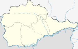 Lazarevo Lazarevo (Jewish Autonomous Oblast) | |
| Coordinates: 48°14′27″N 132°26′37″E | |
| Country | Russia |
| Federal subject | Jewish Autonomous Oblast |
| Administrative district | Leninsky District[1] |
| Population | |
| • Total | 751 |
Municipal status | |
| • Capital of | Lazarevskoye Rural Settlement[1] |
| Time zone | UTC+10 (MSK+7 |
| OKTMO ID | 99610455101 |
Geography
Lazarevo is located at an elevation of 140 meters (460 ft) by a small mountain range north of the Amur River.[4] The town lies 86 kilometers (53 mi) southwest of Birobidzhan, the administrative center of the autonomous oblast.[5] Its population is 751 (2010 Census);[2]
History
Lazarevo is the birthplace of Soviet Arctic explorer Georgy Ushakov (1901 - 1963) who fully surveyed and charted Severnaya Zemlya for the first time in history.[6]
References
- Закон Еврейской автономной области от 26 ноября 2003 года № 231-ОЗ «О статусе и границе Ленинского муниципального района»(Law of the Jewish Autonomous Region on November 26, 2003 № 231-OZ, "On the status of the border and Leninsky municipal district")
- Russian Federal State Statistics Service (2011). Всероссийская перепись населения 2010 года. Том 1 [2010 All-Russian Population Census, vol. 1]. Всероссийская перепись населения 2010 года [2010 All-Russia Population Census] (in Russian). Federal State Statistics Service.
- "Об исчислении времени". Официальный интернет-портал правовой информации (in Russian). 3 June 2011. Retrieved 19 January 2019.
- GoogleEarth
- "Lazarevo". Mapcarta. Retrieved 23 November 2016.
- Biography of G. A. Ushakov Archived 2011-07-25 at the Wayback Machine at Polar World.
Administrative divisions of the Jewish Autonomous Oblast | |||
|---|---|---|---|
Administrative center: Birobidzhan • Rural localities | |||
| Districts |
| ||
| Towns | |||
| Urban-type settlements |
| ||
На других языках
- [en] Lazarevo, Jewish Autonomous Oblast
[ru] Лазарево (Еврейская автономная область)
Ла́зарево — село в Ленинском районе Еврейской автономной области, административный центр Лазаревского сельского поселения. Население — 751[1] чел. (2010).Текст в блоке "Читать" взят с сайта "Википедия" и доступен по лицензии Creative Commons Attribution-ShareAlike; в отдельных случаях могут действовать дополнительные условия.
Другой контент может иметь иную лицензию. Перед использованием материалов сайта WikiSort.org внимательно изучите правила лицензирования конкретных элементов наполнения сайта.
Другой контент может иметь иную лицензию. Перед использованием материалов сайта WikiSort.org внимательно изучите правила лицензирования конкретных элементов наполнения сайта.
2019-2025
WikiSort.org - проект по пересортировке и дополнению контента Википедии
WikiSort.org - проект по пересортировке и дополнению контента Википедии