world.wikisort.org - Romania
Răcari is a town located in Dâmbovița County, Muntenia, Romania. It administers seven villages: Bălănești, Colacu, Ghergani, Ghimpați, Mavrodin, Săbiești and Stănești. It was declared a town in 2004.
Răcari | |
|---|---|
Town | |
 World War I monument | |
 Coat of arms | |
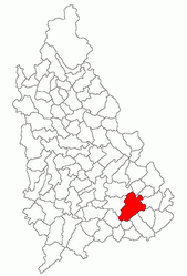 Location in Dâmbovița County | |
 Răcari Location in Romania | |
| Coordinates: 44°38′N 25°44′E | |
| Country | Romania |
| County | Dâmbovița |
| Government | |
| • Mayor (2020–2024) | Marius-Florin Caravețeanu[1] (PNL) |
| Area | 78.94 km2 (30.48 sq mi) |
| Elevation | 140 m (460 ft) |
| Population (2011)[2] | 6,930 |
| • Density | 88/km2 (230/sq mi) |
| Time zone | EET/EEST (UTC+2/+3) |
| Postal code | 137385 |
| Vehicle reg. | DB |
| Website | primariaracari |
The town is located in the southeastern part of the county, 40 km (25 mi) northwest of Bucharest, on road DN7. It lies in the Wallachian Plain, at an altitude of 140 m (460 ft), and is traversed by the rivers Colentina and Ilfov. Răcari borders the following communes: Bilciurești and Cojasca to the north, Tărtășești and Ciocănești to the south, Butimanu to the east, and Conțești and Cornățelu to the west.
| Year | Pop. | ±% |
|---|---|---|
| 1948 | 2,519 | — |
| 2002 | 6,892 | +173.6% |
| 2011 | 6,638 | −3.7% |
| Source: Census data | ||
Notable residents
- Ion Ghica, Prince of Samos (1854–1859) and the 5th Prime Minister of Romania (1866), died in 1897 at his estate in Ghergani.
- Donar Munteanu (1886–1972), a poet, was born in Răcari.
References
Wikimedia Commons has media related to Răcari.
- "Results of the 2020 local elections". Central Electoral Bureau. Retrieved 8 June 2021.
- "Populaţia stabilă pe judeţe, municipii, oraşe şi localităti componenete la RPL_2011" (XLS). National Institute of Statistics.
Dâmbovița County, Romania | ||
|---|---|---|
| Cities |
|  |
| Towns | ||
| Communes |
| |
| Authority control |
|
|---|
This Dâmbovița County location article is a stub. You can help Wikipedia by expanding it. |
На других языках
- [en] Răcari
[ru] Ракари
Ракари (рум. Răcari) — город в Румынии в составе жудеца Дымбовица.Текст в блоке "Читать" взят с сайта "Википедия" и доступен по лицензии Creative Commons Attribution-ShareAlike; в отдельных случаях могут действовать дополнительные условия.
Другой контент может иметь иную лицензию. Перед использованием материалов сайта WikiSort.org внимательно изучите правила лицензирования конкретных элементов наполнения сайта.
Другой контент может иметь иную лицензию. Перед использованием материалов сайта WikiSort.org внимательно изучите правила лицензирования конкретных элементов наполнения сайта.
2019-2026
WikiSort.org - проект по пересортировке и дополнению контента Википедии
WikiSort.org - проект по пересортировке и дополнению контента Википедии