world.wikisort.org - Portugal
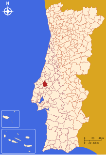
Rio Maior (Portuguese pronunciation: [ˈʁi.u mɐˈjɔɾ] (![]() listen)) is a municipality in the Santarém District in Portugal. The population in 2011 was 21,192,[1] in an area of 272.76 km².[2]
listen)) is a municipality in the Santarém District in Portugal. The population in 2011 was 21,192,[1] in an area of 272.76 km².[2]
Rio Maior | |
|---|---|
Municipality | |
 Flag  Coat of arms | |
 | |
| Coordinates: 39°20′N 8°56′W | |
| Country | |
| Region | Alentejo |
| Intermunic. comm. | Lezíria do Tejo |
| District | Santarém |
| Parishes | 10 |
| Government | |
| • President | Luís Filipe Santana Dias (PSD) |
| Area | |
| • Total | 272.76 km2 (105.31 sq mi) |
| Population (2011) | |
| • Total | 21,192 |
| • Density | 78/km2 (200/sq mi) |
| Time zone | UTC±00:00 (WET) |
| • Summer (DST) | UTC+01:00 (WEST) |
| Local holiday | November 6 |
| Website | http://www.cm-riomaior.pt |
The present mayor is Isaura Morais of the Social Democratic Party (PSD), the first woman to be elected mayor in the municipality. The municipal holiday is November 6.
Parishes
Administratively, the municipality is divided into ten civil parishes (freguesias):[3]
- Alcobertas
- Arrouquelas
- Asseiceira
- Azambujeira e Malaqueijo
- Fráguas
- Marmeleira e Assentiz
- Outeiro da Cortiçada e Arruda dos Pisões
- Rio Maior
- São João da Ribeira e Ribeira de São João
- São Sebastião
Climate
Rio Maior has a Mediterranean climate with warm to hot, dry summers and mild, wet winters. Rio Maior registered a temperature of 44.9 °C (112.8 °F) on 4 August 2018[4] and −6.2 °C (20.8 °F) on January and February.[5]
| Climate data for Rio Maior, 1961-1990 normals, 1984-2020 precipitation | |||||||||||||
|---|---|---|---|---|---|---|---|---|---|---|---|---|---|
| Month | Jan | Feb | Mar | Apr | May | Jun | Jul | Aug | Sep | Oct | Nov | Dec | Year |
| Record high °C (°F) | 22.1 (71.8) |
26.4 (79.5) |
27.2 (81.0) |
29.0 (84.2) |
37.0 (98.6) |
41.7 (107.1) |
40.7 (105.3) |
41.4 (106.5) |
39.8 (103.6) |
34.4 (93.9) |
28.7 (83.7) |
22.8 (73.0) |
41.7 (107.1) |
| Average high °C (°F) | 14.7 (58.5) |
15.4 (59.7) |
17.6 (63.7) |
18.9 (66.0) |
21.5 (70.7) |
25.0 (77.0) |
27.7 (81.9) |
28.3 (82.9) |
27.4 (81.3) |
23.0 (73.4) |
17.9 (64.2) |
15.1 (59.2) |
21.0 (69.9) |
| Daily mean °C (°F) | 9.1 (48.4) |
10.2 (50.4) |
11.8 (53.2) |
13.3 (55.9) |
15.7 (60.3) |
18.8 (65.8) |
21.2 (70.2) |
21.5 (70.7) |
20.2 (68.4) |
16.6 (61.9) |
12.3 (54.1) |
9.7 (49.5) |
15.0 (59.1) |
| Average low °C (°F) | 3.5 (38.3) |
5.0 (41.0) |
6.0 (42.8) |
7.7 (45.9) |
9.9 (49.8) |
12.6 (54.7) |
14.7 (58.5) |
14.7 (58.5) |
13.0 (55.4) |
10.2 (50.4) |
6.7 (44.1) |
4.3 (39.7) |
9.0 (48.3) |
| Average precipitation mm (inches) | 104.0 (4.09) |
72.2 (2.84) |
55.1 (2.17) |
63.7 (2.51) |
58.9 (2.32) |
16.5 (0.65) |
8.2 (0.32) |
6.4 (0.25) |
40.5 (1.59) |
96.0 (3.78) |
113.4 (4.46) |
113.8 (4.48) |
748.7 (29.46) |
| Average relative humidity (%) | 88 | 85 | 78 | 74 | 71 | 70 | 68 | 66 | 71 | 81 | 87 | 89 | 77 |
| Source: IPMA,[5] Portuguese Environment Agency[6] | |||||||||||||
Notable people
- Duarte da Silva Marques (born 1983 in Rio Maior) a triathlete, competed at the 2008 Summer Olympics
- Pedro Oliveira (born 1988 in Rio Maior) a backstroke and butterfly swimmer, participated in the 2008 & 2012 Summer Olympics
- Miguel Carvalho (born 1994) a racewalker, took part in the 2016 Summer Olympics
References
- Instituto Nacional de Estatística
- "Áreas das freguesias, concelhos, distritos e país". Archived from the original on 2018-11-05. Retrieved 2018-11-05.
- "Law nr. 11-A/2013, pages 552, 103-104" (PDF). Diário da República (in Portuguese). Retrieved 29 July 2014.
- "August 2018 bulletin" (PDF). IPMA. Retrieved 19 June 2021.
- "Plano Municipal de Defesa da Floresta Contra Incêndios" (PDF). Rio Maior Municipality. Retrieved 19 June 2021.
- "SNIRH > Dados de Base". snirh.apambiente.pt. Retrieved 19 June 2021.
External links
| Wikivoyage has a travel guide for Rio Maior. |
Authority control | |
|---|---|
| General |
|
| National libraries | |
This Santarém location article is a stub. You can help Wikipedia by expanding it. |
На других языках
[de] Rio Maior
Rio Maior ist eine Gemeinde und Stadt in Portugal. Die Gemeinde zählte am 30. Juni 2011 21.192 Einwohner, wovon 12.005 innerhalb der Stadt leben[3].- [en] Rio Maior
[es] Rio Maior
Rio Maior es una ciudad portuguesa perteneciente al Distrito de Santarém, en Ribatejo, con cerca de 11 500 habitantes en su núcleo principal y un total de unos 22 000 dentro de su término municipal. Desde 2002 está integrada en la região estatística (NUTS II) de Alentejo y en la subregião estatística (NUTS III) de Lezíria do Tejo; hasta 2002 era parte de la antigua región de Lisboa y Valle del Tajo. Antes, pertenecía a la antigua provincia de Ribatejo.[ru] Риу-Майор
Риу-Майор (порт. Rio Maior; [ʁiu mɐi'ɔɾ]) — город в Португалии, центр одноимённого муниципалитета в составе округа Сантарен. Численность населения — 11,5 тыс. жителей (город), 21,1 тыс. жителей (муниципалитет). Город и муниципалитет входит в экономико-статистический регион Алентежу и субрегион Лезирия-ду-Тежу. По старому административному делению входил в провинцию Рибатежу.Текст в блоке "Читать" взят с сайта "Википедия" и доступен по лицензии Creative Commons Attribution-ShareAlike; в отдельных случаях могут действовать дополнительные условия.
Другой контент может иметь иную лицензию. Перед использованием материалов сайта WikiSort.org внимательно изучите правила лицензирования конкретных элементов наполнения сайта.
Другой контент может иметь иную лицензию. Перед использованием материалов сайта WikiSort.org внимательно изучите правила лицензирования конкретных элементов наполнения сайта.
2019-2025
WikiSort.org - проект по пересортировке и дополнению контента Википедии
WikiSort.org - проект по пересортировке и дополнению контента Википедии