world.wikisort.org - Portugal
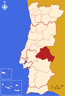
The Comunidade Intermunicipal do Alto Alentejo (Portuguese pronunciation: [ˈaɫtu ɐlẽˈtɛʒu]; English: Upper Alentejo) is an administrative division in Portugal. It was created in 2009.[1] The seat of the intermunicipal community is Portalegre. Alto Alentejo is coterminous with the former Portalegre District. The population in 2011 was 118,506,[2] in an area of 6,084.34 km².[3] Together with Alentejo Central it covers the area of the former Alto Alentejo Province. With Ponte de Sor the intermunicipal community also includes one municipality that lies in the area of the former Ribatejo Province.
Alto Alentejo | |
|---|---|
Intermunicipal community | |
 | |
| Coordinates: 39.29°N 7.43°W | |
| Country | |
| Region | Alentejo |
| Established | 2009 |
| Seat | Portalegre |
| Municipalities | 15 |
| Area | |
| • Total | 6,084.34 km2 (2,349.18 sq mi) |
| Population (2011) | |
| • Total | 118,506 |
| • Density | 19/km2 (50/sq mi) |
| Time zone | UTC±00:00 (WET) |
| • Summer (DST) | UTC+01:00 (WEST) |
| Website | www |
Alto Alentejo is also a NUTS3 subregion of Alentejo Region, in Portugal. Since January 2015, the NUTS 3 subregion covers the same area as the intermunicipal community.[4]
Municipalities
The CIM Alto Alentejo is composed of 15 municipalities:[5]
| Municipality | Population (2011)[2] | Area (km²)[3] |
|---|---|---|
| Alter do Chão | 3,562 | 362.07 |
| Arronches | 3,165 | 314.65 |
| Avis | 4,571 | 605.97 |
| Campo Maior | 8,456 | 247.20 |
| Castelo de Vide | 3,407 | 264.91 |
| Crato | 3,708 | 398.07 |
| Elvas | 23,078 | 631.29 |
| Fronteira | 3,410 | 248.60 |
| Gavião | 4,132 | 294.59 |
| Marvão | 3,512 | 154.90 |
| Monforte | 3,329 | 420.25 |
| Nisa | 7,450 | 575.68 |
| Ponte de Sor | 16,722 | 839.71 |
| Portalegre | 24,930 | 447.14 |
| Sousel | 5,074 | 279.32 |
| Total | 118,506 | 6,084.34 |
References
- CIM Alto Alentejo
- Instituto Nacional de Estatística
- "Áreas das freguesias, concelhos, distritos e país". Archived from the original on 2018-11-05. Retrieved 2018-11-05.
- Adequação dos indicadores à nova organização territorial NUTS III / Entidades Intermunicipais, Instituto Nacional de Estatística, 18 March 2015
- "Law nr. 75/2013" (PDF). Diário da República (in Portuguese). Assembly of the Republic (Portugal). Retrieved 18 August 2014.
External links
| North Region |
| ||||
|---|---|---|---|---|---|
| Centro Region |
| ||||
| Lisboa Region |
| ||||
| Alentejo Region |
| ||||
| Algarve Region |
| ||||
| Autonomous Regions | |||||
All these divisions are further subdivided into municipalities and parishes. | |||||
Другой контент может иметь иную лицензию. Перед использованием материалов сайта WikiSort.org внимательно изучите правила лицензирования конкретных элементов наполнения сайта.
WikiSort.org - проект по пересортировке и дополнению контента Википедии