world.wikisort.org - Poland
Tatra County (Polish: powiat tatrzański) is a unit of territorial administration and local government (powiat) in Lesser Poland Voivodeship, southern Poland, on the Slovak border. It came into being on January 1, 1999, as a result of the Polish local government reforms passed in 1998. Its administrative seat and only town is Zakopane, which lies 85 kilometres (53 mi) south of the regional capital Kraków. The county takes its name from the Tatra mountain range, which covers most of its territory.
Tatra County
Powiat tatrzański | |
|---|---|
County | |
 Flag  Coat of arms | |
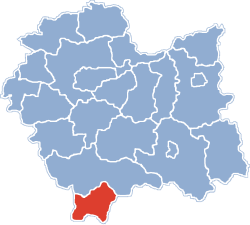 Location within the voivodeship | |
| Coordinates (Zakopane): 49°18′N 19°57′E | |
| Country | |
| Voivodeship | Lesser Poland |
| Seat | Zakopane |
| Gminas | Total 5 (incl. 1 urban) |
| Area | |
| • Total | 471.62 km2 (182.09 sq mi) |
| Population (2006) | |
| • Total | 65,393 |
| • Density | 140/km2 (360/sq mi) |
| • Urban | 27,486 |
| • Rural | 37,907 |
| Car plates | KTT |
| Website | http://www.powiat.tatry.pl |
The county covers an area of 471.62 square kilometres (182.1 sq mi). As of 2006 its total population is 65,393, out of which the population of Zakopane is 27,486 and the rural population is 37,907.
The mountainous southern part of the county (211 km2) makes up the Tatra National Park. This area, together with the Slovak Tatra National Park across the border, make up a UNESCO-designated biosphere reserve.
Neighbouring counties
Tatra County is bordered by only one other Polish county, Nowy Targ County, which lies to the north. To the east, west and south it is bordered by Slovakia (namely, Tvrdošín and Liptovský Mikuláš Districts in Žilina Region to the south and west, and Poprad District in Prešov Region to the south and east).
Administrative division
The county is subdivided into five gminas (one urban and four rural). These are listed in the following table, in descending order of population.
| Gmina | Type | Area (km2) |
Population (2006) |
Seat |
| Zakopane | urban | 84.0 | 27,486 | |
| Gmina Bukowina Tatrzańska | rural | 131.8 | 12,386 | Bukowina Tatrzańska |
| Gmina Poronin | rural | 83.6 | 10,706 | Poronin |
| Gmina Kościelisko | rural | 136.4 | 8,035 | Kościelisko |
| Gmina Biały Dunajec | rural | 35.5 | 6,780 | Biały Dunajec |
See also
References
Gminas of Tatra County | ||
|---|---|---|
| Seat |
|  |
| Rural gminas | ||
Counties of Lesser Poland Voivodeship | ||
|---|---|---|
| City counties |  | |
| Land counties | ||
This Tatra County location article is a stub. You can help Wikipedia by expanding it. |
На других языках
[de] Powiat Tatrzański
Der Powiat Tatrzański ist der südlichste Powiat (Kreis) der polnischen Woiwodschaft Kleinpolen. Er liegt südlich der Beskiden und grenzt im Norden an den Powiat Nowotarski sowie im Süden an die Slowakei.- [en] Tatra County
[ru] Татровский повят
Татровский повят (польск. Powiat tatrzański) — повят (район) в Польше, входит как административная единица в Малопольское воеводство. Центр повята — город Закопане. Занимает площадь 471,62 км². Население — 65 362 человека (на 2005 год).Другой контент может иметь иную лицензию. Перед использованием материалов сайта WikiSort.org внимательно изучите правила лицензирования конкретных элементов наполнения сайта.
WikiSort.org - проект по пересортировке и дополнению контента Википедии