world.wikisort.org - Poland
Korczowa [kɔrˈt͡ʂɔva] (Ukrainian: Корчова, Korchova) is a village in the administrative district of Gmina Radymno, within Jarosław County, Subcarpathian Voivodeship, in south-eastern Poland, close to the border with Ukraine.
Korczowa | |
|---|---|
Village | |
 Korczowa  Korczowa | |
| Coordinates: 49°57′N 23°4′E | |
| Country | |
| Voivodeship | |
| County | Jarosław |
| Gmina | Gmina Radymno |
| Population | 660 |
| Area code(s) | (+48) 16 |
The village lies approximately 18 kilometres (11 mi) east of Radymno, 29 km (18 mi) east of Jarosław, and 77 km (48 mi) east of the regional capital Rzeszów.[1]
Before World War II the settlement was a farmstead in Gnojnice which were a suburb of nearby Krakowiec.
In 2006 the village had a population of 660.
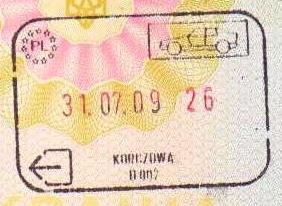
The Korczowa-Krakovets road border crossing with Ukraine is located nearby. As Poland became part of the Schengen Area on 21 December 2007, this border crossing is a Schengen external border. The European route E40 crosses the border here. The eastern terminus of Poland's A4 motorway and National Road 94 are located at Korczowa.
References
| Seat (not part of the gmina) |
|  |
|---|---|---|
| Villages |
| |
This Jarosław County location article is a stub. You can help Wikipedia by expanding it. |
Другой контент может иметь иную лицензию. Перед использованием материалов сайта WikiSort.org внимательно изучите правила лицензирования конкретных элементов наполнения сайта.
WikiSort.org - проект по пересортировке и дополнению контента Википедии