world.wikisort.org - Poland
Istebna [istɛbna] (![]() listen) is a large village and the seat of Gmina Istebna, Cieszyn County in Silesian Voivodeship, southern Poland. The village is situated in the Silesian Beskids mountain range, near the borders with the Czech Republic and Slovakia, in the historical region of Cieszyn Silesia. The Olza River flows through the village.
listen) is a large village and the seat of Gmina Istebna, Cieszyn County in Silesian Voivodeship, southern Poland. The village is situated in the Silesian Beskids mountain range, near the borders with the Czech Republic and Slovakia, in the historical region of Cieszyn Silesia. The Olza River flows through the village.
Istebna | |
|---|---|
Village | |
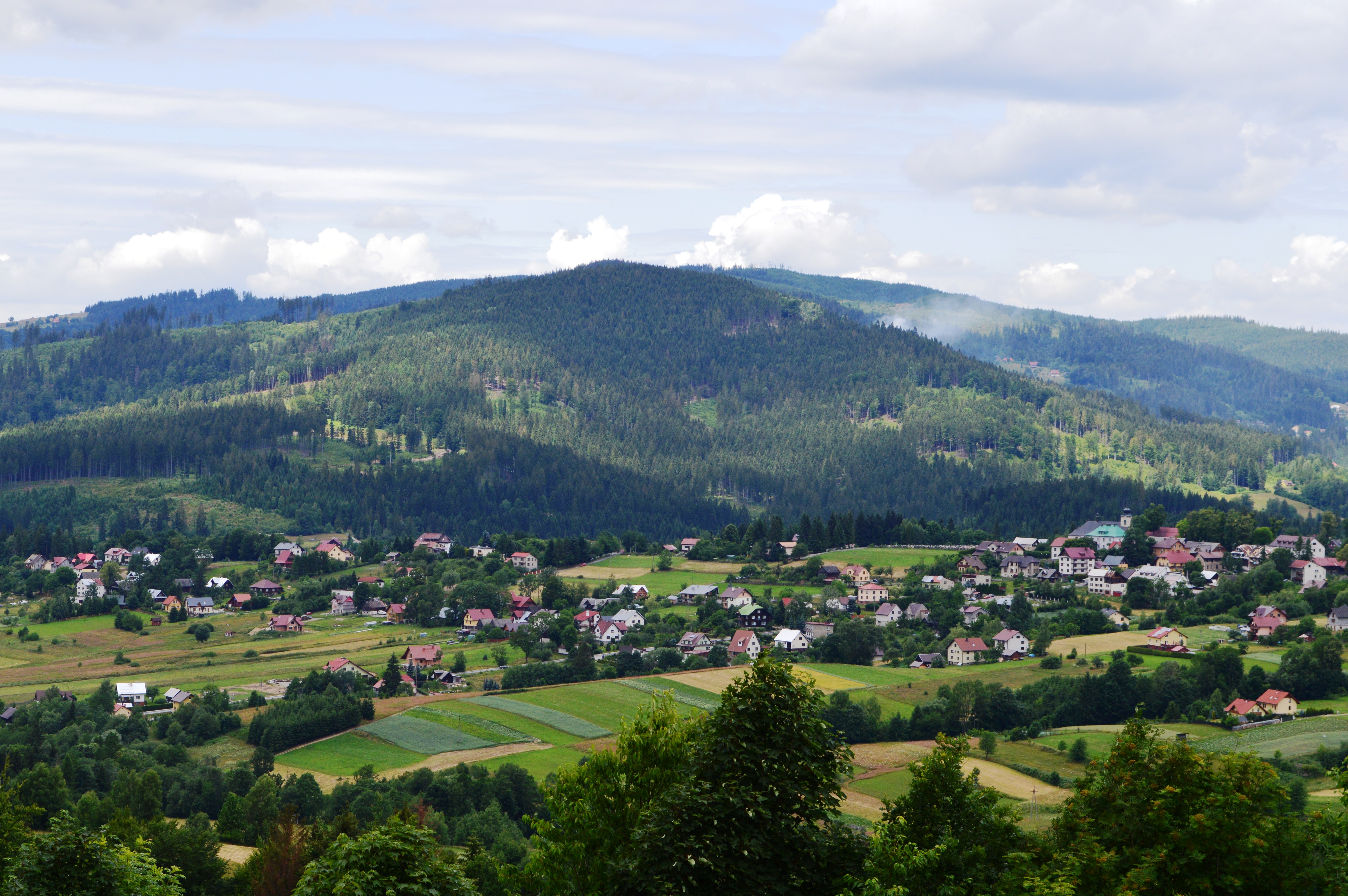 View of Istebna | |
 Coat of arms | |
 Istebna  Istebna | |
| Coordinates: 49°33′50.75″N 18°53′35.82″E | |
| Country | |
| Voivodeship | |
| County | Cieszyn |
| Gmina | Istebna |
| First mentioned | 1583 |
| Government | |
| • Mayor | Jerzy Michałek |
| Area | |
| • Total | 47.41 km2 (18.31 sq mi) |
| Population (2012) | |
| • Total | 5,078 |
| • Density | 110/km2 (280/sq mi) |
| Time zone | UTC+1 (CET) |
| • Summer (DST) | UTC+2 (CEST) |
| Postal code | 43-470 |
| Car plates | SCI |
| Website | http://www.ug.istebna.pl |
Etymology
The name is cultural in origin derived from the word (j)istba, meaning a room in a (especially rural) house (see also izba). It is conjectured that the name was conveyed by settlers from Istebné who supposedly established the village. Historically it was also known as Gistebna (1621, 1629) or Istebne (1724; the name in plural form, meaning rooms).[1]
History
The village was first mentioned in the document from 1592 retrospectively mentioning the village Jistebne as existing in 1583.[2][1] It belonged then to the Duchy of Teschen, a fee of the Kingdom of Bohemia and a part of the Habsburg monarchy.
After Revolutions of 1848 in the Austrian Empire a modern municipal division was introduced in the re-established Austrian Silesia. The village as a municipality was subscribed to the political district of Cieszyn and the legal district of Jablunkov. According to the censuses conducted in 1880, 1890, 1900 and 1910 the population of the municipality grew from 2,112 in 1880 to 2,245 in 1910 with the majority being native Polish-speakers (between 98.2% and 99.5%) accompanied by German-speaking (at most 33 or 1.5% in 1890) and Czech-speaking people (at most 15 or 0.7% in 1880). In terms of religion in 1910 the majority were Roman Catholics (93.9%), followed by Protestants (5.9%) and Jews (6 people).[3] The village was also traditionally inhabited by Silesian Gorals, speaking Jablunkov dialect.
After World War I, fall of Austria-Hungary, Polish–Czechoslovak War and the division of Cieszyn Silesia in 1920, it became a part of Poland and was transferred to Cieszyn County. It was then annexed by Nazi Germany at the beginning of World War II. After the war it was restored to Poland.
Landmarks
There is a Catholic Good Shepherd Church in the village, built in 1794 from previous wooden one.
People
- Emanuel Grim, Catholic priest and writer, worked here and is buried at local cemetery
- Ludwik Konarzewski-junior, Polish painter, sculptor and also artistic educator of children (son of senior)
- Ludwik Konarzewski-senior, Polish painter, sculptor and also educator of fine arts to young people in Istebna
- Janusz Krężelok, cross-country skier
- Jerzy Kukuczka, high altitude mountaineer, and the second person to climb all of the 8,000 metre peaks (Memorial Chamber dedicated to him is located in its own mountain cottage in Istebna)
- Jan Wałach, drawer, engraver (woodcuts), also sculptor and painter
Twin towns
 Iława
Iława- Trzebiatów
Gallery
 Good Shepherd parish church
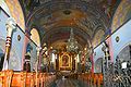 Interior of the Good Shepherd church
 Building in Upper Silesian Ethnographic Park
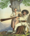 Para góralska z Istebnej, by Henryk Jastrzembski, (1846)
 Memorial plaque Jerzy Kukuczka in Istebna


Footnotes
- Mrózek, Robert (1984). Nazwy miejscowe dawnego Śląska Cieszyńskiego [Local names of former Cieszyn Silesia] (in Polish). Katowice: Uniwersytet Śląski w Katowicach. p. 80. ISSN 0208-6336.
- Panic, Idzi (2011). Śląsk Cieszyński w początkach czasów nowożytnych (1528-1653) [Cieszyn Silesia in the beginnings of Modern Era (1528-1653)] (in Polish). Cieszyn: Starostwo Powiatowe w Cieszynie. p. 167. ISBN 978-83-926929-5-9.
- Piątkowski, Kazimierz (1918). Stosunki narodowościowe w Księstwie Cieszyńskiem (in Polish). Cieszyn: Macierz Szkolna Księstwa Cieszyńskiego. pp. 266, 284.
References
- Londzin, Józef (1932). Kościoły drewniane na Śląsku Cieszyńskim. Cieszyn: Dziedzictwo błog. Jana Sarkandra. pp. 111–122. OCLC 297540848.
External links
- (in Polish) Official website of Gmina Istebna
| Wikimedia Commons has media related to Istebna. |
Gmina Istebna | ||
|---|---|---|
Seat: Istebna | ||
| Other villages |
| |
Cieszyn Silesia | ||||
|---|---|---|---|---|
| Municipalities in the Czech Republic |
|   | ||
| Municipalities in Poland |
| |||
| Related articles |
| |||
Authority control | |
|---|---|
| General |
|
| National libraries | |
Другой контент может иметь иную лицензию. Перед использованием материалов сайта WikiSort.org внимательно изучите правила лицензирования конкретных элементов наполнения сайта.
WikiSort.org - проект по пересортировке и дополнению контента Википедии