world.wikisort.org - Philippines
Veruela, officially the Municipality of Veruela (Cebuano: Lungsod sa Veruela; Tagalog: Bayan ng Veruela), is a 2nd class municipality in the province of Agusan del Sur, Philippines. According to the 2020 census, it has a population of 39,708 people. [3]
Veruela | |
|---|---|
Municipality | |
| Municipality of Veruela | |
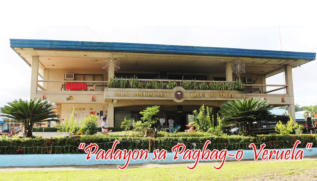 Municipal hall | |
 Map of Agusan del Sur with Veruela highlighted | |
OpenStreetMap  | |
 Veruela Location within the Philippines | |
| Coordinates: 8°04′N 125°58′E | |
| Country | Philippines |
| Region | Caraga |
| Province | Agusan del Sur |
| District | 2nd district |
| Barangays | 20 (see Barangays) |
| Government | |
| • Type | Sangguniang Bayan |
| • Mayor | Myrna S. Mondejar |
| • Vice Mayor | Edgar P. Brigole |
| • Representative | Adolph Edward G. Plaza |
| • Electorate | 22,628 voters (2019) |
| Area | |
| • Total | 385.45 km2 (148.82 sq mi) |
| Elevation | 39 m (128 ft) |
| Highest elevation | 169 m (554 ft) |
| Lowest elevation | 19 m (62 ft) |
| Population | |
| • Total | 39,708 |
| • Density | 100/km2 (270/sq mi) |
| • Households | 6,632 |
| Economy | |
| • Income class | 2nd municipal income class |
| • Poverty incidence | 39.86% (2018)[4] |
| • Revenue | ₱203,102,145.84 (2020) |
| • Assets | ₱415,423,515.55 (2020) |
| • Expenditure | ₱166,103,598.58 (2020) |
| • Liabilities | ₱175,326,191.59 (2020) |
| Service provider | |
| • Electricity | Agusan del Sur Electric Cooperative (ASELCO) |
| Time zone | UTC+8 (PST) |
| ZIP code | 8509 |
| PSGC | |
| IDD : area code | +63 (0)85 |
| Native languages | Agusan Butuanon Cebuano Higaonon Tagalog |
| Website | www |
History
Veruela is considered the oldest town of upper Agusan del Sur. It was believed the name "Veruela" was derived from the word "virus", as the entire area was suffering from smallpox and cholera in the late 18th century when the Spanish missionaries encountered the tribe. From then on, the name Veruela existed out of the Spanish word La Verus.[5]
The Manobo tribes later moved to Manning, also known as Linongsuran along the Agusan River. In 1916 however, a great earthquake destroyed the settlement leaving no trace of it, forcing the survivors to evacuate and reorganize themselves into another place, now the barangay poblacion of the municipality.[5]
In the 18th century, the Muslim tribes in Davao invaded the Manobos in Agusan. The Manobos fought against the Muslims. The first known leader of the inhabitants was Eladio Manguyod, a strong and influential datu of the Manobo tribe, who led his people to victory after a hard-fought battle that drove the Muslims out of Agusan. It was also during those times when the tribe was converted into Christianity. The inhabitants owed their victories to Datu Manguyod as well as their patron, Saint John.[5]
Veruela became a municipality through Executive Order No. 147 proclaimed by President Diosdado Macapagal on March 31, 1965[6] during the term of Congressman Guillermo Sanchez, who once also served as mayor of the town. Since its formal creation as a municipality, Veruela had undergone a series of eight different administrations.
The municipality of Veruela has a silent dispute with the nearby province of Compostela Valley regarding the boundary between the two in Barangay Del Monte. The local governments are trying to solve the issue amicably.[citation needed]
Geography
Veruela is located at 8°04′N 125°58′E.
According to the Philippine Statistics Authority, the municipality has a land area of 385.45 square kilometres (148.82 sq mi) [7] constituting 3.86% of the 9,989.52-square-kilometre- (3,856.98 sq mi) total area of Agusan del Sur.
Climate
| Climate data for Veruela, Agusan del Sur | |||||||||||||
|---|---|---|---|---|---|---|---|---|---|---|---|---|---|
| Month | Jan | Feb | Mar | Apr | May | Jun | Jul | Aug | Sep | Oct | Nov | Dec | Year |
| Average high °C (°F) | 27 (81) |
27 (81) |
27 (81) |
29 (84) |
29 (84) |
29 (84) |
30 (86) |
30 (86) |
30 (86) |
30 (86) |
29 (84) |
28 (82) |
29 (84) |
| Average low °C (°F) | 22 (72) |
22 (72) |
22 (72) |
23 (73) |
23 (73) |
23 (73) |
23 (73) |
23 (73) |
23 (73) |
23 (73) |
23 (73) |
22 (72) |
23 (73) |
| Average precipitation mm (inches) | 105 (4.1) |
80 (3.1) |
58 (2.3) |
39 (1.5) |
62 (2.4) |
75 (3.0) |
69 (2.7) |
62 (2.4) |
59 (2.3) |
71 (2.8) |
69 (2.7) |
69 (2.7) |
818 (32) |
| Average rainy days | 15.8 | 15.4 | 14.8 | 13.8 | 19.7 | 22.5 | 22.9 | 22.7 | 22.0 | 23.0 | 18.1 | 15.0 | 225.7 |
| Source: Meteoblue[8] | |||||||||||||
Barangays
Veruela is politically subdivided into 20 barangays.[9]
| PSGC | Barangay | Population | ±% p.a. | |||
|---|---|---|---|---|---|---|
| 2020 [3] | 2010 [10] | |||||
| 160313013 | Anitap | 1.5% | 595 | 560 | 0.58% | |
| 160313014 | Bacay II | 2.7% | 1,085 | 994 | 0.84% | |
| 160313001 | Binongan | 4.4% | 1,735 | 1,477 | 1.55% | |
| 160313015 | Caigangan | 2.6% | 1,029 | 726 | 3.40% | |
| 160313016 | Candiis | 1.6% | 655 | 553 | 1.63% | |
| 160313002 | Del Monte | 6.0% | 2,375 | 2,260 | 0.48% | |
| 160313003 | Don Mateo | 3.7% | 1,452 | 1,269 | 1.30% | |
| 160313017 | Katipunan | 2.4% | 958 | 922 | 0.37% | |
| 160313004 | La Fortuna | 16.2% | 6,418 | 6,045 | 0.58% | |
| 160313005 | Limot | 2.5% | 973 | 1,104 | −1.20% | |
| 160313006 | Magsaysay | 4.1% | 1,628 | 1,563 | 0.39% | |
| 160313007 | Masayan | 4.3% | 1,726 | 1,430 | 1.82% | |
| 160313008 | Poblacion | 14.8% | 5,891 | 5,643 | 0.41% | |
| 160313009 | Sampaguita | 15.0% | 5,950 | 5,581 | 0.62% | |
| 160313010 | San Gabriel | 6.5% | 2,569 | 2,115 | 1.88% | |
| 160313018 | Santa Cruz | 2.7% | 1,059 | 1,021 | 0.35% | |
| 160313011 | Santa Emelia | 3.7% | 1,483 | 1,463 | 0.13% | |
| 160313019 | Sawagan | 2.8% | 1,099 | 1,214 | −0.95% | |
| 160313012 | Sinobong | 9.3% | 3,706 | 3,206 | 1.40% | |
| 160313020 | Sisimon | 3.3% | 1,320 | 1,311 | 0.07% | |
| Total | 39,708 | 40,457 | −0.18% | |||
Demographics
| Year | Pop. | ±% p.a. |
|---|---|---|
| 1903 | 2,623 | — |
| 1918 | 1,522 | −3.56% |
| 1939 | 1,381 | −0.46% |
| 1948 | 1,528 | +1.13% |
| 1960 | 2,914 | +5.53% |
| 1970 | 6,626 | +8.55% |
| 1975 | 9,915 | +8.42% |
| 1980 | 13,991 | +7.13% |
| 1990 | 20,129 | +3.71% |
| 1995 | 35,706 | +11.34% |
| 2000 | 36,222 | +0.31% |
| 2007 | 36,862 | +0.24% |
| 2010 | 40,457 | +3.44% |
| 2015 | 43,706 | +1.48% |
| 2020 | 39,708 | −1.87% |
| Source: Philippine Statistics Authority [11] [10] [12][13] | ||
In the 2020 census, Veruela had a population of 39,708. [3] The population density was 100 inhabitants per square kilometre (260/sq mi).
Economy
References
- Municipality of Veruela | (DILG)
- "2015 Census of Population, Report No. 3 – Population, Land Area, and Population Density" (PDF). Philippine Statistics Authority. Quezon City, Philippines. August 2016. ISSN 0117-1453. Archived (PDF) from the original on May 25, 2021. Retrieved July 16, 2021.
- Census of Population (2020). "Caraga". Total Population by Province, City, Municipality and Barangay. PSA. Retrieved 8 July 2021.
- "PSA Releases the 2018 Municipal and City Level Poverty Estimates". Philippine Statistics Authority. 15 December 2021. Retrieved 22 January 2022.
- "Municipality of Veruela". Province of Agusan del Sur. Provincial Information Management Office (PIMO). Archived from the original on 9 May 2013. Retrieved 19 October 2016.
- "Executive Order No. 147; Declaring Certain Municipal Districts in the Province of Agusan as Municipalities". Official Gazette of the Republic of the Philippines. 31 March 1965. Retrieved 19 October 2016.
- "Province: Agusan del Sur". PSGC Interactive. Quezon City, Philippines: Philippine Statistics Authority. Retrieved 12 November 2016.
- "Veruela: Average Temperatures and Rainfall". Meteoblue. Retrieved 29 April 2020.
- "Municipal: Veruela". PSGC Interactive. Quezon City, Philippines: Philippine Statistics Authority. Retrieved 8 January 2016.
- Census of Population and Housing (2010). "Caraga". Total Population by Province, City, Municipality and Barangay. NSO. Retrieved 29 June 2016.
- Census of Population (2015). "Caraga". Total Population by Province, City, Municipality and Barangay. PSA. Retrieved 20 June 2016.
- Censuses of Population (1903–2007). "Caraga". Table 1. Population Enumerated in Various Censuses by Province/Highly Urbanized City: 1903 to 2007. NSO.
- "Province of Agusan del Sur". Municipality Population Data. Local Water Utilities Administration Research Division. Retrieved 17 December 2016.
- "Poverty incidence (PI):". Philippine Statistics Authority. Retrieved 28 December 2020.
- https://psa.gov.ph/sites/default/files/NSCB_LocalPovertyPhilippines_0.pdf; publication date: 29 November 2005; publisher: Philippine Statistics Authority.
- https://psa.gov.ph/sites/default/files/2003%20SAE%20of%20poverty%20%28Full%20Report%29_1.pdf; publication date: 23 March 2009; publisher: Philippine Statistics Authority.
- https://psa.gov.ph/sites/default/files/2006%20and%202009%20City%20and%20Municipal%20Level%20Poverty%20Estimates_0_1.pdf; publication date: 3 August 2012; publisher: Philippine Statistics Authority.
- https://psa.gov.ph/sites/default/files/2012%20Municipal%20and%20City%20Level%20Poverty%20Estima7tes%20Publication%20%281%29.pdf; publication date: 31 May 2016; publisher: Philippine Statistics Authority.
- https://psa.gov.ph/sites/default/files/City%20and%20Municipal-level%20Small%20Area%20Poverty%20Estimates_%202009%2C%202012%20and%202015_0.xlsx; publication date: 10 July 2019; publisher: Philippine Statistics Authority.
- "PSA Releases the 2018 Municipal and City Level Poverty Estimates". Philippine Statistics Authority. 15 December 2021. Retrieved 22 January 2022.
External links
Places adjacent to Veruela | |
|---|---|
Prosperidad (capital) | |
| Municipalities | |
| Component city | |
На других языках
[de] Veruela
Veruela ist eine philippinische Stadtgemeinde in der Provinz Agusan del Sur. Sie hat 43.706 Einwohner (Zensus 1. August 2015).- [en] Veruela
Другой контент может иметь иную лицензию. Перед использованием материалов сайта WikiSort.org внимательно изучите правила лицензирования конкретных элементов наполнения сайта.
WikiSort.org - проект по пересортировке и дополнению контента Википедии