world.wikisort.org - Philippines
Kayapa, officially the Municipality of Kayapa (Gaddang: Ili na Kayapa; Ilocano: Ili ti Kayapa; Tagalog: Bayan ng Kayapa), is a 3rd class municipality in the province of Nueva Vizcaya, Philippines. According to the 2020 census, it has a population of 26,469 people. [3]
Kayapa | |
|---|---|
Municipality | |
| Municipality of Kayapa | |
 Municipal hall | |
 Flag  Seal | |
| Nickname(s): Gateway to the Cordilleras Summer Capital of Nueva Vizcaya | |
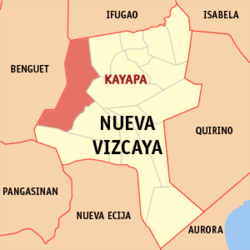 Map of Nueva Vizcaya with Kayapa highlighted | |
OpenStreetMap  | |
 Kayapa Location within the Philippines | |
| Coordinates: 16°21′30″N 120°53′10″E | |
| Country | Philippines |
| Region | Cagayan Valley |
| Province | Nueva Vizcaya |
| District | Lone district |
| Barangays | 30 (see Barangays) |
| Government | |
| • Type | Sangguniang Bayan |
| • Mayor | Elizabeth Balasya |
| • Vice Mayor | Peter L. Bay-an |
| • Representative | Luisa L. Cuaresma |
| • Electorate | 14,889 voters (2019) |
| Area | |
| • Total | 482.90 km2 (186.45 sq mi) |
| Elevation | 1,264 m (4,147 ft) |
| Highest elevation | 2,030 m (6,660 ft) |
| Lowest elevation | 628 m (2,060 ft) |
| Population | |
| • Total | 26,469 |
| • Density | 55/km2 (140/sq mi) |
| • Households | 5,516 |
| Economy | |
| • Income class | 3rd municipal income class |
| • Poverty incidence | 29.15% (2018)[4] |
| • Revenue | ₱175,503,214.47 (2020) |
| • Assets | ₱343,079,442.53 (2020) |
| • Expenditure | ₱174,584,769.10 (2020) |
| • Liabilities | ₱72,740,898.32 (2020) |
| Service provider | |
| • Electricity | Nueva Vizcaya Electric Cooperative (NUVELCO) |
| Time zone | UTC+8 (PST) |
| ZIP code | 3708 |
| PSGC | |
| IDD : area code | +63 (0)78 |
| Native languages | Ilocano Gaddang Ibaloi I-Wak Kallahan Karaw Tagalog |
Kayapa is 61 kilometres (38 mi) from Bayombong and 266 kilometres (165 mi) from Manila.
History
In 1754, Governor-General Don Arandia sent Comandante Dovilla, who was based in Pangasinan, to establish a civil government and spread Christianity among the non-Christian Tribes. The mission first saw the Valley of Yapa (Yapa meaning bountiful) which was inhabited by the Allagots, the second descendants of the Bormangi and Owak, and the third descendants of the Kalanguya, Ibaloi, Ilo-o, and Karao tribes who settled in the fertile valley. When the comandante (commander) and his company arrived in the valley of Yapa, the villagers entertained them under a big tree called “Kalabao”, which stood in the middle of the valley. It was from these words “Kalabao” and “Yapa” where the present name “Kayapa” was coined. On January 29, 1915, Governor-General Francis Burton Harrison signed and issued Executive Order No. 9, transferring all territories of the former Spanish Commandancia of Kayapa, except the area which lies within the Benguet watershed of the Agno River, from the sub-Province of Benguet to the Province of Nueva Vizcaya. On November 11, 1950, President Elpidio Quirino signed Executive Order No. 368,[5] proclaiming the Municipality of Kayapa as a regular town, thus, merging Kayapa and Pingkian into one town as it is today.
Geography
Barangays
Kayapa is politically subdivided into 30 barangays. These barangays are headed by elected officials: Barangay Captain, Barangay Council, whose members are called Barangay Councilors. All are elected every three years.
- Acacia
- Amelong Labeng
- Ansipsip
- Baan
- Babadi
- Balangabang
- Banao
- Binalian
- Besong
- Cabalatan-Alang
- Cabanglasan
- Kayapa Proper East
- Kayapa Proper West
- Mapayao
- Nansiakan
- Pampang (Poblacion)
- Pangawan
- Pinayag
- Pingkian
- San Fabian
- Talecabcab
- Tubongan
- Alang-Salacsac
- Balete
- Buyasyas
- Cabayo
- Castillo Village
- Latbang
- Lawigan
- Tidang Village
Climate
| Climate data for Kayapa, Nueva Vizcaya | |||||||||||||
|---|---|---|---|---|---|---|---|---|---|---|---|---|---|
| Month | Jan | Feb | Mar | Apr | May | Jun | Jul | Aug | Sep | Oct | Nov | Dec | Year |
| Average high °C (°F) | 22 (72) |
23 (73) |
24 (75) |
26 (79) |
25 (77) |
24 (75) |
23 (73) |
23 (73) |
23 (73) |
24 (75) |
25 (77) |
22 (72) |
24 (75) |
| Average low °C (°F) | 13 (55) |
14 (57) |
15 (59) |
17 (63) |
18 (64) |
18 (64) |
18 (64) |
18 (64) |
18 (64) |
16 (61) |
15 (59) |
14 (57) |
16 (61) |
| Average precipitation mm (inches) | 21 (0.8) |
28 (1.1) |
34 (1.3) |
58 (2.3) |
160 (6.3) |
179 (7.0) |
226 (8.9) |
225 (8.9) |
215 (8.5) |
168 (6.6) |
59 (2.3) |
32 (1.3) |
1,405 (55.3) |
| Average rainy days | 7.5 | 8.5 | 10.9 | 14.9 | 23.9 | 25.7 | 26.7 | 25.3 | 24.9 | 18.6 | 11.8 | 8.9 | 207.6 |
| Source: Meteoblue[6] | |||||||||||||
Demographics
|
| ||||||||||||||||||||||||||||||||||||||||||||||||
| Source: Philippine Statistics Authority [7] [8] [9][10] | |||||||||||||||||||||||||||||||||||||||||||||||||
Economy
Government
Kayapa, belonging to the lone congressional district of the province of Nueva Vizcaya, is governed by a mayor designated as its local chief executive and by a municipal council as its legislative body in accordance with the Local Government Code. The mayor, vice mayor, and the councilors are elected directly by the people through an election which is being held every three years.
Elected officials
| Position | Name |
|---|---|
| Congressman | Luisa L. Cuaresma |
| Mayor | Elizabeth Balasya |
| Vice-Mayor | Peter L. Bay-an |
| Councilors | Glennson A. Dangis |
| Tony P. Wakit Sr. | |
| Medy D. Malcat | |
| Adriano A. Dodon | |
| Tony B. Pagnas | |
| Carlito B. Bantayan | |
| Valdez A. Duntogan | |
| Wesley L. Kitano | |
Education
The Schools Division of Nueva Vizcaya governs the town's public education system. The division office is a field office of the DepEd in Cagayan Valley region.[19] The office governs the public and private elementary and public and private high schools throughout the municipality.
Gallery
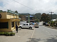 Downtown area
 Public market
 Kayapa Central School
 Saint Joseph Parish Church
 Town proper
 Variant of flag used at parades


References
- Municipality of Kayapa | (DILG)
- "2015 Census of Population, Report No. 3 – Population, Land Area, and Population Density" (PDF). Philippine Statistics Authority. Quezon City, Philippines. August 2016. ISSN 0117-1453. Archived (PDF) from the original on May 25, 2021. Retrieved July 16, 2021.
- Census of Population (2020). "Region II (Cagayan Valley)". Total Population by Province, City, Municipality and Barangay. PSA. Retrieved 8 July 2021.
- "PSA Releases the 2018 Municipal and City Level Poverty Estimates". Philippine Statistics Authority. 15 December 2021. Retrieved 22 January 2022.
- "Reorganizing the municipalities and municipal districts in the province of Nueva Vizcaya into ten municipalities, defining their boundaries, and abolishing the municipal districts". Official Gazette of the Republic of the Philippines. Retrieved 2021-01-12.
- "Kayapa: Average Temperatures and Rainfall". Meteoblue. Retrieved 4 July 2021.
- Census of Population (2015). "Region II (Cagayan Valley)". Total Population by Province, City, Municipality and Barangay. PSA. Retrieved 20 June 2016.
- Census of Population and Housing (2010). "Region II (Cagayan Valley)". Total Population by Province, City, Municipality and Barangay. NSO. Retrieved 29 June 2016.
- Censuses of Population (1903–2007). "Region II (Cagayan Valley)". Table 1. Population Enumerated in Various Censuses by Province/Highly Urbanized City: 1903 to 2007. NSO.
- "Province of Nueva Vizcaya". Municipality Population Data. Local Water Utilities Administration Research Division. Retrieved 17 December 2016.
- "Poverty incidence (PI):". Philippine Statistics Authority. Retrieved 28 December 2020.
- https://psa.gov.ph/sites/default/files/NSCB_LocalPovertyPhilippines_0.pdf; publication date: 29 November 2005; publisher: Philippine Statistics Authority.
- https://psa.gov.ph/sites/default/files/2003%20SAE%20of%20poverty%20%28Full%20Report%29_1.pdf; publication date: 23 March 2009; publisher: Philippine Statistics Authority.
- https://psa.gov.ph/sites/default/files/2006%20and%202009%20City%20and%20Municipal%20Level%20Poverty%20Estimates_0_1.pdf; publication date: 3 August 2012; publisher: Philippine Statistics Authority.
- https://psa.gov.ph/sites/default/files/2012%20Municipal%20and%20City%20Level%20Poverty%20Estima7tes%20Publication%20%281%29.pdf; publication date: 31 May 2016; publisher: Philippine Statistics Authority.
- https://psa.gov.ph/sites/default/files/City%20and%20Municipal-level%20Small%20Area%20Poverty%20Estimates_%202009%2C%202012%20and%202015_0.xlsx; publication date: 10 July 2019; publisher: Philippine Statistics Authority.
- "PSA Releases the 2018 Municipal and City Level Poverty Estimates". Philippine Statistics Authority. 15 December 2021. Retrieved 22 January 2022.
- "2019 National and Local Elections" (PDF). Commission on Elections. Retrieved March 10, 2022.
{{cite web}}: CS1 maint: url-status (link) - "DEPED REGIONAL OFFICE NO. 02". DepED RO2 | The official website of DepED Regional Office No. 02.
{{cite web}}: CS1 maint: url-status (link)
External links
 Media related to Kayapa at Wikimedia Commons
- Philippine Standard Geographic Code
- Philippine Census Information
- Local Governance Performance Management System
Places adjacent to Kayapa | ||||||||||||||||
|---|---|---|---|---|---|---|---|---|---|---|---|---|---|---|---|---|
| ||||||||||||||||
Bayombong (capital) | |
| Municipalities |
|
| Barangays | See: List of barangays in Nueva Vizcaya |
This article about a location in Cagayan Valley region is a stub. You can help Wikipedia by expanding it. |
На других языках
[de] Kayapa
Kayapa ist eine Stadtgemeinde in der philippinischen Provinz Nueva Vizcaya. Im Jahre 2015 zählte sie 23.714 Einwohner. Teile des Naturschutzgebietes Salinas Natural Monument liegen auf dem Gebiet der Gemeinde.- [en] Kayapa
Другой контент может иметь иную лицензию. Перед использованием материалов сайта WikiSort.org внимательно изучите правила лицензирования конкретных элементов наполнения сайта.
WikiSort.org - проект по пересортировке и дополнению контента Википедии