world.wikisort.org - Papua_New_Guinea
Manus Province is the smallest province in Papua New Guinea in terms of both land area and population, with a land area of 2,100 square kilometres (810 sq mi), but with more than 220,000 square kilometres (85,000 sq mi) of water, and the total population is 60,485 (2011 census). The provincial town of Manus is Lorengau.
Manus Province | |
|---|---|
 Flag | |
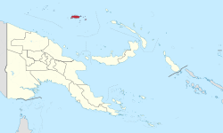 Manus Province in Papua New Guinea | |
| Coordinates: 2°5′S 147°0′E | |
| Country | Papua New Guinea |
| Capital | Lorengau |
| Districts | List
|
| Government | |
| • Governor | Charlie Benjamin |
| Area | |
| • Total | 2,000 km2 (800 sq mi) |
| Population (2011 census) | |
| • Total | 60,485 |
| • Density | 30/km2 (78/sq mi) |
| Time zone | UTC+10 (AEST) |
| HDI (2019) | 0.611[1] medium · 2nd of 22 |
The province consists of only one district (Manus District; with identical boundaries to those of the province), 12 Local Level Governments (LLGs) and 127 Wards.[2][3]
The province is made up of the Admiralty Islands (a group of 18 islands in the Bismarck Archipelago), as well as Wuvulu Island and nearby atolls in the west, which collectively are referred to as the Western Islands. The largest island in the group is Manus Island, where Lorengau and a former Australian immigration detention centre are located.
Flag
The Manus friarbird, known locally as the chauka, is represented on the Manus provincial flag. Designer of the Manus Province flag Luke Bulei explained his reasons for its design in 1977: chauka is only found in the Manus province; it heralds dawn and signals sunset; it often warns us of dangers; and lastly, it informs us of the success or otherwise of a forthcoming hunting trip. He added that NBC Radio Station had changed its name to Maus Bilong Chauka several years before. He explained that the colour brown on the flag represents the inland people and the blue represents the island people. The other important symbol on the flag is the green snail, which is also unique to the Manus province.[4]
District and LLGs
Manus Province has a single district, which contains one urban (Lorengau) and eleven rural Local Level Government (LLG) areas. Manus District has the highest number of LLGs of any other district in Papua New Guinea. For census purposes, the LLG areas are subdivided into wards and those into census units.[5]
| District | District Capital | LLG Name |
|---|---|---|
| Manus District | Lorengau | Aua-Wuvulu Rural |
| Balopa Rural | ||
| Bisikani-Soparibeu Kabin Rural | ||
| Lelemadih-Bupichupeu Rural | ||
| Lorengau Urban | ||
| Los Negros Rural | ||
| Nali Sopat-Penabu Rural | ||
| Nigoherm Rural | ||
| Pobuma Rural | ||
| Pomutu-Kurti-Andra Rural | ||
| Rapatona Rural | ||
| Tetidu Rural |
Provincial leaders
The province was governed by a decentralised provincial administration, headed by a Premier, from 1977 to 1995. Following reforms taking effect that year, notably the introduction of the Organic Law on Provincial Government and Local Level Government 1995, the national government reassumed some powers, and the role of Premier was replaced by a position of Governor, to be held by the winner of the province-wide seat in the National Parliament of Papua New Guinea.[6][7]
Premiers (1977–1995)
| Premier | Term |
|---|---|
| Papi Rasahei | 1977–1978 |
| Banabas Kombil | 1979–1982 |
| Joel Maiah | 1982–1984 |
| Stephen Pokawin | 1984–1995 |
Governors (1995–present)
| Governor | Term |
|---|---|
| Martin Thompson | 1995–1996 |
| Stephen Pokawin | 1996–2002 |
| Jacob Jumogot | 2002–2007 |
| Michael Sapau | 2007–2012 |
| Charlie Benjamin | 2012–present |
Members of the National Parliament
The province and each district is represented by a Member of the National Parliament. There is one provincial electorate and each district is an open electorate. Job Pomat as Manus District Open Member, elected into office in 2016, made history as the first politician from the province to be elected as the Speaker of the Parliament of Papua New Guinea in 2016.[citation needed]
| Electorate | Member |
|---|---|
| Manus Provincial | Charlie Benjamin |
| Manus Open | Job Pomat |
References
- "Sub-national HDI - Area Database - Global Data Lab". hdi.globaldatalab.org. Retrieved 18 April 2020.
- Narayan, Siddharth; Cuthbert, Richard; et al. (2015). Protecting against coastal hazards in Manus and New Ireland provinces Papua New Guinea: An assessment of present and future options (Report). Wildlife Conservation Society. doi:10.13140/RG.2.1.4607.2729.
- "Manus Province". PNG Facts. Retrieved 17 December 2020.
- "Manus (Papua New Guinea)". Flags of the world. 2009.
- National Statistical Office of Papua New Guinea
- May, R. J. "8. Decentralisation: Two Steps Forward, One Step Back". State and society in Papua New Guinea: the first twenty-five years. Australian National University. Retrieved 31 March 2017.
- "Provinces". rulers.org. Retrieved 31 March 2017.
Further reading
- Chandler, Jo (15 December 2014). "Welcome to Manus, the island that has been changed forever by Australian asylum-seeker policy". The Guardian. Retrieved 26 April 2018.
- WWII Battle for Manus Island
External links
| Highlands Region | |
|---|---|
| Islands Region |
|
| Momase Region | |
| Southern Region |
|
LLGs and Districts of Manus Province, Papua New Guinea | ||
|---|---|---|
| Manus District | ||
Authority control | |
|---|---|
| National libraries | |
| Other |
|
На других языках
- [en] Manus Province
[ru] Манус (провинция)
Манус (англ. Manus Province) — провинция Папуа — Новой Гвинеи, включающая в себя Острова Адмиралтейства. Административный центр провинции — город Лоренгау, расположена на северо-восточном побережье острова Манус — самого крупного в архипелаге.Другой контент может иметь иную лицензию. Перед использованием материалов сайта WikiSort.org внимательно изучите правила лицензирования конкретных элементов наполнения сайта.
WikiSort.org - проект по пересортировке и дополнению контента Википедии