world.wikisort.org - Pakistan
The Skardu District (Urdu: ضلع سکردو) is one of the 10 districts of Gilgit-Baltistan territory of Pakistan.[1] The Skardu District is bounded on the east by the Ghanche District, on the south by the Kharmang District, on the west by the Astore District, on the north-west by the Rondu District and on the north by the Shigar district. The district headquarters is the town of Skardu, which is also the division headquarters.
Skardu District
ضلع سکردو | |
|---|---|
District of Gilgit-Baltistan | |
 Map of Gilgit–Baltistan showing its 14 districts | |
| Country | |
| Territory | |
| Division | Baltistan Division |
| Headquarters | Skardu |
| Government | |
| • Type | District Administration |
| • Deputy Commissioner | N/A |
| • District Police Officer | N/A |
| • District Health Officer | N/A |
| Area | |
| • Total | 15,000 km2 (6,000 sq mi) |
| Population | |
| • Total | 214,848 |
| Number of tehsils | 4 |

Mountain peaks and glaciers
The highest peak in the Skardu District is K2 (8,611 m), which is the highest peak in Pakistan and its two dependent territories and is the second-highest peak in the world. The Baltoro Muztagh, the subrange of the Karakoram Mountains that includes the mighty peaks of K2 (8,611 m), Broad Peak (8,047 m), the Gasherbrums (8,000+ m), and Masherbrum (7,821 m), is located in the Skardu District. Askole is the last settlement in the district for all treks to Concordia (the confluence of the Baltoro Glacier and the Godwin-Austen Glacier). The Biafo Glacier and a major part of the Hispar Glacier are also located in the Skardu District.[citation needed]

Education
According to the Alif Ailaan Pakistan District Education Rankings 2015, the Skardu District is ranked 14th out of 148 districts in terms of education. For facilities and infrastructure, the district is ranked 89th out of 148 districts.[2]
Deosai National Park
The Deosai Plateau is one of the highest plateaus in the world. Skardu District shares the area of the Deosai National Park including Small Deosai, part of Gultari Skardu, and others with Astore District, which has a major portion. The Deosai Plateau is the second- highest plateau in the world, after the Tibet Plateau.
Major towns
The major towns of Skardu District are:- Arandu, Haji Gham, Sakwar and Skardu itself.
Demography
People of the Skardu District are predominantly of the Shia sect of Islam, where 98% of the people are of the Shia sect, 2% are of the Noorbakshi sect, and 2% are of the Sunni sect.[3]
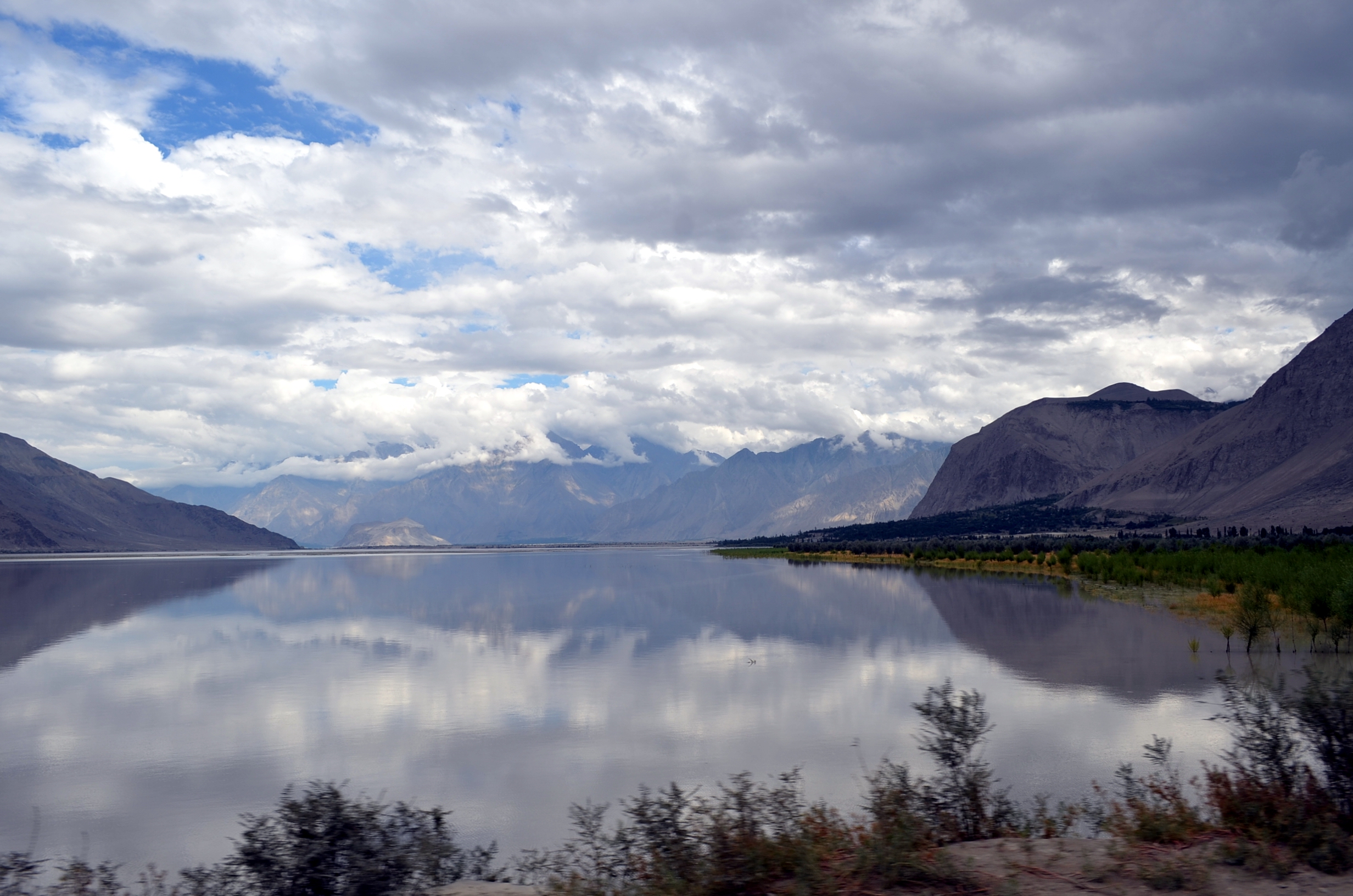
Lakes
The main lakes in the district are:
- Kachura Lake
- Satpara Lake
- Shangrila Lake
- Sheosar Lake
- Snow Lake
Mountain passes
The Gondogoro Pass is located in the Skardu District.
See also
Geography of Gilgit–Baltistan
References
- Hussain, Zakir (2018). "Geo-Strategic Significance of Gilgit Baltistan: Political, Economic and Security Interests of Pakistan, India and China (1947-2013)". University of the Punjab, Lahore.
- "Individual district profile link, 2015". Alif Ailaan. Retrieved 2015-05-07.
- "Sectarian Conflict in Gilgit-Baltistan". PILDAT. 1 May 2011.
External links
Capital: Gilgit | |
| Passes |
|
| Valleys |
|
| Cities and towns |
|
| Rivers, glaciers and lakes |
|
| Architecture |
|
| See also |
|
Authority control | |
|---|---|
| General |
|
| National libraries | |
На других языках
[de] Skardu (Distrikt)
Der Distrikt Skardu ist einer von sieben Distrikten der autonomen Region Gilgit-Baltistan (früher Northern Areas) in Pakistan. Der Distrikt liegt im Südosten des Karakorum am Oberlauf des Indus, östlich von Hunza und Gilgit-Distrikt, westlich vom indischen Ladakh und nördlich des West-Himalaya.[1]- [en] Skardu District
[ru] Скарду (округ)
Скарду (англ. Skardu District) — один из 7 округов пакистанской территории Гилгит-Балтистан.Другой контент может иметь иную лицензию. Перед использованием материалов сайта WikiSort.org внимательно изучите правила лицензирования конкретных элементов наполнения сайта.
WikiSort.org - проект по пересортировке и дополнению контента Википедии