world.wikisort.org - Pakistan
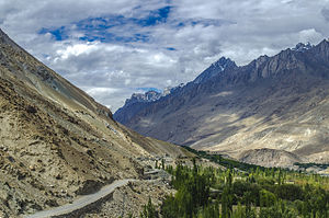
Hushe Valley (Urdu: وادی ہوشے) is a valley in Ghanche District, Gilgit-Baltistan, Pakistan. Formed by the Hushe River, the valley runs from Masherbrum Mountain[1] (at 7,821 meters) and nearby glaciers south to the Shyok River, opposite Khaplu. Hushe village lies in the center of the valley.
Hushe Valley | |
|---|---|
Valley | |
 Road in lower Hushe Valley | |
 Hushe Valley Location in Pakistan | |
| Coordinates: 35°28′17″N 76°21′12″E | |
| Country | Pakistan |
| Administrative unit | Gilgit-Baltistan |
| District | Ghanche |
| Time zone | UTC+5 (PST) |
| • Summer (DST) | UTC+6 (GMT+6) |
The valley is known for the surrounding high mountains of the Karakoram range, including several peaks above six thousands meters like Laila Peak, K6, and K7. Murtaza peak is 5100m just behind K6 base camp and is considered epicenter of trackers and beginners.[citation needed]
There are many sub-valleys in the area, including Gondogor (see Gondogoro Pass), Charkusa, Nagma, Nanbroq and Mashabrum.
References
External links
![]() Media related to Hushe Valley at Wikimedia Commons
Media related to Hushe Valley at Wikimedia Commons
На других языках
- [en] Hushe Valley
[fr] Vallée de Hushe
La vallée de Hushe (ourdou : وادی ہوشے) est une vallée située dans le district de Ghanche, dans la région autonome du Gilgit-Baltistan, au Pakistan. La vallée de Hushe est célèbre pour les sommets de plus de 6 000 mètres qui l'entourent, parmi lesquels le pic Laila, le K6 et le K7. Le pic Murtaza (5 100 m) est situé derrière le camp de base du K6. Elle donne naissance à de nombreuses vallées secondaires : Gondogor, Charkusa, Nagma, Nanbroq et Mashabrum.Текст в блоке "Читать" взят с сайта "Википедия" и доступен по лицензии Creative Commons Attribution-ShareAlike; в отдельных случаях могут действовать дополнительные условия.
Другой контент может иметь иную лицензию. Перед использованием материалов сайта WikiSort.org внимательно изучите правила лицензирования конкретных элементов наполнения сайта.
Другой контент может иметь иную лицензию. Перед использованием материалов сайта WikiSort.org внимательно изучите правила лицензирования конкретных элементов наполнения сайта.
2019-2025
WikiSort.org - проект по пересортировке и дополнению контента Википедии
WikiSort.org - проект по пересортировке и дополнению контента Википедии