world.wikisort.org - Norway
Osen is a municipality in Trøndelag county, Norway. It is part of the Fosen region. The administrative centre of the municipality is the village of Steinsdalen.
Osen kommune | |
|---|---|
Municipality | |
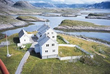
 View of the Osen river | |
 Flag  Coat of arms 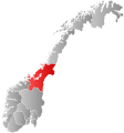 Trøndelag within Norway | |
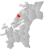 Osen within Trøndelag | |
| Coordinates: 64°17′52″N 10°30′48″E | |
| Country | Norway |
| County | Trøndelag |
| District | Fosen |
| Established | 1 June 1892 |
| • Preceded by | Bjørnør Municipality |
| Administrative centre | Steinsdalen |
| Government | |
| • Mayor (2015) | John Einar Høvik (Ap) |
| Area | |
| • Total | 387.09 km2 (149.46 sq mi) |
| • Land | 369.61 km2 (142.71 sq mi) |
| • Water | 17.48 km2 (6.75 sq mi) 4.5% |
| • Rank | #240 in Norway |
| Population (2022) | |
| • Total | 904 |
| • Rank | #340 in Norway |
| • Density | 2.4/km2 (6/sq mi) |
| • Change (10 years) | |
| Demonym | Osing[1] |
| Official language | |
| • Norwegian form | Bokmål |
| Time zone | UTC+01:00 (CET) |
| • Summer (DST) | UTC+02:00 (CEST) |
| ISO 3166 code | NO-5020 |
| Website | Official website |
The 387-square-kilometre (149 sq mi) municipality is the 240th largest by area out of the 356 municipalities in Norway. Osen is the 340th most populous municipality in Norway with a population of 904. The municipality's population density is 2.4 inhabitants per square kilometre (6.2/sq mi) and its population has decreased by 2.4% over the previous 10-year period.[3][4]
General information

The municipality of Osen was established on 1 June 1892 when the old municipality of Bjørnør was split into three new municipalities: Osen (population: 1,575), Roan (population: 2,069), and Stoksund (population: 1,122). The municipal boundaries have not changed since.[5] On 1 January 2018, the municipality switched from the old Sør-Trøndelag county to the new Trøndelag county.
Name
The municipality (originally the parish) is named after the old Osen farm (Old Norse: Óss), since the first church was built there. The name is identical with the word óss which means "mouth of a river" (here Steinselva). Osen ("the Os") is a later finite form of óss.[6]
Coat of arms
The coat of arms was granted on 27 March 1987, and is a copy of an old petroglyph. The arms show a part of a fishing net placed over the blue shield. The arms simply indicate the importance of fishing for the community. Several different arms were designed, all with fisheries as the main theme, but the council finally chose this one, which is unique among civic heraldry.[7]
Churches
The Church of Norway has one parish (sokn) within the municipality of Osen. It is part of the Fosen prosti (deanery) in the Diocese of Nidaros.
| Parish (sokn) | Church Name | Location of the Church | Year Built |
|---|---|---|---|
| Osen | Osen Church | Steinsdalen | 1877 |
| Seter Chapel (Osen) | Seter | 1969 |
History
Osen was used as a satellite prison camp during the World War Two, mainly for Yugoslavian population.
Government
All municipalities in Norway, including Osen, are responsible for primary education (through 10th grade), outpatient health services, senior citizen services, unemployment and other social services, zoning, economic development, and municipal roads. The municipality is governed by a municipal council of elected representatives, which in turn elect a mayor.[8] The municipality falls under the Trøndelag District Court and the Frostating Court of Appeal.
Municipal council
The municipal council (Kommunestyre) of Osen is made up of 15 representatives that are elected to four year terms. The party breakdown of the council is as follows:
| Party Name (in Norwegian) | Number of representatives | |
|---|---|---|
| Labour Party (Arbeiderpartiet) | 8 | |
| Centre Party (Senterpartiet) | 3 | |
| Joint list of the Liberal Party (Venstre) and Christian Democratic Party (Kristelig Folkeparti) | 3 | |
| Seter Community List (Seter kretsliste) | 1 | |
| Total number of members: | 15 | |
| Party Name (in Norwegian) | Number of representatives | |
|---|---|---|
| Labour Party (Arbeiderpartiet) | 5 | |
| Progress Party (Fremskrittspartiet) | 1 | |
| Conservative Party (Høyre) | 1 | |
| Centre Party (Senterpartiet) | 3 | |
| Joint list of the Liberal Party (Venstre) and Christian Democratic Party (Kristelig Folkeparti) | 4 | |
| Seter Community List (Seter kretsliste) | 1 | |
| Total number of members: | 15 | |
| Party Name (in Norwegian) | Number of representatives | |
|---|---|---|
| Labour Party (Arbeiderpartiet) | 4 | |
| Progress Party (Fremskrittspartiet) | 1 | |
| Centre Party (Senterpartiet) | 2 | |
| Joint list of the Liberal Party (Venstre) and Christian Democratic Party (Kristelig Folkeparti) | 5 | |
| Local List(s) (Lokale lister) | 1 | |
| Seter Community List (Seter kretsliste) | 2 | |
| Total number of members: | 15 | |
| Party Name (in Norwegian) | Number of representatives | |
|---|---|---|
| Labour Party (Arbeiderpartiet) | 3 | |
| Progress Party (Fremskrittspartiet) | 2 | |
| Conservative Party (Høyre) | 1 | |
| Centre Party (Senterpartiet) | 2 | |
| Socialist Left Party (Sosialistisk Venstreparti) | 2 | |
| Non-party local list (Upolitisk bygdaliste) | 3 | |
| Election list for the Seter and Angen area (Valgliste for Seter og Angen krets) | 2 | |
| Total number of members: | 15 | |
| Party Name (in Norwegian) | Number of representatives | |
|---|---|---|
| Labour Party (Arbeiderpartiet) | 5 | |
| Conservative Party (Høyre) | 2 | |
| Christian Democratic Party (Kristelig Folkeparti) | 3 | |
| Centre Party (Senterpartiet) | 3 | |
| Socialist Left Party (Sosialistisk Venstreparti) | 2 | |
| Election list for the Seter and Angen area (Valgliste for Seter og Angen krets) | 2 | |
| Total number of members: | 17 | |
| Party Name (in Norwegian) | Number of representatives | |
|---|---|---|
| Labour Party (Arbeiderpartiet) | 7 | |
| Conservative Party (Høyre) | 1 | |
| Christian Democratic Party (Kristelig Folkeparti) | 2 | |
| Centre Party (Senterpartiet) | 4 | |
| Socialist Left Party (Sosialistisk Venstreparti) | 1 | |
| Seter Community list (Seter kretsliste) | 2 | |
| Total number of members: | 17 | |
| Party Name (in Norwegian) | Number of representatives | |
|---|---|---|
| Labour Party (Arbeiderpartiet) | 5 | |
| Conservative Party (Høyre) | 1 | |
| Christian Democratic Party (Kristelig Folkeparti) | 2 | |
| Centre Party (Senterpartiet) | 5 | |
| Socialist Left Party (Sosialistisk Venstreparti) | 1 | |
| Liberal Party (Venstre) | 1 | |
| Election list for Seter (Valgliste for Sæter) | 2 | |
| Total number of members: | 17 | |
| Party Name (in Norwegian) | Number of representatives | |
|---|---|---|
| Labour Party (Arbeiderpartiet) | 3 | |
| Conservative Party (Høyre) | 1 | |
| Christian Democratic Party (Kristelig Folkeparti) | 2 | |
| Centre Party (Senterpartiet) | 4 | |
| Socialist Left Party (Sosialistisk Venstreparti) | 2 | |
| Liberal Party (Venstre) | 3 | |
| Election list for the Sæter and Angen area (Valgliste for Sæter og Angen krets) | 2 | |
| Total number of members: | 17 | |
| Party Name (in Norwegian) | Number of representatives | |
|---|---|---|
| Labour Party (Arbeiderpartiet) | 7 | |
| Conservative Party (Høyre) | 2 | |
| Christian Democratic Party (Kristelig Folkeparti) | 2 | |
| Centre Party (Senterpartiet) | 3 | |
| Election list for the Seter area (Valgliste for Seter krets) | 2 | |
| Village list for the Vingsand area (Kretsliste for Vingsand og omegn) | 1 | |
| Total number of members: | 17 | |
| Party Name (in Norwegian) | Number of representatives | |
|---|---|---|
| Labour Party (Arbeiderpartiet) | 6 | |
| Conservative Party (Høyre) | 2 | |
| Christian Democratic Party (Kristelig Folkeparti) | 2 | |
| Centre Party (Senterpartiet) | 2 | |
| Liberal Party (Venstre) | 2 | |
| Election list for the Seter area (Valgliste for Seter krets) | 2 | |
| Village list for the Vingsand area (Kretsliste for Vingsand og omegn) | 1 | |
| Total number of members: | 17 | |
| Party Name (in Norwegian) | Number of representatives | |
|---|---|---|
| Labour Party (Arbeiderpartiet) | 4 | |
| Conservative Party (Høyre) | 3 | |
| Christian Democratic Party (Kristelig Folkeparti) | 2 | |
| Centre Party (Senterpartiet) | 3 | |
| Liberal Party (Venstre) | 1 | |
| Local list for Sæter and Svefjorden (Kretsliste for Sæter og Svefjorden) | 1 | |
| Local list for the Vingsand area (Kretsliste for Vingsand og omegn) | 1 | |
| Non-party list for the Strand area (Upolitisk liste for Strand og omegn) | 1 | |
| Local list for Skjærvøya (Kretsliste for Skjærvøya) | 1 | |
| Total number of members: | 17 | |
| Party Name (in Norwegian) | Number of representatives | |
|---|---|---|
| Labour Party (Arbeiderpartiet) | 5 | |
| Christian Democratic Party (Kristelig Folkeparti) | 1 | |
| Centre Party (Senterpartiet) | 4 | |
| Liberal Party (Venstre) | 1 | |
| Local list for Sæter and Svefjorden (Kretsliste for Sæter og Svefjorden) | 3 | |
| Local list for the Vingsand area (Kretsliste for Vingsand og omegn) | 1 | |
| Non-party list for the Strand area (Upolitisk liste for Strand og omegn) | 1 | |
| Local list for Skjærvøy (Kretsliste for Skjærvøy) | 1 | |
| Total number of members: | 17 | |
| Party Name (in Norwegian) | Number of representatives | |
|---|---|---|
| Labour Party (Arbeiderpartiet) | 4 | |
| Centre Party (Senterpartiet) | 3 | |
| Joint List(s) of Non-Socialist Parties (Borgerlige Felleslister) | 2 | |
| Local List(s) (Lokale lister) | 8 | |
| Total number of members: | 17 | |
| Party Name (in Norwegian) | Number of representatives | |
|---|---|---|
| Labour Party (Arbeiderpartiet) | 5 | |
| Centre Party (Senterpartiet) | 3 | |
| Liberal Party (Venstre) | 1 | |
| Local List(s) (Lokale lister) | 8 | |
| Total number of members: | 17 | |
| Party Name (in Norwegian) | Number of representatives | |
|---|---|---|
| Labour Party (Arbeiderpartiet) | 3 | |
| Joint List(s) of Non-Socialist Parties (Borgerlige Felleslister) | 4 | |
| Local List(s) (Lokale lister) | 10 | |
| Total number of members: | 17 | |
| Party Name (in Norwegian) | Number of representatives | |
|---|---|---|
| Labour Party (Arbeiderpartiet) | 3 | |
| Joint List(s) of Non-Socialist Parties (Borgerlige Felleslister) | 2 | |
| Local List(s) (Lokale lister) | 12 | |
| Total number of members: | 17 | |
| Party Name (in Norwegian) | Number of representatives | |
|---|---|---|
| Labour Party (Arbeiderpartiet) | 3 | |
| Local List(s) (Lokale lister) | 14 | |
| Total number of members: | 17 | |
| Party Name (in Norwegian) | Number of representatives | |
|---|---|---|
| Labour Party (Arbeiderpartiet) | 3 | |
| Local List(s) (Lokale lister) | 13 | |
| Total number of members: | 16 | |
| Party Name (in Norwegian) | Number of representatives | |
|---|---|---|
| Labour Party (Arbeiderpartiet) | 2 | |
| Liberal Party (Venstre) | 5 | |
| Local List(s) (Lokale lister) | 9 | |
| Total number of members: | 16 | |
| Party Name (in Norwegian) | Number of representatives | |
|---|---|---|
| Labour Party (Arbeiderpartiet) | 4 | |
| Communist Party (Kommunistiske Parti) | 1 | |
| Local List(s) (Lokale lister) | 11 | |
| Total number of members: | 16 | |
| Party Name (in Norwegian) | Number of representatives | |
|---|---|---|
| Labour Party (Arbeiderpartiet) | 3 | |
| Local List(s) (Lokale lister) | 13 | |
| Total number of members: | 16 | |
| Note: Due to the German occupation of Norway during World War II, no elections were held for new municipal councils until after the war ended in 1945. | ||
Geography

The municipality of Osen is located to the north of Roan and the ocean lies to the west.
Most of the residents live in the Steinsdalen valley or along the coast. The northern part of the municipality has no direct road connection to the rest of the municipality, but is connected to the municipality of Flatanger to the north.
The Kya lighthouse is situated on a small island west in the Norwegian Sea, while Buholmråsa lighthouse lie on an island along the coast in the western part of the municipality.
Climate
The Norwegian Meteorological Institute has a weather station located near Buholmråsa lighthouse, with recording since 1965, showing a marine west coast climate/oceanic climate (Cfb). The all-time high temperature is 30.3 °C (86.5 °F) recorded July 2014; the all-time low is −20.7 °C (−5.3 °F) recorded in February 1966. The four months June - September have never recorded overnight freezes. The average date for the first overnight freeze (below 0 °C (32 °F)) in autumn is November 7 (1981-2020 average).[27] The driest month on record is January 1972 with 5.4 mm precipitation, and the wettest is September 1975 with 232.6 mm.
| Climate data for Buholmråsa 1991-2020 (precipitation 1961-90, extremes 1965-2022) | |||||||||||||
|---|---|---|---|---|---|---|---|---|---|---|---|---|---|
| Month | Jan | Feb | Mar | Apr | May | Jun | Jul | Aug | Sep | Oct | Nov | Dec | Year |
| Record high °C (°F) | 11 (52) |
10.9 (51.6) |
12.6 (54.7) |
20.9 (69.6) |
25 (77) |
28.5 (83.3) |
30.3 (86.5) |
27.2 (81.0) |
24.9 (76.8) |
19.8 (67.6) |
16.1 (61.0) |
12.5 (54.5) |
30.3 (86.5) |
| Daily mean °C (°F) | 2 (36) |
1.4 (34.5) |
2.5 (36.5) |
5.2 (41.4) |
8.2 (46.8) |
11 (52) |
13.5 (56.3) |
14.1 (57.4) |
11.9 (53.4) |
7.9 (46.2) |
4.8 (40.6) |
3 (37) |
7.1 (44.8) |
| Record low °C (°F) | −18 (0) |
−20.7 (−5.3) |
−12.5 (9.5) |
−6.2 (20.8) |
−1.7 (28.9) |
2.1 (35.8) |
5.5 (41.9) |
5 (41) |
0 (32) |
−5.2 (22.6) |
−10.2 (13.6) |
−15.5 (4.1) |
−20.7 (−5.3) |
| Average precipitation mm (inches) | 79 (3.1) |
64 (2.5) |
61 (2.4) |
56 (2.2) |
43 (1.7) |
49 (1.9) |
65 (2.6) |
71 (2.8) |
100 (3.9) |
106 (4.2) |
86 (3.4) |
90 (3.5) |
870 (34.3) |
| Source: Norwegian Meteorological Institute[28] | |||||||||||||
See also
- Prison camps in North Norway during World War Two, including at Osen
Notable people
- Augusta Aasen (1878 in Osen – 1920) a Norwegian politician, buried in the Kremlin Wall Necropolis - the only Norwegian woman buried there
- Einar Hepsø (1926–2005) a Norwegian fishers' leader and politician, Mayor of Osen 1984-1985 and 1995-2003
- Vivian Sørmeland (born 1985 in Osen) contestant in Idol (Norway) in May 2006
References
- "Navn på steder og personer: Innbyggjarnamn" (in Norwegian). Språkrådet.
- "Forskrift om målvedtak i kommunar og fylkeskommunar" (in Norwegian). Lovdata.no.
- Statistisk sentralbyrå. "Table: 06913: Population 1 January and population changes during the calendar year (M)" (in Norwegian).
- Statistisk sentralbyrå. "09280: Area of land and fresh water (km²) (M)" (in Norwegian).
- Jukvam, Dag (1999). "Historisk oversikt over endringer i kommune- og fylkesinndelingen" (PDF) (in Norwegian). Statistisk sentralbyrå.
- Rygh, Oluf (1901). Norske gaardnavne: Søndre Trondhjems amt (in Norwegian) (14 ed.). Kristiania, Norge: W. C. Fabritius & sønners bogtrikkeri. p. 3.
- "Civic heraldry of Norway - Norske Kommunevåpen". Heraldry of the World. Retrieved 5 May 2018.
- Hansen, Tore, ed. (12 May 2016). "kommunestyre". Store norske leksikon (in Norwegian). Kunnskapsforlaget. Retrieved 1 January 2019.
- "Tall for Norge: Kommunestyrevalg 2019 - Trøndelag". Valg Direktoratet. Retrieved 20 October 2019.
- "Table: 04813: Members of the local councils, by party/electoral list at the Municipal Council election (M)" (in Norwegian). Statistics Norway.
- "Tall for Norge: Kommunestyrevalg 2011 - Sør-Trøndelag". Valg Direktoratet. Retrieved 20 October 2019.
- "Kommunestyrevalget 1995" (PDF) (in Norwegian). Oslo-Kongsvinger: Statistisk sentralbyrå. 1996. Retrieved 12 April 2020.
- "Kommunestyrevalget 1991" (PDF) (in Norwegian). Oslo-Kongsvinger: Statistisk sentralbyrå. 1993. Retrieved 12 April 2020.
- "Kommunestyrevalget 1987" (PDF) (in Norwegian). Oslo-Kongsvinger: Statistisk sentralbyrå. 1988. Retrieved 12 April 2020.
- "Kommunestyrevalget 1983" (PDF) (in Norwegian). Oslo-Kongsvinger: Statistisk sentralbyrå. 1984. Retrieved 12 April 2020.
- "Kommunestyrevalget 1979" (PDF) (in Norwegian). Oslo: Statistisk sentralbyrå. 1979. Retrieved 12 April 2020.
- "Kommunevalgene 1975" (PDF) (in Norwegian). Oslo: Statistisk sentralbyrå. 1977. Retrieved 12 April 2020.
- "Kommunevalgene 1972" (PDF) (in Norwegian). Oslo: Statistisk sentralbyrå. 1973. Retrieved 12 April 2020.
- "Kommunevalgene 1967" (PDF) (in Norwegian). Oslo: Statistisk sentralbyrå. 1967. Retrieved 12 April 2020.
- "Kommunevalgene 1963" (PDF) (in Norwegian). Oslo: Statistisk sentralbyrå. 1964. Retrieved 12 April 2020.
- "Kommunevalgene og Ordførervalgene 1959" (PDF) (in Norwegian). Oslo: Statistisk sentralbyrå. 1960. Retrieved 12 April 2020.
- "Kommunevalgene og Ordførervalgene 1955" (PDF) (in Norwegian). Oslo: Statistisk sentralbyrå. 1957. Retrieved 12 April 2020.
- "Kommunevalgene og Ordførervalgene 1951" (PDF) (in Norwegian). Oslo: Statistisk sentralbyrå. 1952. Retrieved 12 April 2020.
- "Kommunevalgene og Ordførervalgene 1947" (PDF) (in Norwegian). Oslo: Statistisk sentralbyrå. 1948. Retrieved 12 April 2020.
- "Kommunevalgene og Ordførervalgene 1945" (PDF) (in Norwegian). Oslo: Statistisk sentralbyrå. 1947. Retrieved 12 April 2020.
- "Kommunevalgene og Ordførervalgene 1937" (PDF) (in Norwegian). Oslo: Statistisk sentralbyrå. 1938. Retrieved 12 April 2020.
- "Første frostnatt". 25 September 2013.
- http://sharki.oslo.dnmi.no/portal/page?_pageid=73,39035,73_39080&_dad=portal&_schema=PORTAL.
{{cite web}}: Missing or empty|title=(help)
External links
 Media related to Osen at Wikimedia Commons
 Trøndelag travel guide from Wikivoyage
- Municipal fact sheet from Statistics Norway (in Norwegian)
Trøndelag county, Norway | |||||||||||
|---|---|---|---|---|---|---|---|---|---|---|---|
| |||||||||||
 | Towns and cities |
|  | ||||||||
| Municipalities |
| ||||||||||
На других языках
[de] Osen
Osen ist eine Kommune im norwegischen Fylke Trøndelag. Die Kommune hat 904 Einwohner (Stand: 1. Januar 2022). Verwaltungssitz ist der gleichnamige Ort Osen.- [en] Osen
[ru] Усен (Норвегия)
Усен (норв. Osen) — коммуна в губернии Сёр-Трёнделаг в Норвегии. Административный центр коммуны — город Стейнсдален. Официальный язык коммуны — букмол. Население коммуны на 2007 год составляло 1041 чел. Площадь коммуны Усен — 387,09 км², код-идентификатор — 1633.Другой контент может иметь иную лицензию. Перед использованием материалов сайта WikiSort.org внимательно изучите правила лицензирования конкретных элементов наполнения сайта.
WikiSort.org - проект по пересортировке и дополнению контента Википедии