world.wikisort.org - Norway
Oppland [ˈɔ̂plɑn] (![]() listen) is a former county in Norway which existed from 1781 until its dissolution on 1 January 2020. The old Oppland county bordered the counties of Trøndelag, Møre og Romsdal, Sogn og Fjordane, Buskerud, Akershus, Oslo and Hedmark. The county administration was located in the town of Lillehammer.
listen) is a former county in Norway which existed from 1781 until its dissolution on 1 January 2020. The old Oppland county bordered the counties of Trøndelag, Møre og Romsdal, Sogn og Fjordane, Buskerud, Akershus, Oslo and Hedmark. The county administration was located in the town of Lillehammer.
Oppland fylke | |||||||||||||||||||||||||||||
|---|---|---|---|---|---|---|---|---|---|---|---|---|---|---|---|---|---|---|---|---|---|---|---|---|---|---|---|---|---|
Former County | |||||||||||||||||||||||||||||
 Oppland mountains | |||||||||||||||||||||||||||||
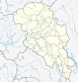
 Flag Coat of arms  Oppland within Norway | |||||||||||||||||||||||||||||
 Oppland fylke Oppland within Oppland  Oppland fylke Oppland fylke (Norway) | |||||||||||||||||||||||||||||
| Coordinates: 61.41°N 9.34°E | |||||||||||||||||||||||||||||
| Country | Norway | ||||||||||||||||||||||||||||
| County | Oppland | ||||||||||||||||||||||||||||
| District | Eastern Norway | ||||||||||||||||||||||||||||
| Established | 1781 | ||||||||||||||||||||||||||||
| • Preceded by | Oplandenes amt | ||||||||||||||||||||||||||||
| Disestablished | 1 Jan 2020 | ||||||||||||||||||||||||||||
| • Succeeded by | Innlandet county | ||||||||||||||||||||||||||||
| Administrative centre | Lillehammer | ||||||||||||||||||||||||||||
| Government | |||||||||||||||||||||||||||||
| • Body | Oppland County Municipality | ||||||||||||||||||||||||||||
| • Governor (2015-2019) | Christl Kvam | ||||||||||||||||||||||||||||
| • County mayor (2015-2019) | Even Aleksander Hagen | ||||||||||||||||||||||||||||
| Area (upon dissolution) | |||||||||||||||||||||||||||||
| • Total | 25,192 km2 (9,727 sq mi) | ||||||||||||||||||||||||||||
| • Land | 23,787 km2 (9,184 sq mi) | ||||||||||||||||||||||||||||
| • Water | 1,405 km2 (542 sq mi) 5.6% | ||||||||||||||||||||||||||||
| Population (30 September 2019) | |||||||||||||||||||||||||||||
| • Total | 189,437 | ||||||||||||||||||||||||||||
| • Density | 7.5/km2 (19/sq mi) | ||||||||||||||||||||||||||||
| • Change (10 years) | |||||||||||||||||||||||||||||
| Demonym(s) | Opplending[1] | ||||||||||||||||||||||||||||
| Official language | |||||||||||||||||||||||||||||
| • Norwegian form | Neutral | ||||||||||||||||||||||||||||
| Time zone | UTC+01:00 (CET) | ||||||||||||||||||||||||||||
| • Summer (DST) | UTC+02:00 (CEST) | ||||||||||||||||||||||||||||
| ISO 3166 code | NO-05 | ||||||||||||||||||||||||||||
| Income (per capita) | 133,600 kr (2001) | ||||||||||||||||||||||||||||
| GDP (per capita) | 193,130 kr (2001) | ||||||||||||||||||||||||||||
| GDP national rank | #13 in Norway (2.32% of country) | ||||||||||||||||||||||||||||
| |||||||||||||||||||||||||||||
Merger
On 1 January 2020, the neighboring counties of Oppland and Hedmark were merged to form the new Innlandet county. Both Oppland and Hedmark were the only landlocked counties of Norway, and the new Innlandet county is the only landlocked county in Norway. The two counties had historically been one county that was divided in 1781. Historically, the region was commonly known as "Opplandene". In 1781, the government split the area into two: Hedemarkens amt and Kristians amt (later renamed Hedmark and Oppland. In 2017, the government approved the merger of the two counties. There were several names debated, but the government settled on Innlandet.[6][7]
Geography
Oppland extended from the lakes Mjøsa and Randsfjorden to the mountains Dovrefjell, Jotunheimen and Rondane. Gråhøe is a mountain on the border between the municipalities of Sel and Dovre in Oppland.[8][9]
The county was conventionally divided into traditional districts. These are the Gudbrandsdalen, Valdres, Toten, Hadeland and Land. Oppland included the towns Lillehammer, Gjøvik, Otta, and Fagernes, and Norway's two highest mountains, Glittertind and Galdhøpiggen, Valdres and the Gudbrand Valley being popular attractions. The Gudbrand Valley surrounds the river Gudbrandsdalslågen, and includes the area extending from Jotunheimen down to Bagn at Begna River. It is a well known place for skiing and winter sports. The main population centres in this area were Beitostølen and Fagernes. Eight of the ten highest mountains in Norway are located in the western part of Oppland.
Etymology
In Norse times the inner parts of Norway were called Upplǫnd which means 'the upper countries'. The first element is upp which means 'upper'. The last element is lǫnd which is the plural form of 'land'.
In 1757 the inner parts of the great Akershus amt were separated, and given the name Oplandenes Amt. This was divided in 1781 into Christians Amt (named after the king Christian VII) and Hedemarkens Amt. The name/form was changed to Kristians Amt in 1877 after an official spelling reform that changed ch to k (see also Kristiania, Kristiansand and Kristiansund). In 1919, the name Kristians Amt was changed (back) to Opland fylke, and the spelling Oppland was approved in 1950.
Coat of arms
The coat of arms was granted in 1989, and it showed two Pulsatilla vernalis.
Municipalities

Oppland County (Christians Amt)[10] had a total of 26 municipalities:
|
|
| Number of minorities (1st and 2nd gen.) in Oppland by country of origin in 2017[11] | |
| Nationality | Population (2017) |
|---|---|
| 2,421 | |
| 1,606 | |
| 1,209 | |
| 1,164 | |
| 817 | |
| 743 | |
| 714 | |
| 698 | |
| 660 | |
| 624 | |
| 574 | |
| 560 | |
| 495 | |
| 495 | |
| 466 | |
| 376 | |
| 365 | |
| 330 | |
Districts
- Begnadalen
- Espedalen
- Gudbrandsdalen
- Hadeland
- Heidal
- Hunndalen
- Land
- Toten
- Valdres
- Vestoppland
Cities
- Gjøvik
- Lillehammer
- Fagernes
- Otta
- Vinstra
Parishes
- Aulstad
- Aurdal
- Austsinni
- Bagn
- Balke
- Begndal
- Biri
- Brandbu (Nes)
- Bruflat
- Bøverdal
- Dovre
- Eina
- Etnedal
- Fluberg
- Follebu (Folleboe)
- Fåberg
- Fåvang (Fodevang)
- Garmo
- Gausdal
- Gjøvik
- Gran
- Hedal
- Hegge
- Heidal
- Hoff
- Hunn
- Hurum
- Høre
- Jevnaker
- Kolbu
- Kvam
- Kvikne (Quiekne)
- Land
- Lesja (Læssø)
- Lesjaskog
- Lillehammer
- Lom
- Lomen (Røn, Røen)
- Lunner
- Mesna
- Nes (Brandbu)
- Nord-Aurdal
- Nord-Fron
- Nordberg
- Nordre Etnedal
- Nordre Land
- Nordsinni (Hogner)
- Nykirke
- Reinli
- Ringebu
- Rogne
- Røn (Røen)
- Saksumdal
- Sel
- Sister
- Skiåker
- Skjåk
- Skrautvål
- Slidredomen
- Snertingdal
- St. Mary
- St. Thomas
- Strand
- Svatsum
- Svenes
- Sødorp (Søthorp)
- Søndre Land
- Sør-Aurdal
- Sør-Fron
- Tingelstad
- Torpa
- Tretten (Trøtten)
- Ulnes
- Vang
- Vardal
- Venabygd
- Vestre Gausdal
- Vestre Slidre
- Vestre Toten
- Volbu
- Vågå
- Østre Gausdal
- Østre Slidre
- Østre Toten
- Østsinni (Gårder)
- Øye (Øie)
- Øyer
- Åmot
- Ås
Villages
- Aurdal
- Bagn
- Begna
- Beitostølen
- Bismo
- Biri
- Bjoneroa
- Bjorli
- Bjølstad
- Bjørgo
- Brandbu
- Brekkom
- Bruflat
- Bybrua
- Bøverbru
- Dale
- Dokka
- Dombås
- Dovre
- Egge
- Eina
- Fagernes
- Fluberg
- Follebu
- Forset
- Fåberg
- Fåvang
- Grotli
- Grua
- Harestua
- Harpefoss
- Hjerkinn
- Hov
- Høvringen
- Jaren
- Jevnaker
- Kapp
- Kolbu
- Kvam
- Lalm
- Leira
- Lena
- Lensbygda
- Lesjaskog
- Lesjaverk
- Lora
- Moane
- Nordlia
- Odnes
- Raufoss
- Reinsvoll
- Ringstad
- Røn
- Sandbumoen
- Segalstad bru
- Skogbygda
- Skrautvål
- Skreia
- Skåbu
- Sletta
- Slidre
- Snertingdal
- Svingvoll
- Tretten
- Tyinkrysset
- Vang i Valdres
- Vinstra
- Vågåmo
Former municipalities
- Biri (Birid)
- Brandbu
- Eina
- Fluberg
- Fron
- Fåberg (Faabeg)
- Heidal
- Kolbu
- Land
- Slidre
- Snertingdal
- Torpa
- Vardal
- Vestre Gausdal
- Østre Gausdal
See also
References
- "Navn på steder og personer: Innbyggjarnamn" (in Norwegian). Språkrådet.
- "Forskrift om målvedtak i kommunar og fylkeskommunar" (in Norwegian). Lovdata.no.
- Projected population - Statistics Norway[permanent dead link]
- Statistics Norway - Church of Norway.
- Statistics Norway - Members of religious and life stance communities outside the Church of Norway, by religion/life stance. County. 2006-2010
- Magnus Newth; Ingvill Dybfest Dahl (21 February 2017). "Dette er Norges nye regioner" [These are Norway's new regions]. Verdens Gang (in Norwegian). Retrieved 9 May 2018.
- "Hedmark og Oppland blir ett fylke" [Hedmark and Oppland become one county] (in Norwegian). NRK. 21 February 2017. Retrieved 9 May 2018.
- "Gråhøe". Kartverket. Retrieved 29 November 2020.
- "Norgeskart". www.norgeskart.no. Retrieved 29 November 2020.
- Formannskapsdistrikt Original spellings of counties and municipalities in parentheses.
- "Immigrants and Norwegian-born to immigrant parents, by immigration category, country background and percentages of the population". SSB. Retrieved 9 May 2018.
External links
Counties of Norway | |||||||||||||||||||||||||||||||||||||||||||||||||||||||||||||||||||||
|---|---|---|---|---|---|---|---|---|---|---|---|---|---|---|---|---|---|---|---|---|---|---|---|---|---|---|---|---|---|---|---|---|---|---|---|---|---|---|---|---|---|---|---|---|---|---|---|---|---|---|---|---|---|---|---|---|---|---|---|---|---|---|---|---|---|---|---|---|---|
| |||||||||||||||||||||||||||||||||||||||||||||||||||||||||||||||||||||

Authority control | |
|---|---|
| General | |
| National libraries | |
| Other |
|
На других языках
- [en] Oppland
[ru] Оппланн
О́ппланн[4] (норв. Oppland) — бывшая норвежская губерния (фюльке). С 1 января 2020 года объединена с фюльке Хедмарк в новую фюльке — Иннландет. Была расположена в западной части Эстланна (Восточной Норвегии) и являлась одной из двух норвежских фюльке, не имевших выхода к морю (второй была фюльке Хедмарк). Административным центром являлся город Лиллехаммер. Граничила с фюльке Мёре-ог-Ромсдал, Сёр-Трёнделаг, Согн-ог-Фьюране, Хедмарк, Бускеруд, Осло и Акерсхус.Другой контент может иметь иную лицензию. Перед использованием материалов сайта WikiSort.org внимательно изучите правила лицензирования конкретных элементов наполнения сайта.
WikiSort.org - проект по пересортировке и дополнению контента Википедии