world.wikisort.org - Norway
Fyresdal is a municipality in Telemark in the county of Vestfold og Telemark in Norway. It is part of the traditional region of Vest-Telemark. The administrative centre of the municipality is the village of Moland. The municipality of Moland was established on 1 January 1838 (see formannskapsdistrikt). In 1879, the name was changed to Fyresdal.
Fyresdal kommune | |
|---|---|
Municipality | |
 Coat of arms 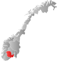 Vestfold og Telemark within Norway | |
 Fyresdal within Vestfold og Telemark | |
| Coordinates: 59°9′57″N 8°1′11″E | |
| Country | Norway |
| County | Vestfold og Telemark |
| District | Vest-Telemark |
| Administrative centre | Moland |
| Government | |
| • Mayor (2015) | Erik Skjervagen (Ap) |
| Area | |
| • Total | 1,281 km2 (495 sq mi) |
| • Land | 1,108 km2 (428 sq mi) |
| • Rank | #71 in Norway |
| Population (2004) | |
| • Total | 1,347 |
| • Rank | #383 in Norway |
| • Density | 1/km2 (3/sq mi) |
| • Change (10 years) | |
| Demonym(s) | Fyresdøl[1] |
| Official language | |
| • Norwegian form | Nynorsk |
| Time zone | UTC+01:00 (CET) |
| • Summer (DST) | UTC+02:00 (CEST) |
| ISO 3166 code | NO-3823 |
| Website | Official website |
General information
Name
The Old Norse form of the name was Fyrisdalr. The first element is the genitive case of the name of the lake Fyrir (now called Fyresvatn). The last element is dalr which means "valley" or "dale". The name of the lake is derived from the word fura which means "pine tree". Prior to 1879, the municipality was called Moland.[3]
Coat-of-arms
The coat-of-arms is from modern times. They were granted in 1992. The arms show two silver-colored broadaxes on a green background. It was chosen to represent the forestry work in the municipality.
History
Fyresdal is known for its many findings from the Viking Age, its mighty Viking graves, heaps of slag, and the former pilgrim church that once stood proudly north of the village centre. People travelled to this church from all over Norway and even from Europe. It was said that the stream running behind the church had healing powers.
A few miles south of the site where the Heggland Pilgrim Church (Norwegian: Heggland Kyrkje), once stood at Molandsmoen, a stone with Runic inscriptions can be found. This is a reminder from the Viking Age when horse battles were held there. Originally, one believes, there were four of them. Klokkarhamaren is a little mountain on a peninsula in the municipal centre, and it is the location of a cave called Munkhola. It is believed that a certain number of monks in Medieval times resided, held masses, and sought refuge here.
Economy
Most people in the municipality work in the fields of agriculture, forestry, trade, industry and tourism. There are not many full-time farmers left in Fyresdal, but many people derive a secondary income from agriculture and forestry.
The largest employer in the municipality is Telemark Kildevann which makes bottled water and soft drinks for the national and Swedish markets. There are also a few small high-competence mechanical factories which produce parts for the offshore industry.
Transportation
The Vest-Telemark airport, Fyresdal is located in Moland, with a nearby hotel. This is a joint operation under the name Airparc Fyresdal.
Fyresdal has bus connections with the city centres of Skien and Porsgrunn in Telemark county; Arendal in Aust-Agder county; Bergen in Vestland county; Haugesund in Rogaland county; and to the capital, Oslo. A bus also travels between Fyresdal and Dalen, the municipal centre of Tokke, every school day of the year.
Geography

The municipality of Fyresdal consists of several little villages north of the municipal centre, in the main valley of Fyresdal, and on the western and southeastern shores of Fyresvatn (Lake Fyresdal), one of Norway's deepest lakes. The municipal centre of Fyresdal is Moland. This is the location of the municipal assembly, the school, the community house, kindergartens, the home for the elderly, and most of the commercial enterprises in the village. Moland is the most heavily populated aea of Fyresdal.
Fyresdal is among the westernmost municipalities in Telemark. It borders the municipalities of Tokke, Kviteseid, and Nissedal in Telemark county. It also shares borders with the municipalities of Åmli, Bygland, and Valle in Aust-Agder county.
Neighbourhoods in Fyresdal
- Geitstadgrend
- Spockeligrend
- Momrak
- Sitje
- Tøddebakkane
- Folkestadbyen
- Øvre Birtedalen
- Nedre Birtedalen
- Fardal
- Breivik
- Hegglandsgrend
- Grunnvik
- Moland
- Veum
- Hauggrend
- Liegrend
- Fjellgardane
- Kilegrend
Attractions
- One of Fyresdal's two churches (Moland Kyrkje) and the vicarage (Fyresdal Prestegard) are located in Moland. According to Telemark folklore, the Troll of Røykjenes moved across the lake because the bells of the Moland church were disturbing its nap. The vicarage is where Vidkun Quisling was born.
- Within the administrative center of Moland, one also finds the old village centre, Folkestadbyen. Folkestadbyen is the location of the Fyresdal Vertshus, a Swiss-styled dwelling built in 1890. It has housed and served both food and drinks to locals and travellers for over 100 years. Øyskogen park, which contains Viking graves and a lot of traditional Telemark houses (e.g. lofts and stabburs) is also part of the old village. The Fyresdal Bygdemuseum, the village museum, is also located in Øyskogen. Folkestadbyen was named the prettiest town/village centre in Telemark in 2003.[citation needed]
- Rv 355 runs straight through the municipality from north to south. Hegglandsgrend, Veum, and Hauggrend are villages along Rv 355 located north of Moland. Hegglandsgrend is the home of Heggland Gamle Kyrkjegard; Veum is the home of Veum Kyrkje. A Rudolf Steiner School (an upper secondary level school) was located at Foldsæ in Hauggrend. This so-called friskole ("Free school") based on the thoughts and ideas of Rudolf Steiner was however closed down after few years. In Hauggrend, one also finds the most distinct mountain in Fyresdal, Roan. This peak is 1,192 metres (3,911 ft) above sea level, but not the highest point in the municipality, since the border to Valle passes near the peak of Napuren, at a height of 1,284 metres (4,213 ft) above sea level, some 300 feet higher.
- North of Moland, to the west from the main valley we find the little settlements of Kleivgrend, Åslandsgrend. Turning left of the Rv 355 in Hegglandsgrend, one comes to Kleivgrend and Åslandsgrend. Between Kleivgrend and the neighbouring municipality Valle on the western side of the mountains, one finds an old track that priests and bishops used to get between the counties of Agder and Telemark. This track is named Bispevegen ("Bishop's Road") and every year a march called Bispevegmarsjen ("The Bishop's Road March") starts in Kleivgrend. In Fjellgardane, Germans ran mines in the 16th century at Moisesberg.
- On the western shores of Fyresvatn (Lake Fyresdal), to the southwest of Moland, one finds the villages of Fardal, Breivik. Here one finds an old and interesting stone called Røykjenessteinen. In 2005, one also found some arrowheads in this area that are believed to be 4000–4500 years old. Farther along the country road we find Birtedalen, a popular place for people who set up mountain cabins.
- South of Moland, at the southern end of Rv 355 across the scenic and mighty mountain of Våmur where one can see the lake from up above, one comes to the little village of Kilegrend. In the old days there was no road connecting Kilegrend with the municipal centre. Thus one had to travel by boat. For years the steamboats called Teisner and Fyresdølen travelled between Moland and Kilegrend. The latter eventually capsized and sank. The wreck is still visible in Kilegrend.
 Moland Church
 Fyresdal Airport
 Veum Church
 Fyresvatn (Lake Fyresdal)


Notable natives

- Petter Veum, (Norwegian Wiki) (1811 in Fyresdal - 1889) fiddler
- Jon Lauritz Qvisling, (Norwegian Wiki) (1844 in Fyresdal - 1930) clergyman, author and genealogist
- John Lie, (Norwegian Wiki) (1846 in Fyresdal - 1916) author
- Ivar Peterson Tveiten (1850 in Fyresdal – 1934) a Norwegian teacher and politician
- Torgeir Vraa (1868 in Fyresdal – 1934) a Norwegian educator, newspaper editor and politician
- Haakon Lie (1884 in Fyresdal – 1970) a Norwegian forester, novelist, poet and children's writer
- Vidkun Quisling (1887 in Fyresdal – 1945) a Norwegian military officer, politician, Nazi collaborator & traitor
- Frode Rui, (Norwegian Wiki) (born 1969 im Fyresdal) a Norwegian weightlifter
- Sugar Plum Fairies (formed 2000 in Fyresdal – 2009) a folk and pop band
References
- "Navn på steder og personer: Innbyggjarnamn" (in Norwegian). Språkrådet.
- "Forskrift om målvedtak i kommunar og fylkeskommunar" (in Norwegian). Lovdata.no.
- Rygh, Oluf (1914). Norske gaardnavne: Bratsbergs amt (Dokumentasjonsprosjektet) (in Norwegian) (7 ed.). Kristiania, Norge: W. C. Fabritius & sønners bogtrikkeri. pp. 382–383.
{{cite book}}: External link in|format=
External links
- Municipal fact sheet from Statistics Norway
 Telemark travel guide from Wikivoyage
Vestfold og Telemark county, Norway | |||||||||
|---|---|---|---|---|---|---|---|---|---|
| |||||||||
 | Towns and cities |  | |||||||
| Municipalities |
| ||||||||
| Authority control |
|
|---|
На других языках
- [en] Fyresdal
[ru] Фюресдал
Фюресдал (норв. Fyresdal) — коммуна в губернии Телемарк в Норвегии. Административный центр коммуны — город Фолкестадбюэн. Официальный язык коммуны — нюнорск. Население коммуны на 2007 год составляло 1375 чел. Площадь коммуны Фюресдал — 1280,6 км², код-идентификатор — 0831.Другой контент может иметь иную лицензию. Перед использованием материалов сайта WikiSort.org внимательно изучите правила лицензирования конкретных элементов наполнения сайта.
WikiSort.org - проект по пересортировке и дополнению контента Википедии