world.wikisort.org - New_Zealand
Waitangi (/waɪˈtæŋi/ wy-TANG-ee[3] or /ˈwaɪtəŋi/ WY-təng-ee, Māori: [ˈwaitaŋi]) is a locality in the Bay of Islands on the North Island of New Zealand. It is close to the town of Paihia (of which it is considered a part), 60 kilometres north of Whangarei. "Waitangi" is a Māori-language name meaning "weeping waters".
Waitangi | |
|---|---|
 The whare runanga (Māori meeting house) | |
 | |
| Coordinates: 35°15′58″S 174°4′48″E | |
| Country | New Zealand |
| Region | Northland Region |
| District | Far North District |
| Ward | Bay of Islands/Whangaroa |
| Government | |
| • Territorial Authority | Far North District Council |
| • Regional council | Northland Regional Council |
| Area | |
| • Total | 17.19 km2 (6.64 sq mi) |
| Population (2018 Census)[2] | |
| • Total | 51 |
| • Density | 3.0/km2 (7.7/sq mi) |
The Treaty of Waitangi was first signed at Waitangi on February 6, 1840. It is also the place where the Declaration of Independence of New Zealand was signed five years earlier, on October 28, 1835. This document was ratified by the British Crown the following year (1836).
History and culture
Signing of Treaty of Waitangi

The Treaty of Waitangi proper began on February 5, 1840 when a public meeting was held on the grounds in front of James Busby's residence. Lieutenant Governor Hobson read a proposed document to the 300 or so European and Māori who were in attendance and then provided the Māori chiefs an opportunity to speak. Initially, a large number of chiefs (including Te Kemara, Rewa and Moka Te Kainga-mataa) spoke against accepting the Crown's proposition to rule over Aotearoa.[4] Later in the proceedings a few chiefs began to entertain the idea; amongst the more notable chiefs to support the Crown were Te Wharerahi, Pumuka, and the two Hokianga chiefs, Tāmati Wāka Nene and his brother Eruera Maihi Patuone.[4]
The proceedings were ended and were to recommence on February 7; however, a number of chiefs pressed to sign earlier. The Treaty of Waitangi was initially signed on February 6, 1840 in a marquee erected in the grounds of James Busby's house at Waitangi by representatives of the British Crown, the chiefs of the Confederation of the United Tribes of New Zealand, and other Māori tribal leaders, and subsequently by other Māori chiefs at other places in New Zealand. Not all of the chiefs chose to sign this document, with a number of chiefs either delaying or refusing to put pen to paper.
In 2007, researcher Brent Kerehona claimed[citation needed] that uncertainty has arisen over whether Ngapuhi chief Moka Te Kainga-mataa actually signed; despite his name appearing on this document. A close inspection of the Treaty document itself shows no evidence of a signature or 'mark' next to Moka's name (which is written as 'Te Tohu o Moka'). Kerehona elaborates by inferring that it is clear by the accounts of Colenso (1890)[4] that not only did Moka clearly express his concerns about the Treaty's effects whilst at the meeting on February 5, but that the discussion that he had with the Reverend Charles Baker, combined with Moka's final comment, should be taken into account.
The Treaty of Waitangi followed on from The Declaration of Independence (He Whakaputanga) but did not render it void.[5]
Facilities
Marae
Te Tii Waitangi Marae and meeting house are affiliated with the Ngāpuhi hapū of Ngāti Kawa and Ngāti Rāhiri. The upper marae grounds and Te Whare Runanga meeting house are affiliated with both hapū, and with the hapū of Ngati Moko.[6][7]
In October 2020, the Government committed $66,234 from the Provincial Growth Fund to replacing all roofs at the marae.[8]
The Treaty House
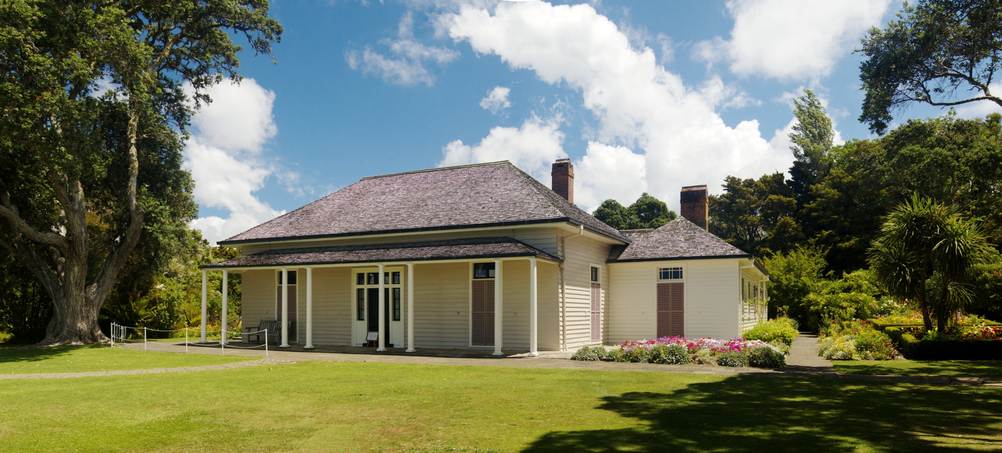
What is now called the 'Treaty House' was first occupied by James Busby, who acted as the British resident in New Zealand from 1832 until the arrival of William Hobson, and his wife Agnes Busby. In preparation for New Zealand Centenary in 1940 the Treaty House was restored in the 1930s, and the Māori meeting house was built beside it, sparking the first emergence of the Treaty into Pākehā attention since the 19th century.
Museums
Waitangi Treaty Grounds has been open to the public since 1934.[9][10]
Te Kōngahu Museum of Waitangi is an accompanying museum, opened in 2015.[11][10] Another museum, Te Rau Aroha, opened in 2020.[12][10]
Demographics
Statistics New Zealand describes Waitangi as a rural settlement. It covers 17.19 km2 (6.64 sq mi).[1] The settlement is part of the larger Puketona-Waitangi statistical area.[13]
| Year | Pop. | ±% p.a. |
|---|---|---|
| 2006 | 72 | — |
| 2013 | 66 | −1.24% |
| 2018 | 51 | −5.03% |
| Source: [2] | ||
Waitangi had a population of 51 at the 2018 New Zealand census, a decrease of 15 people (−22.7%) since the 2013 census, and a decrease of 21 people (−29.2%) since the 2006 census. There were 39 households, comprising 30 males and 21 females, giving a sex ratio of 1.43 males per female. The median age was 39.2 years (compared with 37.4 years nationally), with 6 people (11.8%) aged under 15 years, 12 (23.5%) aged 15 to 29, 21 (41.2%) aged 30 to 64, and 9 (17.6%) aged 65 or older.
Ethnicities were 58.8% European/Pākehā, 35.3% Māori, 11.8% Asian, and 5.9% other ethnicities. People may identify with more than one ethnicity.
Although some people chose not to answer the census's question about religious affiliation, 52.9% had no religion, 35.3% were Christian, 11.8% were Hindu and 5.9% had Māori religious beliefs.
Of those at least 15 years old, 12 (26.7%) people had a bachelor's or higher degree, and 0 (0.0%) people had no formal qualifications. The median income was $33,200, compared with $31,800 nationally. 6 people (13.3%) earned over $70,000 compared to 17.2% nationally. The employment status of those at least 15 was that 27 (60.0%) people were employed full-time, 12 (26.7%) were part-time, and 0 (0.0%) were unemployed.[2]
References
- "ArcGIS Web Application". statsnz.maps.arcgis.com. Retrieved 9 April 2022.
- "Statistical area 1 dataset for 2018 Census". Statistics New Zealand. March 2020. 7000268.
- "Oxford Dictionaries Online: 'Waitangi Day'". Oxford Dictionaries Online. Oxford University Press. Archived from the original on 6 February 2015. Retrieved 6 February 2015.
- Colenso, William (1890). "The Authentic and Genuine History of the Signing of the Treaty of Waitangi". Retrieved 27 August 2010.
- "He Whakaputanga me te Tiriti - The Declaration and the TreatyT - The Report on Stage 1 of the Te Paparahi o Te Raki Inquiry" (PDF). Waitangi Tribunal. 2014. pp. 526–528.
- "Te Kāhui Māngai directory". tkm.govt.nz. Te Puni Kōkiri.
- "Māori Maps". maorimaps.com. Te Potiki National Trust.
- "Marae Announcements" (Excel). growregions.govt.nz. Provincial Growth Fund. 9 October 2020.
- "Waitangi Treaty Grounds". Waitangi Treaty Grounds.
- "Waitangi Treaty Grounds on NZ Museums". nzmuseums.co.nz. Te Papa.
- "Te Kōngahu Museum of Waitangi". Te Kōngahu Museum of Waitangi.
- "Te Rau Aroha Museum". Te Rau Aroha Museum. 16 February 2020.
- 2018 Census place summary: Puketona-Waitangi
- Colenso, William (1890) The Authentic and Genuine History of the Signing of the Treaty of Waitangi, Published by the Government Printer, Wellington, in 1890, and reprinted by Capper Press, ChCh in 1971.
External links
![]() Media related to Waitangi at Wikimedia Commons
Media related to Waitangi at Wikimedia Commons
- Waitangi Treaty Ground website
- Info on Waitangi Archived 21 February 2013 at archive.today
- Biography of chief Moka Te Kainga-mataa; signatory to the Declaration of Independence, Hobson's Proclamations, and participant in the Treaty of Waitangi.
| Authority control |
|
|---|
На других языках
[de] Waitangi (Northland)
Waitangi ist der Ort im Far North District der Region Northland auf der Nordinsel von Neuseeland, wo am 6. Februar 1840 der Treaty of Waitangi unterzeichnet wurde.- [en] Waitangi, Northland
Другой контент может иметь иную лицензию. Перед использованием материалов сайта WikiSort.org внимательно изучите правила лицензирования конкретных элементов наполнения сайта.
WikiSort.org - проект по пересортировке и дополнению контента Википедии