world.wikisort.org - New_Zealand
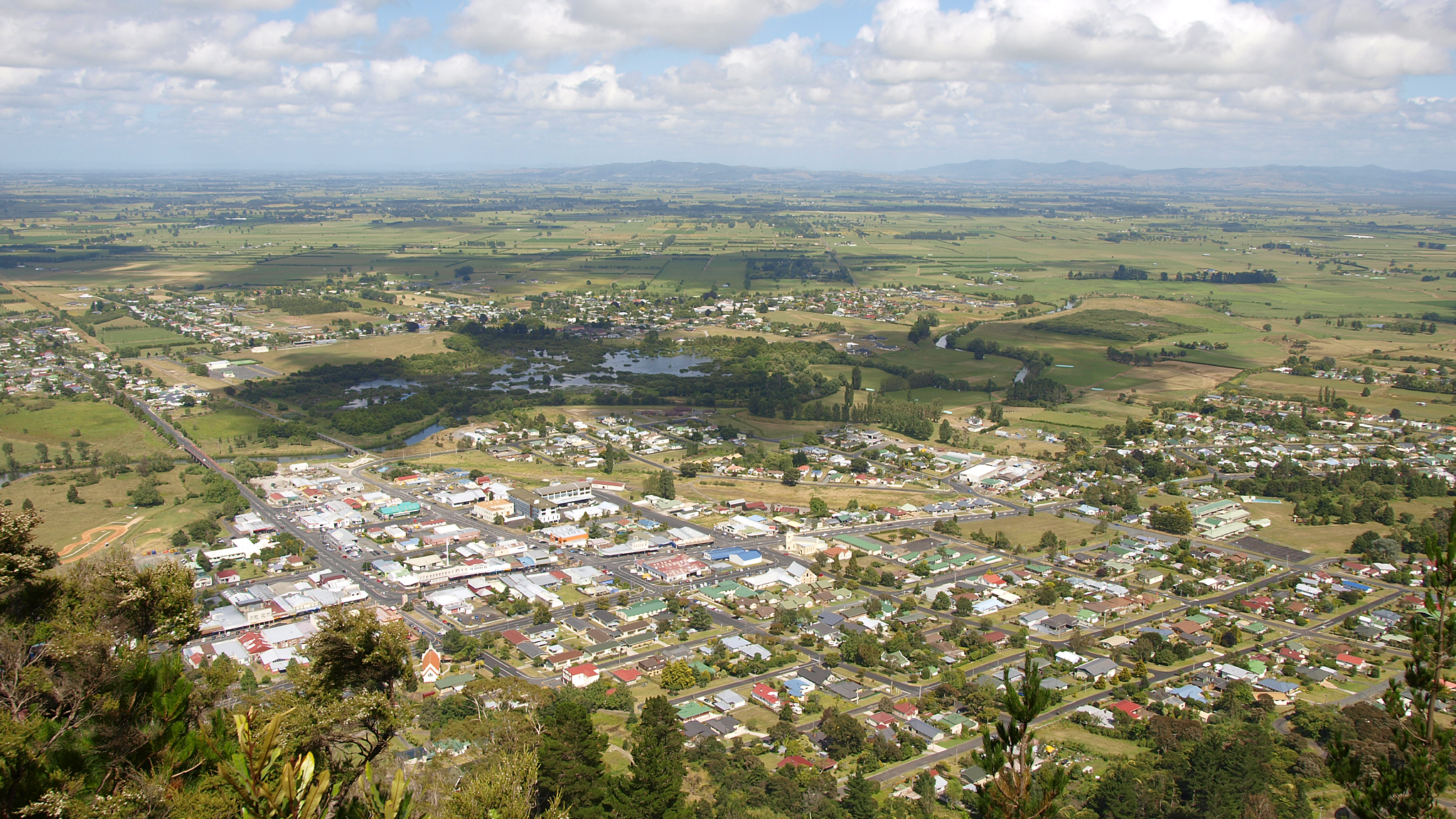
Te Aroha (Māori: Te Aroha-a-uta) is a rural town in the Waikato region of New Zealand with a population of 3,906 people in the 2013 census, an increase of 138 people since 2006.[3] It is 53 km (33 mi) northeast of Hamilton and 50 km (31 mi) south of Thames. It sits at the foot of 952 metres (3,123 ft) Mount Te Aroha, the highest point in the Kaimai Range.
Te Aroha | |
|---|---|
Minor urban area | |
 Cadman Bathhouse in Te Aroha Domain | |
 | |
| Coordinates: 37°32′S 175°43′E | |
| Country | New Zealand |
| Region | Waikato |
| Territorial authority | Matamata-Piako District |
| Ward | Te Aroha |
| Electorate | Waikato |
| Government | |
| • Territorial Authority | Matamata-Piako District Council |
| • Regional council | Waikato Regional Council |
| Area | |
| • Total | 10.97 km2 (4.24 sq mi) |
| Population (June 2022)[2] | |
| • Total | 4,670 |
| • Density | 430/km2 (1,100/sq mi) |
| Postcode(s) | 3320 |
History
The name Te Aroha derives from the Māori name of Mount Te Aroha. In one version, Rāhiri, the eponymous ancestor of Ngāti Rāhiri Tumutumu, climbed the mountain and saw his homeland in the distance and felt a sense of love (aroha) for it. The town is properly named Te Aroha-a-uta; uta meaning 'inland', so the town is named "love flowing inland".[4] In some Tainui traditions, Rakataura, a tohunga of the Tainui waka, was one of the first people to leave the waka, settling at Rarotonga / Mount Smart. After a period of time, Rakataura decided to leave Tāmaki Makaurau and travel south, however during the journey his wife Kahukeke died. Eventually Rakataura settled at Te Aroha, naming the area after the love he felt for Kahukeke.[5]
The European settlement was established in the late 1870s. The population grew quickly during the 1880s as a result of a gold rush. A spa was founded in 1883 but popularity had declined by the 1930s.[4]
Te Aroha Borough Council took over from the 1880 Town Board on 2 May 1898.[6] Herriesville became part of Te Aroha Borough Council.[7] The 1938 Council Chambers is now a Category 2 listed building.[8] Matamata-Piako District Council took over under the 1989 local government reforms.[9]
Created in 1888, Te Aroha and Lemon was New Zealand's first local fizzy drink. It was produced up until the 1960s.[10]
On 17 February 1985 Te Aroha experienced a severe flash flood that washed boulders, mud, and trees through the town. Most shops and more than 50 homes were damaged, resulting in the death of three people.[11][12][13]
Bridges
Coulter Bridge, over the Waihou River, on Kenrick St (SH26) was rebuilt in 1910[14] and the present bridge was built alongside it in 1928.[15] The railway bridge was rebuilt in 1912,[16] replacing the 1895 swing bridge.[17] It is now a footbridge, but will not be replaced.[18]
Railway stations
The Thames Branch reached Te Aroha in 1895 and the station opened on 1 March 1886.[19] The station was described in 1902 as, "of wood, and include a ladies' waiting room, a public waiting room, a vestibule, stationmaster's office, ticket office, and parcels office. There is a long asphalted platform."[6]
The area west of the Waihou was named Herriesville from 1914,[20][21] when a private railway siding[22] was opened on 24 January 1914 to serve the A&P ground.[23][24] William Herries had been a local landowner.[25] Seven railway cottages were built in 1924.[26] Both stations closed to passengers on 11 September 1967 and to freight on 11 July 1986, though Herriesville was only open for racecourse traffic.[19]
Demographics
Te Aroha covers 10.97 km2 (4.24 sq mi)[1] and had an estimated population of 6,680 as of June 2022,[2] with a population density of 426 people per km2.
| Year | Pop. | ±% p.a. |
|---|---|---|
| 2006 | 3,810 | — |
| 2013 | 4,005 | +0.72% |
| 2018 | 4,554 | +2.60% |
| Source: [27] | ||
Te Aroha had a population of 4,554 at the 2018 New Zealand census, an increase of 549 people (13.7%) since the 2013 census, and an increase of 744 people (19.5%) since the 2006 census. There were 1,776 households, comprising 2,214 males and 2,337 females, giving a sex ratio of 0.95 males per female, with 849 people (18.6%) aged under 15 years, 639 (14.0%) aged 15 to 29, 1,839 (40.4%) aged 30 to 64, and 1,221 (26.8%) aged 65 or older.
Ethnicities were 84.8% European/Pākehā, 17.7% Māori, 3.9% Pacific peoples, 6.4% Asian, and 2.0% other ethnicities. People may identify with more than one ethnicity.
The percentage of people born overseas was 17.1, compared with 27.1% nationally.
Although some people chose not to answer the census's question about religious affiliation, 48.6% had no religion, 37.2% were Christian, 0.7% had Māori religious beliefs, 0.1% were Hindu, 0.7% were Muslim, 2.0% were Buddhist and 1.7% had other religions.
Of those at least 15 years old, 384 (10.4%) people had a bachelor's or higher degree, and 1,095 (29.6%) people had no formal qualifications. 450 people (12.1%) earned over $70,000 compared to 17.2% nationally. The employment status of those at least 15 was that 1,506 (40.6%) people were employed full-time, 498 (13.4%) were part-time, and 126 (3.4%) were unemployed.[27]
| Name | Area (km2) | Population | Density (per km2) | Households | Median age | Median income |
|---|---|---|---|---|---|---|
| Te Aroha East | 4.68 | 2,529 | 540 | 1,029 | 47.1 years | $23,800[28] |
| Te Aroha West | 6.29 | 2,025 | 322 | 747 | 49.1 years | $27,600[29] |
| New Zealand | 37.4 years | $31,800 |
Geography

The Waihou River runs through Te Aroha. Close by to the east is the base of the Kaimai Range, and the town is overlooked by the 952-metre Mount Te Aroha. To the north of the town is the low-lying, swampy land of the Hauraki Plains.[citation needed]
Hot springs
Thermal and mineral springs are both found close to the centre of the town. The springs have been used by the Māori for many years before becoming popular in the 1870s with European settlers. The New Zealand Herald writes that the site was gifted to New Zealand by chief Mokena Hou in the 1880s. The hot spring water emerges from the source at a range of 75 °C /167 °F to 85 °C / 185 °F, and is cooled before reaching the soaking pools. Te Aroha has a hot soda-water geyser, which is the only one of its kind in the Southern Hemisphere.[30]
Economy
Te Aroha is at the centre of a dairy farming community and much of its economic activity is in serving that community. Tourism is increasing in Te Aroha. The mineral baths are a very popular spot for tourists and locals alike.[citation needed]

Historically mining played a role in the area, and has left some legacies – not all of them positive, such as toxic residues leaking from the abandoned Tui mine tailings dam.[31] Miners' cottages are in evidence.[citation needed]
Attractions
Te Aroha is the location of the Mokena Hou Geyser, the only natural soda water geyser in the world.[32] The geyser complex, the most intact Edwardian spa in New Zealand, is located in the Te Aroha Domain.[33]

The first sections of the Hauraki Rail Trail opened in 2012, connecting the town to Paeroa, Waihi, Matamata and Thames.

Events
This section needs additional citations for verification. (May 2022) |
- Waihou and Te Aroha Cobras play an annual rugby match for the Dr Dunn memorial trophy. This is one of the biggest days on the calendar of Te Aroha.
- A Day in the Domain was started in Te Aroha in 1977 by the Arts Council and continues to be a fun, affordable day out. The day attracts artists and performers from far and wide with a variety of stalls and foodies on display. Entertainment is free with competitions and games all day.
- The King and Queen of the Mountain and Bald Spur Derby have been annual events in Te Aroha since the 1950s. Held the weekend before Christmas, the challenge is to be the first man or woman up Mt Te Aroha and back down again. This has been achieved in under one hour. The Bald Spur Derby offers competitors a shorter but still challenging course.
- Te Aroha AP & H Show has been running since the 1890s. Boasting one of the most extensive home industries sections, it has full agricultural and equestrian sections and the usual country fair activities such as the gumboot throwing competition and cattle dogs.
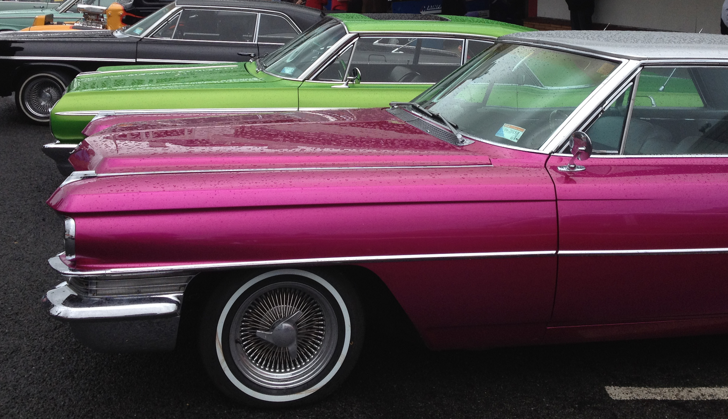
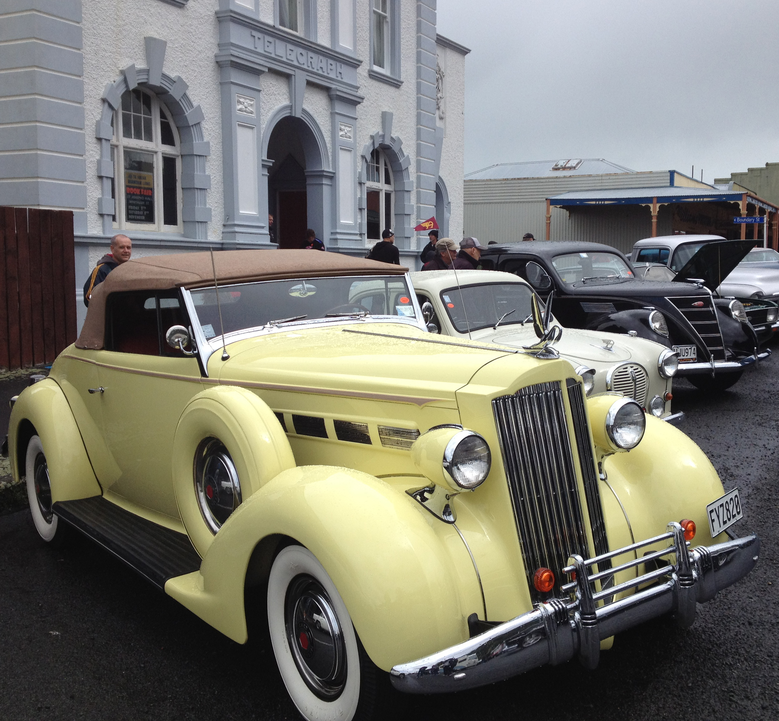
- Te Aroha Cruise In (car event) started 2008.[34]
Education
Te Aroha College is the town's state secondary school,[35][36] with a roll of 311.[37]
There are two state primary schools in the town: Te Aroha Primary School,[38][39] with a roll of 193;[40] and Stanley Avenue School,[41][42] with a roll of 269.[43]
St Joseph's Catholic School is a state integrated Catholic school,[44] with a roll of 76.[45]
All these schools are co-educational. Rolls are as of July 2022.[46]
Notable people
- Olympic Gold Medalist Peter Snell
- All Blacks Don Clarke, Kevin 'Herb' Schuler, Carl Hoeft, Keith Robinson and Kevin O'Neill
- Ian S. Ardern of the First Quorum of the Seventy of The Church of Jesus Christ of Latter-day Saints was born in the town
- Robert Coulter, Mayor of Te Aroha and Labour MP
- David Cunliffe, former leader of the New Zealand Labour Party, was born in Te Aroha.
- Stuart Farquhar, Olympic javelin thrower
- Jack Body, New Zealand composer
- Don Beard, New Zealand cricketer and principal of Te Aroha College from 1961 to 1982
- Todd Muller, Member of Parliament for Bay of Plenty, was born in Te Aroha.
Fauna and flora
In 2020 a report was produced on the moths of Mount Te Aroha outlining important species that inhabit the area.[47]
References
- "ArcGIS Web Application". statsnz.maps.arcgis.com. Retrieved 6 October 2022.
- "Subnational population estimates (RC, SA2), by age and sex, at 30 June 1996-2022 (2022 boundaries)". Statistics New Zealand. Retrieved 25 October 2022. (regional councils); "Subnational population estimates (TA, SA2), by age and sex, at 30 June 1996-2022 (2022 boundaries)". Statistics New Zealand. Retrieved 25 October 2022. (territorial authorities); "Subnational population estimates (urban rural), by age and sex, at 30 June 1996-2022 (2022 boundaries)". Statistics New Zealand. Retrieved 25 October 2022. (urban areas)
- 2013 Census QuickStats about a place : Te Aroha
- "Te Aroha". nzhistory.govt.nz. Ministry for Culture and Heritage. Retrieved 8 May 2020.
- Walker, Ranginui (2004). "Nga Korero o Nehera". Ka Whawhai Tonu Matou - Struggle Without End (Second ed.). Auckland, New Zealand: Penguin Books. p. 46. ISBN 9780143019459.
- "Te Aroha". The Cyclopedia of New Zealand [Auckland Provincial District]. 1902.
- "Waihou River Bridge". New Zealand Herald. 1925. p. 6. Retrieved 25 May 2018.
- "Te Aroha Borough Council Chambers". www.heritage.org.nz. Retrieved 25 May 2018.
- "Orders in Council for Local Government Reorganisation - The Local Government (Waikato Region) Reorganisation Order 1986 - Matamata- Piako District" (PDF). New Zealand Gazette. New Zealand Government. 8 June 1989. p. 2482.
- Sharnae Hope (5 January 2020). "New Zealand's first Kiwi fizz wasn't L&P but Te Aroha and Lemon".
- "Case Study: Te Aroha Flood, 1985". Matamata Piako District Council. Retrieved 22 January 2014.
- McSaveney, Eileen (9 July 2013). "Debris from a flash flood". Te Ara – the Encyclopedia of New Zealand.
- "The day disaster arrived". Stuff. Retrieved 24 December 2015.
- "Opening of a new traffic bridge at Te Aroha". www.aucklandcity.govt.nz. 17 March 1910. Retrieved 25 May 2018.
- "An important work at Te Aroha". www.aucklandcity.govt.nz. 13 October 1927. Retrieved 25 May 2018.
- "Te Aroha Heritage Trails". www.mpdc.govt.nz. Retrieved 25 May 2018.
- "Of no further use: the swing span of the Te Aroha railway bridge, which is to be removed". www.aucklandcity.govt.nz. 13 June 1912. Retrieved 25 May 2018.
- "Corporate and Operations Committee" (PDF). Matamata Piako Council. 24 May 2017. Archived from the original (PDF) on 28 January 2018.
- Scoble, Juliet. "Names & Opening & Closing Dates of Railway Stations in New Zealand 1863 to 2010" (PDF). Rail Heritage Trust of New Zealand.
- "Waikato Argus". 9 October 1913. p. 2. Retrieved 25 May 2018.
- "Herriesville". New Zealand Herald. 17 April 1914. p. 9. Retrieved 25 May 2018.
- "Piako County Council". Waikato Times. 23 July 1915. p. 6. Retrieved 25 May 2018.
- "Te Aroha a. P. and H. Show". Thames Star. 1914. p. 4. Retrieved 25 May 2018.
- "New Zealand Railways". Waikato Independent. 1914. p. 5. Retrieved 25 May 2018.
- Taonga, New Zealand Ministry for Culture and Heritage Te Manatu. "Herries, William Herbert". teara.govt.nz. Retrieved 25 May 2018.
- "Railway Cottages". New Zealand Herald. 7 April 1924. p. 8. Retrieved 25 May 2018.
- "Statistical area 1 dataset for 2018 Census". Statistics New Zealand. March 2020. Te Aroha East (174100) and Te Aroha West (174200).
- 2018 Census place summary: Te Aroha East
- 2018 Census place summary: Te Aroha West
- Meads, Linda. "GO NZ: A short break at Waikato's Te Aroha mineral pools an antidote to city life". The New Zealand Herald. Retrieved 1 April 2022.
- Cumming, Geoff (6 March 2010). "Miners press to enter the green zone". The New Zealand Herald. Retrieved 26 March 2010.
- "Mokena Geyser Access". Archived from the original on 9 February 2013. Retrieved 5 January 2012. Mokena Hou section of the MPDC website
- "Te Aroha Domain". Matamata Piako District Council. Retrieved 14 February 2021.
- Tanirau, Katrina (25 October 2017). "Thousands roar into Te Aroha for Aroha Cruise In". Waikato Times.
- "Te Aroha College Official School Website". tearoha-college.school.nz.
- "Te Aroha College Ministry of Education School Profile". educationcounts.govt.nz. Ministry of Education.
- "Te Aroha College Education Review Office Report". ero.govt.nz. Education Review Office.
- "Te Aroha Primary School Official School Website". tearohaprimary.school.nz.
- "Te Aroha Primary School Ministry of Education School Profile". educationcounts.govt.nz. Ministry of Education.
- "Te Aroha Primary School Education Review Office Report". ero.govt.nz. Education Review Office.
- "Stanley Avenue School Official School Website". stanleyave.school.nz.
- "Stanley Avenue School Ministry of Education School Profile". educationcounts.govt.nz. Ministry of Education.
- "Stanley Avenue School Education Review Office Report". ero.govt.nz. Education Review Office.
- "St Joseph's Catholic School Ministry of Education School Profile". educationcounts.govt.nz. Ministry of Education.
- "St Joseph's Catholic School Education Review Office Report". ero.govt.nz. Education Review Office.
- "New Zealand Schools Directory". New Zealand Ministry of Education. Retrieved 19 August 2022.
- Robert J. B. Hoare (2020), The Moths of Mt Te Aroha (PDF), pp. 1–11, Wikidata Q113345596, archived from the original (PDF) on 7 March 2022
External links
- Te Aroha i-SITE Visitor Centre
- Te Aroha Museum Website
- Te Aroha section of the MPDC website
- Te Aroha College
Photos -
- Main street 1909
- Railway station - 1899, 1903, 1905, 1905, 1908 (new station) 1910
- Railway swing bridge 1898
Authority control | |
|---|---|
| General |
|
| National libraries | |
На других языках
[de] Te Aroha
Te Aroha ist eine kleine Stadt im Matamata-Piako District der Region Waikato auf der Nordinsel von Neuseeland.- [en] Te Aroha
Другой контент может иметь иную лицензию. Перед использованием материалов сайта WikiSort.org внимательно изучите правила лицензирования конкретных элементов наполнения сайта.
WikiSort.org - проект по пересортировке и дополнению контента Википедии