world.wikisort.org - New_Zealand
Parkside is a suburb of Timaru, in the Timaru District and Canterbury Region of New Zealand's South Island.
Parkside | |
|---|---|
Suburb of Timaru | |
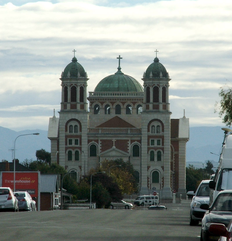 Sacred Heart Church (Timaru Basilica) | |
 | |
| Coordinates: 44.404003°S 171.251246°E | |
| Country | New Zealand |
| City | Timaru |
| Local authority | Timaru District Council |
| Electoral ward | Timaru |
| Area | |
| • Land | 115 ha (284 acres) |
| Population (June 2021)[2] | |
| • Total | 2,460 |
| Hospitals(s) | Timaru Hospital |
| East End | Seaview | Timaru Central |
| Watlington |
|
|
| Kensington |
The suburb includes the Timaru Botanic Gardens, a garden reserve officially set aside in 1867. The garden started being planted in 1968 and was put under the care of a ranger in 1872.[3]
Timaru Hospital is located on the north-eastern corner of the Botanic Gardens. It is a public hospital operated by South Canterbury District Health Board, which provides medical, mental health, children's health, maternity and surgical services.[4]
The suburb has one designated park, Anzac Square.[5] It also has three smaller pockets of reserve land: Alexandra Square, Russell Square and Boer War Memorial Park.[6]
Demographics
Parkside covers 1.15 km2 (0.44 sq mi)[1] and had an estimated population of 2,460 as of June 2021,[2] with a population density of 2,139 people per km2.
| Year | Pop. | ±% p.a. |
|---|---|---|
| 2006 | 2,295 | — |
| 2013 | 2,358 | +0.39% |
| 2018 | 2,376 | +0.15% |
| Source: [7] | ||
Parkside had a population of 2,376 at the 2018 New Zealand census, an increase of 18 people (0.8%) since the 2013 census, and an increase of 81 people (3.5%) since the 2006 census. There were 1,053 households. There were 1,182 males and 1,197 females, giving a sex ratio of 0.99 males per female. The median age was 40.7 years (compared with 37.4 years nationally), with 420 people (17.7%) aged under 15 years, 474 (19.9%) aged 15 to 29, 1,035 (43.6%) aged 30 to 64, and 447 (18.8%) aged 65 or older.
Ethnicities were 87.9% European/Pākehā, 11.7% Māori, 2.8% Pacific peoples, 5.3% Asian, and 1.8% other ethnicities (totals add to more than 100% since people could identify with multiple ethnicities).
The proportion of people born overseas was 12.6%, compared with 27.1% nationally.
Although some people objected to giving their religion, 51.1% had no religion, 36.0% were Christian, 0.9% were Hindu, 0.5% were Muslim, 0.3% were Buddhist and 2.4% had other religions.
Of those at least 15 years old, 183 (9.4%) people had a bachelor or higher degree, and 564 (28.8%) people had no formal qualifications. The median income was $27,400, compared with $31,800 nationally. 198 people (10.1%) earned over $70,000 compared to 17.2% nationally. The employment status of those at least 15 was that 966 (49.4%) people were employed full-time, 255 (13.0%) were part-time, and 69 (3.5%) were unemployed.[7]
Education
Timaru South School is a co-educational state primary for years 1 to 8[8] with a roll of 241. The school opened in 1881 as an extension of Timaru Main School. It merged with Pareora East School in 2004 and kept both campuses until 2018.[9]
Timaru Girls' High School is a single-sex state secondary school for years 9 to 13[10] with a roll of 382. It opened in 1880, initially sharing a site with Timaru Boys' High School but separated by a fence.[11]
Roncalli College is a Catholic coeducational state-integrated school for years 9 to 13[12] with a roll of 497. It was created by the 1982 merger of Mercy College (established 1935 as Sacred Heart College) and St Patrick's High School (established 1938).[11]
Rolls are as of July 2022.[13]
References
- "ArcGIS Web Application". statsnz.maps.arcgis.com. Retrieved 20 November 2021.
- "Population estimate tables - NZ.Stat". Statistics New Zealand. Retrieved 22 October 2021.
- "Timaru Botanic Gardens". timaru.govt.nz. Timaru District Council.
- "Timaru Hospital – Ministry of Health Profile". health.govt.nz. Ministry of Health.
- "Timaru Parks". timaru.govt.nz. Timaru District Council.
- "Parks, Reserves, Sports Fields & Playgrounds". arcgis.com. Timaru District Council.
- "Statistical area 1 dataset for 2018 Census". Statistics New Zealand. March 2020. Parkside (341300). 2018 Census place summary: Parkside
- Education Counts: Timaru South School
- "Our History". Timaru South School. Retrieved 20 November 2021.
- Education Counts: Timaru Girls' High School
- "South Canterbury Schools" (PDF). South Canterbury branch, New Zealand Society of Genealogists. Retrieved 20 November 2021.
- Education Counts: Roncalli College
- "New Zealand Schools Directory". New Zealand Ministry of Education. Retrieved 19 August 2022.
Другой контент может иметь иную лицензию. Перед использованием материалов сайта WikiSort.org внимательно изучите правила лицензирования конкретных элементов наполнения сайта.
WikiSort.org - проект по пересортировке и дополнению контента Википедии