world.wikisort.org - New_Zealand
Mackenzie District is a local government district in New Zealand's South Island administered by the Mackenzie District Council. It is part of the larger Canterbury Region.
Mackenzie District | |
|---|---|
Territorial authority | |
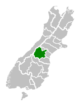 Mackenzie District within the South Island | |
| Country | New Zealand |
| Island | South Island |
| Region | Canterbury |
| Communities |
|
| Wards |
|
| Formed | 1989 |
| Seat | Fairlie |
| Government | |
| • Mayor | Graham Smith |
| • Deputy Mayor | James Leslie |
| • Territorial authority | Mackenzie District Council |
| Area | |
| • Total | 7,339.23 km2 (2,833.69 sq mi) |
| • Land | 7,138.59 km2 (2,756.23 sq mi) |
| Population (June 2022)[1] | |
| • Total | 5,460 |
| • Density | 0.74/km2 (1.9/sq mi) |
| Postcode(s) | |
| Website | Mackenzie District Council |
Principal settlements
The Mackenzie District only has three towns with a permanent population over 300 at the 2013 census:
- Fairlie (pop. 690) – seat of the district
- Twizel (pop. 1,140) – the district's largest town
- Tekapo (pop. 370)
Other smaller settlements include:
- Mount Cook Village
- Albury
- Burkes Pass
Geography
- Mackenzie Basin
- Mackenzie River
- Tekapo River
- Pukaki River
- Grays River
Demographics
Mackenzie District covers a land area of 7,138.59 km2 (2,756.23 sq mi)[2] and had an estimated population of 5,460 as of June 2022,[1] with a population density of 0.76 people per km2.
| Year | Pop. | ±% p.a. |
|---|---|---|
| 2006 | 3,801 | — |
| 2013 | 4,158 | +1.29% |
| 2018 | 4,866 | +3.19% |
| Source: [3] | ||
Mackenzie District had a population of 4,866 at the 2018 New Zealand census, an increase of 708 people (17.0%) since the 2013 census, and an increase of 1,065 people (28.0%) since the 2006 census. There were 1,863 households. There were 2,511 males and 2,352 females, giving a sex ratio of 1.07 males per female. The median age was 40.6 years (compared with 37.4 years nationally), with 801 people (16.5%) aged under 15 years, 978 (20.1%) aged 15 to 29, 2,274 (46.7%) aged 30 to 64, and 810 (16.6%) aged 65 or older.
Ethnicities were 86.4% European/Pākehā, 6.8% Māori, 1.2% Pacific peoples, 8.9% Asian, and 3.4% other ethnicities. People may identify with more than one ethnicity.
The percentage of people born overseas was 24.5, compared with 27.1% nationally.
Although some people objected to giving their religion, 51.7% had no religion, 37.1% were Christian, 1.1% were Hindu, 0.2% were Muslim, 1.2% were Buddhist and 1.5% had other religions.
Of those at least 15 years old, 777 (19.1%) people had a bachelor or higher degree, and 702 (17.3%) people had no formal qualifications. The median income was $33,400, compared with $31,800 nationally. 555 people (13.7%) earned over $70,000 compared to 17.2% nationally. The employment status of those at least 15 was that 2,451 (60.3%) people were employed full-time, 660 (16.2%) were part-time, and 30 (0.7%) were unemployed.[3]
| Name | Area (km2) | Population | Density (per km2) | Households | Median age | Median income |
|---|---|---|---|---|---|---|
| Pukaki Ward | 5,155.26 | 2,634 | 0.51 | 981 | 38.2 years | $34,500 |
| Opuha Ward | 1,983.34 | 2,229 | 1.12 | 879 | 42.8 years | $31,500 |
| New Zealand | 37.4 years | $31,800 |
| SA2 name | Population | Dwellings | Median age | Median income |
|---|---|---|---|---|
| Fairlie | 885 | 480 | 47.3 years | $25,700 |
| Mackenzie Lakes | 1,182 | 984 | 31.8 years | $36,500 |
| Opua | 1,347 | 639 | 40.0 years | $36,600 |
| Twizel | 1,455 | 1,485 | 46.5 years | $31,400 |
Economy

In 2012, the Mackenzie District had 850 businesses who employed 1900 full time equivalent staff and generated $190 million dollars in revenue. The economy is based on hydroelectric generation, farming (including aquaculture) and tourism.[5]
Of the 267 farms in the Mackenzie District in 2012, 34% of these were sheep farms, 18% sheep and beef cattle, and 15% beef cattle. Minimal amounts of crop farming occurs in the Mackenzie District with small amounts of barley (7,733 tonnes) and oats (2,265 tonnes) grown.[5]
A relatively sparsely settled area, the district does have a wide number of farms. However, in the late 2000s, numerous proposals for new farming operations have locals fearing that the agriculture will be transformed from often family-held farms to large agribusiness operations, causing increased local ecologic damage and siphoning off capital overseas.[6]
Climate
The Mackenzie District has a dry temperate-continental climate with clear, crisp snowy winters and long, hot summers. Autumn is known for being a riot of colour, while spring brings wildflowers blooming throughout the region, including lupins. The warm summer season is from November to February, with temperatures often passing 30 degrees. In the cooler winter season, from June to September, temperatures drop to below 0 degrees Celsius overnight, while sunny winter days average around 8 degrees and regular snowfall.[7]
History
The MacKenzie Basin was named in the 1850s by and after James Mckenzie, a Scottish-origin shepherd and sheep thief, and the name transferred to the modern district.
Notable places
Mountains
Lakes
- Lake Tekapo and the 'Church of the Good Shepherd'.
- Lake Pukaki
- Lake Ruataniwha, one of New Zealand's main rowing venues
- Lake Ōhau
Glaciers
- Tasman Glacier
- Hooker Glacier
Skifields
- Fox Peak
- Mt Dobson
- Round Hill
- Tasman Glacier Heliski
National parks
- Aoraki / Mount Cook National Park
List of mayors
| Name | Term of office |
|---|---|
| Bruce Scott | 1989-1992 reference to follow |
| Neil Anderson | 1992–2001[8] |
| Stan Scorringe | 2001–2004[9] |
| John O'Neill | 2004–2010[10] |
| Claire Barlow | 2010–2016[11] |
| Graham Smith | 2016–present[12] |
References
- "Subnational population estimates (RC, SA2), by age and sex, at 30 June 1996-2022 (2022 boundaries)". Statistics New Zealand. Retrieved 25 October 2022. (regional councils); "Subnational population estimates (TA, SA2), by age and sex, at 30 June 1996-2022 (2022 boundaries)". Statistics New Zealand. Retrieved 25 October 2022. (territorial authorities); "Subnational population estimates (urban rural), by age and sex, at 30 June 1996-2022 (2022 boundaries)". Statistics New Zealand. Retrieved 25 October 2022. (urban areas)
- "ArcGIS Web Application". statsnz.maps.arcgis.com. Retrieved 13 March 2022.
- "Statistical area 1 dataset for 2018 Census". Statistics New Zealand. March 2020. Mackenzie District (065). 2018 Census place summary: Mackenzie District
- "2018 Census place summaries | Stats NZ". www.stats.govt.nz. Retrieved 2020-12-14.
- Nick Taylor, Simon Harris, Wayne McClintock, Mike Mackay (May 2015). "Upper Waitaki Limit Setting Process: Social-economic Profile of the Waitaki Catchment". Ecan. Retrieved 19 January 2022.
{{cite web}}: CS1 maint: multiple names: authors list (link) CS1 maint: url-status (link) - Taylor, Gary (2010-02-08). "A national treasure is being squandered". The New Zealand Herald. Retrieved 8 February 2010.
- "Aoraki Mount Cook Mackenzie". mtcooknz.com. Archived from the original on 2009-08-02. Retrieved 2009-07-18.
- "Health Minister announces DHB deputy chairs". Scoop.co.nz. 21 December 2001.
- "Mayoral Election Results 2004 Affecting the Mayors Taskforce For Jobs". Mayors Taskforce for Jobs.
- "O'Neill plans family time". Stuff. 8 October 2010.
- "Receptionist becomes Mayor for Mackenzie". Newshub. 10 October 2010.
- "'Exciting times' for new Mackenzie mayor Graham Smith". Stuff. 9 October 2016.
External links
На других языках
- [en] Mackenzie District
[it] Distretto di Mackenzie
Il distretto di Mackenzie è un'autorità territoriale della Nuova Zelanda che si trova entro i confini della regione di Canterbury, nell'Isola del Sud. La sede del Consiglio distrettuale si trova nella città di Fairlie.Другой контент может иметь иную лицензию. Перед использованием материалов сайта WikiSort.org внимательно изучите правила лицензирования конкретных элементов наполнения сайта.
WikiSort.org - проект по пересортировке и дополнению контента Википедии