world.wikisort.org - New_Zealand
Goodwood Heights is a suburb of Auckland, New Zealand. It is located approximately 20 kilometres southeast of the Auckland CBD; to the north of Totara Heights, east of Manukau Central and south of Chapel Downs. It was formerly part of Manukau City until the merger of all of Auckland's councils into the 'super city' in 2010.
Goodwood Heights | |
|---|---|
Suburb of Auckland | |
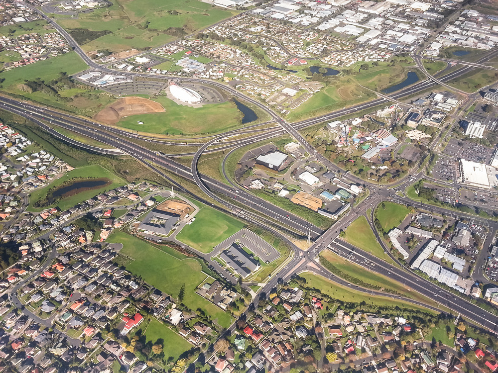 Goodwood Heights is in the lower left of this picture, with the interchange between the Auckland Southern Motorway and Southwestern Motorway in the background | |
 | |
| Coordinates: 36.9939°S 174.8994°E | |
| Country | New Zealand |
| City | Auckland |
| Local authority | Auckland Council |
| Electoral ward | Manurewa-Papakura ward |
| Local board | Manurewa Local Board |
| Area | |
| • Land | 128 ha (316 acres) |
| Population (June 2021)[2] | |
| • Total | 4,800 |
| Papatoetoe | Clover Park | Flat Bush |
| Manukau |
|
Totara Park |
| Wiri | Totara Heights | The Gardens |
Demographics
Goodwood Heights covers 1.28 km2 (0.49 sq mi)[1] and had an estimated population of 4,800 as of June 2021,[2] with a population density of 3,750 people per km2.
| Year | Pop. | ±% p.a. |
|---|---|---|
| 2006 | 3,834 | — |
| 2013 | 4,071 | +0.86% |
| 2018 | 4,401 | +1.57% |
| Source: [3] | ||
Goodwood Heights had a population of 4,401 at the 2018 New Zealand census, an increase of 330 people (8.1%) since the 2013 census, and an increase of 567 people (14.8%) since the 2006 census. There were 1,143 households, comprising 2,238 males and 2,166 females, giving a sex ratio of 1.03 males per female. The median age was 34.5 years (compared with 37.4 years nationally), with 843 people (19.2%) aged under 15 years, 1,035 (23.5%) aged 15 to 29, 2,082 (47.3%) aged 30 to 64, and 438 (10.0%) aged 65 or older.
Ethnicities were 25.2% European/Pākehā, 11.5% Māori, 19.0% Pacific peoples, 55.3% Asian, and 2.7% other ethnicities. People may identify with more than one ethnicity.
The percentage of people born overseas was 51.5, compared with 27.1% nationally.
Although some people chose not to answer the census's question about religious affiliation, 25.1% had no religion, 35.1% were Christian, 0.7% had Māori religious beliefs, 18.0% were Hindu, 6.3% were Muslim, 3.5% were Buddhist and 6.3% had other religions.
Of those at least 15 years old, 816 (22.9%) people had a bachelor's or higher degree, and 519 (14.6%) people had no formal qualifications. The median income was $36,400, compared with $31,800 nationally. 576 people (16.2%) earned over $70,000 compared to 17.2% nationally. The employment status of those at least 15 was that 1,980 (55.6%) people were employed full-time, 411 (11.6%) were part-time, and 144 (4.0%) were unemployed.[3]
Education
Everglade School is a coeducational contributing primary school (years 1–6) with a roll of 461 as of July 2022.[4][5]
References
- "ArcGIS Web Application". statsnz.maps.arcgis.com. Retrieved 12 August 2022.
- "Population estimate tables - NZ.Stat". Statistics New Zealand. Retrieved 22 October 2021.
- "Statistical area 1 dataset for 2018 Census". Statistics New Zealand. March 2020. Goodwood Heights (158500). 2018 Census place summary: Goodwood Heights
- "New Zealand Schools Directory". New Zealand Ministry of Education. Retrieved 19 August 2022.
- Education Counts: Everglade School
Другой контент может иметь иную лицензию. Перед использованием материалов сайта WikiSort.org внимательно изучите правила лицензирования конкретных элементов наполнения сайта.
WikiSort.org - проект по пересортировке и дополнению контента Википедии