world.wikisort.org - Netherlands
Zijtaart is a village in the south of the Netherlands. It is situated in the municipality of Meierijstad, North Brabant. As of January 2015 it has a population of 1,727.
Zijtaart | |
|---|---|
Village | |
 St. Lambert Church in Zijtaart | |
 Zijtaart Location in the province of North Brabant in the Netherlands  Zijtaart Zijtaart (Netherlands) | |
| Coordinates: 51°35′33″N 5°32′30″E | |
| Country | Netherlands |
| Province | North Brabant |
| Municipality | Meierijstad |
| Area | |
| • Total | 6.43 km2 (2.48 sq mi) |
| Elevation | 12 m (39 ft) |
| Population (2021)[1] | |
| • Total | 1,655 |
| • Density | 260/km2 (670/sq mi) |
| Time zone | UTC+1 (CET) |
| • Summer (DST) | UTC+2 (CEST) |
| Postal code | 5465[1] |
| Dialing code | 0413 |
| Major roads | A50, N265 |
History
Zijtaart as a church village was officially founded in 1872 when it split off as a separate parish from the St. Lambert Parish in Veghel. The church of the Zijtaart St. Lambert Parish still bears the original tower cross atop the spire, of the old St. Lambert Church of Veghel. The tower cross was presented as a gift by the St. Lambert Parish of Veghel in 1873, which would start the demolition of its old church that following year, because of the completion of a new and larger church.
Gallery
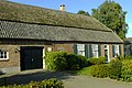 Farm in Zijtaart
 Former women monastery
 Two children statue


References
- "Kerncijfers wijken en buurten 2021". Central Bureau of Statistics. Retrieved 17 April 2022.
two entries
- "Postcodetool for 5465LA". Actueel Hoogtebestand Nederland (in Dutch). Het Waterschapshuis. Retrieved 17 April 2022.
Wikimedia Commons has media related to Zijtaart.
External links
This North Brabant location article is a stub. You can help Wikipedia by expanding it. |
Текст в блоке "Читать" взят с сайта "Википедия" и доступен по лицензии Creative Commons Attribution-ShareAlike; в отдельных случаях могут действовать дополнительные условия.
Другой контент может иметь иную лицензию. Перед использованием материалов сайта WikiSort.org внимательно изучите правила лицензирования конкретных элементов наполнения сайта.
Другой контент может иметь иную лицензию. Перед использованием материалов сайта WikiSort.org внимательно изучите правила лицензирования конкретных элементов наполнения сайта.
2019-2026
WikiSort.org - проект по пересортировке и дополнению контента Википедии
WikiSort.org - проект по пересортировке и дополнению контента Википедии