world.wikisort.org - Netherlands
Well is a village in the Dutch province of Gelderland. It is a part of the municipality of Maasdriel, and lies about 9 km northwest of 's-Hertogenbosch.
Well | |
|---|---|
Village | |
 | |
 Well Location in the Netherlands  Well Well (Netherlands) | |
| Coordinates: 51.7438°N 5.2033°E | |
| Country | Netherlands |
| Province | Gelderland |
| Municipality | Maasdriel |
| Area | |
| • Total | 0.36 km2 (0.14 sq mi) |
| Elevation | 3 m (10 ft) |
| Population (2021)[1] | |
| • Total | 520 |
| • Density | 1,400/km2 (3,700/sq mi) |
| Time zone | UTC+1 (CET) |
| • Summer (DST) | UTC+2 (CEST) |
| Postal code | 5325[1] |
| Dialing code | 073 |
History
It was first mentioned in the 10th or 11th century as Vualli, and means well.[3] Well developed on an artificial mound and was originally a linear settlement along the road. Later it became more concentrated. The tower of the Dutch Reformed Church dates from the 12th century. The church itself dates from the 16th century. Castle Well probably dates from the 14th century. The tower was remodelled in the 16th century.[4] In 1672, it was heavily damaged by the French. In 1884, the castle was extended.[5] In 1840, Well was home to 843 people.[5]
Gallery
 Castle Well
 Farm in Well
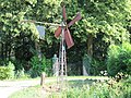 Little wind mill


References
- "Kerncijfers wijken en buurten 2021". Central Bureau of Statistics. Retrieved 23 March 2022.
- "Postcodetool for 5325GA". Actueel Hoogtebestand Nederland (in Dutch). Het Waterschapshuis. Retrieved 23 March 2022.
- "Well - (geografische naam)". Etymologiebank (in Dutch). Retrieved 23 March 2022.
- Ronald Stenvert & Sabine Broekhoven (2000). "Well" (in Dutch). Zwolle: Waanders. ISBN 90 400 9406 3. Retrieved 23 March 2022.
- "Well (Gelderland)". Plaatsengids (in Dutch). Retrieved 23 March 2022.
This Gelderland location article is a stub. You can help Wikipedia by expanding it. |
Другой контент может иметь иную лицензию. Перед использованием материалов сайта WikiSort.org внимательно изучите правила лицензирования конкретных элементов наполнения сайта.
WikiSort.org - проект по пересортировке и дополнению контента Википедии