world.wikisort.org - Netherlands
Warder is a village in the Dutch province of North Holland. It is a part of the municipality of Edam-Volendam, and lies about 7 km northeast of Purmerend.
Warder | |
|---|---|
Village | |
 Former school building | |
 Warder Location in the Netherlands  Warder Location in the province of North Holland in the Netherlands | |
| Coordinates: 52°35′53″N 5°1′39″E | |
| Country | Netherlands |
| Province | North Holland |
| Municipality | Edam-Volendam |
| Area | |
| • Total | 10.82 km2 (4.18 sq mi) |
| Elevation | −1.3 m (−4.3 ft) |
| Population (2021)[1] | |
| • Total | 810 |
| • Density | 75/km2 (190/sq mi) |
| Time zone | UTC+1 (CET) |
| • Summer (DST) | UTC+2 (CEST) |
| Postal code | 1473[1] |
| Dialing code | 0299 |
The village was first mentioned between 1130 and 1161 as Werthere, and means "island".[3] The original village was probably more to the east on the former lake Almere and moved inland as the Zuiderzee started to grow.[4] The current Warder developed in the late 12th century as a peat excavation settlement. The elementary school was built as an L-shaped building with tower in 1885. It was renovated around 1920.[5]
Warder was home to 290 people in 1840.[4] It was a separate municipality between 1817 and 1970, when the new municipality of Zeevang was created.[6] In 2016, it became part of the municipality of Edam-Volendam.[4]
Gallery
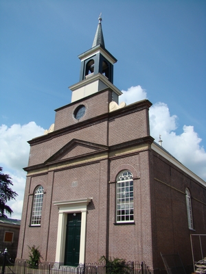
 The church of Warder
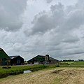 Farm in Warder
 Little shop in the street


References
- "Kerncijfers wijken en buurten 2021". Central Bureau of Statistics. Retrieved 29 April 2022.
- "Postcodetool for 1473BD". Actueel Hoogtebestand Nederland (in Dutch). Het Waterschapshuis. Retrieved 29 April 2022.
- "Warder - (geografische naam)". Etymologiebank (in Dutch). Retrieved 29 April 2022.
- "Warde". Plaatsengids (in Dutch). Retrieved 29 April 2022.
- Ronald Stenvert & Saskia van Ginkel-Meester (2006). "Warder" (in Dutch). Zwolle: Waanders. Retrieved 29 April 2022.
- Ad van der Meer and Onno Boonstra, Repertorium van Nederlandse gemeenten, KNAW, 2011.
This North Holland location article is a stub. You can help Wikipedia by expanding it. |
Другой контент может иметь иную лицензию. Перед использованием материалов сайта WikiSort.org внимательно изучите правила лицензирования конкретных элементов наполнения сайта.
WikiSort.org - проект по пересортировке и дополнению контента Википедии