world.wikisort.org - Netherlands
Ulestraten (Limburgish: Ulesjtraote) is a village in the Dutch province of Limburg. It is located in the municipality of Meerssen. It is surrounded by several forests.
Ulestraten
Ulesjtraote | |
|---|---|
Village | |
 Place name sign and Huize Vliek | |
 Coat of arms | |
 Ulestraten Location in the Netherlands  Ulestraten Location in the province of Limburg in the Netherlands | |
| Coordinates: 50°54′19″N 5°46′49″E | |
| Country | Netherlands |
| Province | Limburg |
| Municipality | Meerssen |
| Area | |
| • Total | 5.84 km2 (2.25 sq mi) |
| Elevation | 125 m (410 ft) |
| Population (2021)[1] | |
| • Total | 2,805 |
| • Density | 480/km2 (1,200/sq mi) |
| Time zone | UTC+1 (CET) |
| • Summer (DST) | UTC+2 (CEST) |
| Postal code | 6235[1] |
| Dialing code | 043 |
History
The village was first mentioned in 1335 as Hulenstroten, and is combination of "land near water" and "swampy place with shrubbery".[3] Ulestration developed in the Middle Ages on the plateau of Schimmert. Between 1626 and 1794, it was a heerlijkheid within the Land van Valkenburg.[4] Between June 1814 and May 1815, it was part of Prussia, but awarded to the Kingdom of the Netherlands at the Congress of Vienna.[5] Ulestraten became an independent parish in 1833.[4]
The St Catharina Church is a three aisled basilica-like church built between 1905 and 1906 in Gothic Revival style. Initially, the tower from 1805/1806 was retained, but it was replaced in 1929 by a new tower.[4]
Vliek Castle was first mentioned in 1374. The current manor house was built around 1725 in Louis XIV style. Short side wings have been added in 1908.[4]
Ulestraten was home to 366 people in 1840.[5] In 1944, an airfield was built by the Allies partially in the municipality of Ulestraten. It is currently known as Maastricht Aachen Airport. The airport triggered a rapid population increase and industrialisation of the village.[5] It was a separate municipality until 1982, when it was merged with Meerssen.[6]
Gallery
 The St Catharina Church
 Villa in Ulestraten
 Carnival in Ulestraten
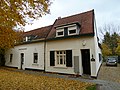 House in Ulestraten


References
- "Kerncijfers wijken en buurten 2021". Central Bureau of Statistics. Retrieved 25 April 2022.
- "Postcodetool for 6235AA". Actueel Hoogtebestand Nederland (in Dutch). Het Waterschapshuis. Retrieved 25 April 2022.
- "Ulestraten - (geografische naam)". Etymologiebank (in Dutch). Retrieved 25 April 2022.
- Sabine Broekhoven, & Ronald Stenvert (2003). Ulestraten (in Dutch). Zwolle: Waanders. ISBN 90 400 9623 6. Retrieved 25 April 2022.
- "Ulestraten". Plaatsengids (in Dutch). Retrieved 25 April 2022.
- Ad van der Meer and Onno Boonstra, Repertorium van Nederlandse gemeenten, KNAW, 2011.
| Authority control |
|
|---|
Другой контент может иметь иную лицензию. Перед использованием материалов сайта WikiSort.org внимательно изучите правила лицензирования конкретных элементов наполнения сайта.
WikiSort.org - проект по пересортировке и дополнению контента Википедии