world.wikisort.org - Netherlands
Uitweg is a hamlet in the Dutch province of Utrecht. It is a part of the municipality of Lopik, and lies about 5 km southwest of IJsselstein. The town consists almost completely of a ribbon of farms along the Enge IJssel and Lopiker Wetering rivers, between Graaf and Lopikerkapel.
Uitweg | |
|---|---|
Hamlet | |
 Uitweg | |
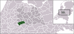 | |
 Uitweg in the municipality of Lopik. | |
| Coordinates: 51°58′57″N 5°0′52″E | |
| Country | Netherlands |
| Province | Utrecht (province) |
| Municipality | Lopik |
| Area | |
| • Total | 1.00 km2 (0.39 sq mi) |
| Elevation | 1 m (3 ft) |
| Population (2021)[1] | |
| • Total | 610 |
| • Density | 610/km2 (1,600/sq mi) |
| Time zone | UTC+1 (CET) |
| • Summer (DST) | UTC+2 (CEST) |
| Postal code | 3412[1] |
| Dialing code | 030 |
It was first mentioned between 1165 and 1169 as "inter viam que dicitur Vtweg", and means side road. The road is nowadays called Opweg.[3] The postal authorities have placed it under Lopikerkapel.[4] Uitweg has its own place name signs. The nature area De Horde was originally a river island. In 1860, it was turned into a peninsula by the creation of a dike.[5]
Gallery
 View on Uitweg
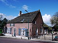 Farm in Uitweg
 De Wiel in winter
 Street view


References
- "Kerncijfers wijken en buurten 2021". Central Bureau of Statistics. Retrieved 28 March 2022.
- "Postcodetool for 3412JA". Actueel Hoogtebestand Nederland (in Dutch). Het Waterschapshuis. Retrieved 28 March 2022.
- "Uitweg - (geografische naam)". Etymologiebank (in Dutch). Retrieved 28 March 2022.
- "Postcode 3412 in Lopikerkapel". Postcode bij adres (in Dutch). Retrieved 28 March 2022.
- "Uitweg". Plaatsengids (in Dutch). Retrieved 28 March 2022.
Wikimedia Commons has media related to Uitweg.
This Utrecht location article is a stub. You can help Wikipedia by expanding it. |
Текст в блоке "Читать" взят с сайта "Википедия" и доступен по лицензии Creative Commons Attribution-ShareAlike; в отдельных случаях могут действовать дополнительные условия.
Другой контент может иметь иную лицензию. Перед использованием материалов сайта WikiSort.org внимательно изучите правила лицензирования конкретных элементов наполнения сайта.
Другой контент может иметь иную лицензию. Перед использованием материалов сайта WikiSort.org внимательно изучите правила лицензирования конкретных элементов наполнения сайта.
2019-2026
WikiSort.org - проект по пересортировке и дополнению контента Википедии
WikiSort.org - проект по пересортировке и дополнению контента Википедии