world.wikisort.org - Netherlands
Stiens is a town in the municipality of Leeuwarden, Netherlands. As of January 2017, the town has a population of about 7,545.[3] Between 1944 and 2018, it was the capital of the municipality of Leeuwarderadeel.
Stiens | |
|---|---|
Village | |
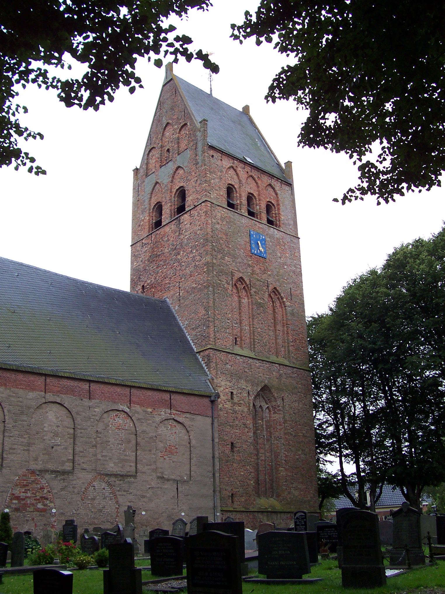 St Vitus' Church | |
 Location in (former) Leeuwarderadeel municipality | |
 Stiens Location in the Netherlands  Stiens Stiens (Netherlands) | |
| Coordinates: | |
| Country | |
| Province | |
| Municipality | |
| Area | |
| • Total | 18.07 km2 (6.98 sq mi) |
| Elevation | 0.9 m (3.0 ft) |
| Population (2021)[1] | |
| • Total | 7,695 |
| • Density | 430/km2 (1,100/sq mi) |
| Postal code | 9051[1] |
| Dialing code | 058 |
History
The village was first mentioned in the 13th century Steninge, and means settlement of the people of Stena (person). Staining in Lancashire, England has the same origin.[4] Stiens is a terp (artificial living mound) village with a radial structure which developed before our era along the Middelzee. There are additional terps to the north and south of the main terp on which the church was built. The western part of the main terp was later lost in floods.[5]
The nave of the Dutch Reformed Church dates from around 1100. The tower dates from the 15th century and was restored in 1898.[5] In 1840, Stiens was home to 1,617 people.[6] In 1933, a monument was erected for Pieter Jelles Troelstra, however it is not for his achievements as a politician, but as a poet.[5] The capital of the municipality of Leeuwarderadeel was the village of Huizum. In 1944, the southern part of the municipality including Huizum was annexed by Leeuwarden, and Stiens became the new capital of Leeuwarderadeel.[7]
Before 2018, the town was part of the Leeuwarderadeel municipality. The town hall of the municipality was located in Stiens.[6]
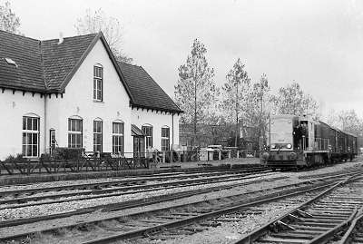
Railways
Stiens was the main station on the North Friesland Railway. It opened in April 1901, with a branch to Harlingen opening in stages between December 1902 and May 1904. Closures of the railway include the following
- Direct service to Franeker in October 1933;
- Direct service to Harlingen in May 1935 and freight in January 1938;
- All other passenger services ceased in July 1936, but were reopened as far as Tzummarum and Dokkum-Aalsum in May 1940;
- The passenger service to Dokkum-Aalsum closed again in December 1940 and then it became permanently closed in October 1942;
- The final freight service from Stiens to Leeuwarden closed in 1997.
Windmills
There are three windmills in Stiens, including De Hoop, De Kleine Molen, and De Steenhuistermolen.
Notable people
- Abe Bonnema (1926-2001), architect
- Piet Dankert (1934-2003), politician
- Pieter Jelles Troelstra (1860-1930), politician
Gallery
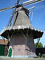 De Hoop
 Steenhuistermolen
 Former town hall
 Former railway station (1974)
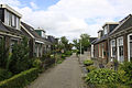 Street view
 Houses in Stiens


References
- "Kerncijfers wijken en buurten 2021". Central Bureau of Statistics. Retrieved 31 March 2022.
two entries
- "Postcodetool for 9051AA". Actueel Hoogtebestand Nederland (in Dutch). Het Waterschapshuis. Retrieved 31 March 2022.
- Kerncijfers wijken en buurten 2017 - CBS Statline
- "Stiens - (geografische naam)". Etymologiebank (in Dutch). Retrieved 31 March 2022.
- Ronald Stenvert & Sabine Broekhoven (2000). "Stiens" (in Dutch). Zwolle: Waanders. ISBN 90 400 9476 4. Retrieved 31 March 2022.
- "Stiens". Plaatsengids (in Dutch). Retrieved 31 March 2022.
- "Grenswijziging Leeuwarden - Leeuwarderadeel". Nieuwsblad van Friesland (in Dutch). 10 January 1944. Retrieved 31 March 2022.
External links
![]() Media related to Stiens at Wikimedia Commons
Media related to Stiens at Wikimedia Commons
Другой контент может иметь иную лицензию. Перед использованием материалов сайта WikiSort.org внимательно изучите правила лицензирования конкретных элементов наполнения сайта.
WikiSort.org - проект по пересортировке и дополнению контента Википедии