world.wikisort.org - Netherlands
Soestduinen is a hamlet in the Dutch province of Utrecht. It is a part of the municipality of Soest, and lies about 3 km south of Soest.
Soestduinen | |
|---|---|
Hamlet | |
 The dunes covered in snow | |
 Soestduinen Location in the Netherlands  Soestduinen Soestduinen (Netherlands) | |
| Coordinates: 52°8′45″N 5°17′55″E | |
| Country | Netherlands |
| Province | Utrecht |
| Municipality | Soest |
| Area | |
| • Total | 2.33 km2 (0.90 sq mi) |
| Elevation | 5 m (16 ft) |
| Population (2021)[1] | |
| • Total | 170 |
| • Density | 73/km2 (190/sq mi) |
| Time zone | UTC+1 (CET) |
| • Summer (DST) | UTC+2 (CEST) |
| Postal code | 3768[1] |
| Dialing code | 0346 |
The hamlet was first mentioned in 1936 as Soestduinen, and means the dunes near Soest.[3] The railway station Soestduinen has existed between 1863 and 1998, and was called Soestduinen since 1922.[4] The hamlet has always had place name signs, but since 2009, it reads Soest with Soestduinen underneath to emphasise that it is a hamlet belonging to Soest.[5]
Gallery
 Pumping station
 Former railway station building
 Houses in Soestduinen
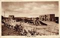 Old postcard of a holiday resort in Soestduinen


References
- "Kerncijfers wijken en buurten 2021". Central Bureau of Statistics. Retrieved 27 March 2022.
- "Postcodetool for 3768AA". Actueel Hoogtebestand Nederland (in Dutch). Het Waterschapshuis. Retrieved 27 March 2022.
- "Soestduinen - (geografische naam)". Etymologiebank (in Dutch). Retrieved 27 March 2022.
- "station Soestduinen". Stationsweb (in Dutch). Retrieved 27 March 2022.
- "Soestduinen". Plaatsengids (in Dutch). Retrieved 27 March 2022.
Wikimedia Commons has media related to Soestduinen.
This Utrecht location article is a stub. You can help Wikipedia by expanding it. |
Текст в блоке "Читать" взят с сайта "Википедия" и доступен по лицензии Creative Commons Attribution-ShareAlike; в отдельных случаях могут действовать дополнительные условия.
Другой контент может иметь иную лицензию. Перед использованием материалов сайта WikiSort.org внимательно изучите правила лицензирования конкретных элементов наполнения сайта.
Другой контент может иметь иную лицензию. Перед использованием материалов сайта WikiSort.org внимательно изучите правила лицензирования конкретных элементов наполнения сайта.
2019-2026
WikiSort.org - проект по пересортировке и дополнению контента Википедии
WikiSort.org - проект по пересортировке и дополнению контента Википедии