world.wikisort.org - Netherlands
Siddeburen (Dutch pronunciation: [sɪdəbyrən]; Gronings: Sibboeren or Siddeboeren) is a village in the Dutch province of Groningen. It is located in the municipality of Midden-Groningen, about 10 km southwest of Delfzijl.
Siddeburen | |
|---|---|
Village | |
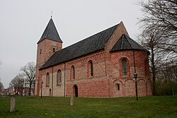
 Protestant Church in 2014 | |
Location of Siddeburen in the province of Groningen  Siddeburen Siddeburen (Netherlands) | |
| Coordinates: 53°14′55″N 6°51′52″E | |
| Country | Netherlands |
| Province | Groningen |
| Municipality | Midden-Groningen |
| Area | |
| • Total | 22.04 km2 (8.51 sq mi) |
| Elevation | 1.1 m (3.6 ft) |
| Population (2021)[1] | |
| • Total | 3,205 |
| • Density | 150/km2 (380/sq mi) |
| Postal code | 9628[1] |
| Dialing code | 0598 |
Siddeburen was a separate municipality until 1826, when it was merged with Slochteren.[3]
History
The village was first mentioned in 1226 as "de Sigerdachurke", and means "settlement of Syerd (person)".[4] Siddeburen is a road village which developed on a sandy ridge in the late 12th century.[5] The village originally consisted of two parallel linear settlements.[6]
The Dutch Reformed church dates from around 1200. The tower was enlarged several times, but partially rebuilt and lowered in 1832.[5] The church was restored in the mid-20th century.[6]
Siddeburen was home to 1,335 people in 1840.[6]
References
- "Kerncijfers wijken en buurten 2021". Central Bureau of Statistics. Retrieved 9 April 2022.
- "Postcodetool for 9628AA". Actueel Hoogtebestand Nederland (in Dutch). Het Waterschapshuis. Retrieved 9 April 2022.
- Ad van der Meer and Onno Boonstra, Repertorium van Nederlandse gemeenten, KNAW, 2011.
- "Siddeburen - (geografische naam)". Etymologiebank (in Dutch). Retrieved 9 April 2022.
- Ronald Stenvert & Redmer Alma (1998). "Siddeburen" (in Dutch). Zwolle: Waanders. ISBN 90 400 9258 3. Retrieved 9 April 2022.
- "Siddeburen". Plaatsengids (in Dutch). Retrieved 9 April 2022.
External links
 Media related to Siddeburen at Wikimedia Commons
Другой контент может иметь иную лицензию. Перед использованием материалов сайта WikiSort.org внимательно изучите правила лицензирования конкретных элементов наполнения сайта.
WikiSort.org - проект по пересортировке и дополнению контента Википедии
