world.wikisort.org - Netherlands
Oosterstreek (West Frisian: Easterstreek) is a small village in Weststellingwerf in the province of Friesland, the Netherlands. It had a population of around 535 in 2017.[3]
Oosterstreek | |
|---|---|
Village | |
 | |
 Location in Weststellingwerf municipality | |
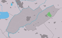
 Oosterstreek Location in the Netherlands  Oosterstreek Oosterstreek (Netherlands) | |
| Coordinates: | |
| Country | |
| Province | |
| Municipality | |
| Area | |
| • Total | 4.47 km2 (1.73 sq mi) |
| Elevation | 5 m (16 ft) |
| Population (2021)[1] | |
| • Total | 545 |
| • Density | 120/km2 (320/sq mi) |
| Postal code | 8388[1] |
| Dialing code | 0561 |
The village was first mentioned in 1974 as Oosterstreek, and is a new name for the linear settlement along the Noordwolde to Boijl road,[4] however it was first used around 1930 by the local football club. It means "eastern region" (as viewed from Noordwolde). The area around Oosterstreek was a peat excavation region, and nowadays mainly consists of heath.[5]
References
- "Kerncijfers wijken en buurten 2021". Central Bureau of Statistics. Retrieved 2 April 2022.
- "Postcodetool for 8388MA". Actueel Hoogtebestand Nederland (in Dutch). Het Waterschapshuis. Retrieved 2 April 2022.
- Villages - Weststellingwerf municipality (in Dutch)
- "Oosterstreek - (geografische naam)". Etymologiebank (in Dutch). Retrieved 2 April 2022.
- "Oosterstreek". Plaatsengids. Retrieved 2 April 2022.
This Friesland location article is a stub. You can help Wikipedia by expanding it. |
Текст в блоке "Читать" взят с сайта "Википедия" и доступен по лицензии Creative Commons Attribution-ShareAlike; в отдельных случаях могут действовать дополнительные условия.
Другой контент может иметь иную лицензию. Перед использованием материалов сайта WikiSort.org внимательно изучите правила лицензирования конкретных элементов наполнения сайта.
Другой контент может иметь иную лицензию. Перед использованием материалов сайта WikiSort.org внимательно изучите правила лицензирования конкретных элементов наполнения сайта.
2019-2026
WikiSort.org - проект по пересортировке и дополнению контента Википедии
WikiSort.org - проект по пересортировке и дополнению контента Википедии