world.wikisort.org - Netherlands
Nederweert (Dutch: [ˈneːdərˌʋeːrt] (![]() listen); Limburgish: Ni-jwieërt [ˈnɪjˌwiəʀt]) is a municipality and a town in southeastern Netherlands with a population of 17,001 as of 2019 and has an area of 101.78 km2 (39.30 sq mi) of which 1.80 km2 (0.69 sq mi) is water.
listen); Limburgish: Ni-jwieërt [ˈnɪjˌwiəʀt]) is a municipality and a town in southeastern Netherlands with a population of 17,001 as of 2019 and has an area of 101.78 km2 (39.30 sq mi) of which 1.80 km2 (0.69 sq mi) is water.
Nederweert
Ni-jwieërt | |
|---|---|
Municipality | |
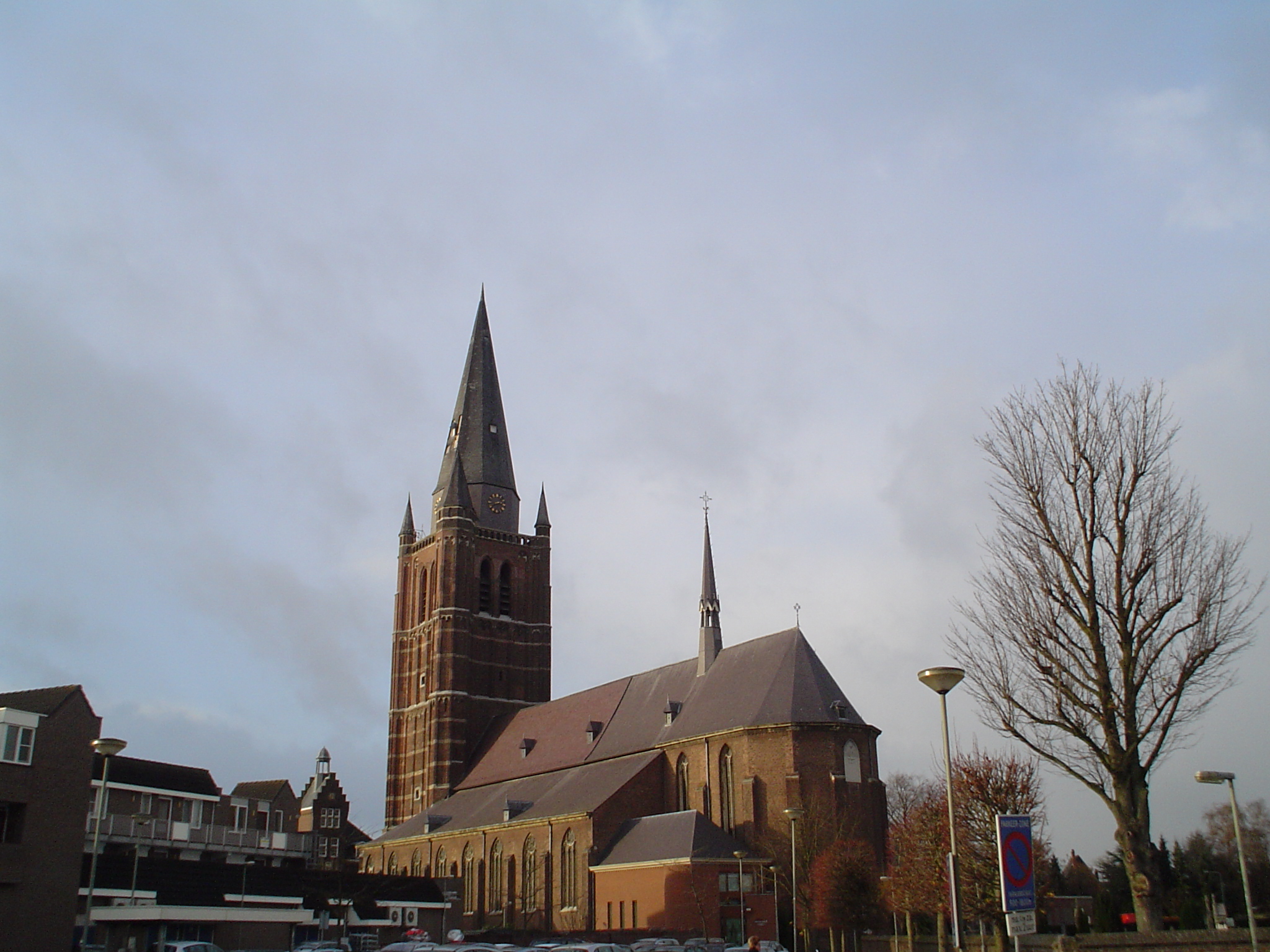 Saint Lambert church in Nederweert | |
 Flag  Coat of arms | |
 Location in Limburg | |
| Coordinates: 51°17′N 5°45′E | |
| Country | Netherlands |
| Province | Limburg |
| Government | |
| • Body | Municipal council |
| • Mayor | B.M.T.J. (Birgit) Op de Laak (PvdA) |
| Area | |
| • Total | 101.78 km2 (39.30 sq mi) |
| • Land | 99.98 km2 (38.60 sq mi) |
| • Water | 1.80 km2 (0.69 sq mi) |
| Elevation | 33 m (108 ft) |
| Population (January 2019)[4] | |
| • Total | 17,001 |
| • Density | 170/km2 (400/sq mi) |
| Demonym(s) | Nederweerter |
| Time zone | UTC+1 (CET) |
| • Summer (DST) | UTC+2 (CEST) |
| Postcode | 6030–6035, 6090–6092 |
| Area code | 0495 |
| Website | www |
Nederweert lies at the intersection of three channels: the Zuid-Willemsvaart, the Noordervaart and the Wessem-Nederweert Canal. In the 19th century these channels provided transport routes to export peat that was harvested from the Peel. These channels connect Nederweert to Maastricht and 's-Hertogenbosch.
History
Nederweert was originally called 'Merefelt' which means 'amongst the lakes', though it was later named Weert van den nedersten eynde. A 'Weert' in old Dutch means a high place in the landscape. This latter name later changed into Nederweert as it is called today.

Before the 14th century Nederweert was part of the municipality of Weert. The first reference which speaks of Nederweert as independent was in 1419.
Nederweert has been under rule of the Graven van Horn (the dukes of Horn) until 1701. Later in 1715 it became part of the southern states of the Netherlands.
In 1785 it was annexed by the French. During this era it was part of the Belgian departement of the Nedermaas.

Monuments
The most prominent monument of Nederweert is the Sint-Lambertus Kerk. It is a Brabantine Gothic-style church that was built in 1467.
Population centres
- Budschop
- Leveroy
- Nederweert
- Nederweert-Eind
- Ospel
- Ospeldijk
- Schoor
Notable people
- Margriet Tindemans (1951 in Nederweert – 2014) a musician, specializing in medieval music
- Marie Kessels (born 1954 in Nederweert) a Dutch poet and prose writer
Gallery
 Restaurant Bi-J Siem, built in 1659
 Front of the former rectory in Nederweert
 Sluis 15 in de Zuid-Willemsvaart
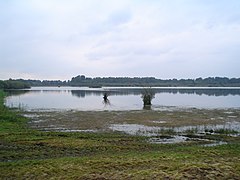 "De Banen", a lake in the nature area "Sarsven en De Banen", near Nederweert


References
- "Collegeleden" [Members of the board] (in Dutch). Gemeente Nederweert. Archived from the original on 13 November 2013. Retrieved 13 November 2013.
- "Kerncijfers wijken en buurten 2020" [Key figures for neighbourhoods 2020]. StatLine (in Dutch). CBS. 24 July 2020. Retrieved 19 September 2020.
- "Postcodetool for 6031VR". Actueel Hoogtebestand Nederland (in Dutch). Het Waterschapshuis. Retrieved 13 November 2013.
- "Bevolkingsontwikkeling; regio per maand" [Population growth; regions per month]. CBS Statline (in Dutch). CBS. 1 January 2019. Retrieved 1 January 2019.
External links
 Media related to Nederweert at Wikimedia Commons
- Official website
Places adjacent to Nederweert | ||||||||||||||||
|---|---|---|---|---|---|---|---|---|---|---|---|---|---|---|---|---|
| ||||||||||||||||
Municipalities of Limburg | ||
|---|---|---|
|  | |
| ||
На других языках
[de] Nederweert
Nederweert ( anhören?/i) ist eine Gemeinde in der niederländischen Provinz Limburg. Der ursprüngliche Name der Gemeinde war Merefelt, später hieß sie Weert van den nedersten eynde. Aus diesem Namen entwickelte sich der heutige Name Nederweert.- [en] Nederweert
[ru] Недерверт
Недерверт (нидерл. Nederweert, лимб. Ni-jwieërt) — община в нидерландской провинции Лимбург. Расположена в западной части провинции, в месте пересечения каналов Зёйд-Виллемсварт, Нортдерварт и Вессем-Недерверт. Эти каналы соединяют Недерверт с городами Маастрихт и Хертогенбос. Площадь составляет 101,79 км². Население по данным на январь 2009 года — 16 695 человек. Плотность населения — 167 чел/км².Другой контент может иметь иную лицензию. Перед использованием материалов сайта WikiSort.org внимательно изучите правила лицензирования конкретных элементов наполнения сайта.
WikiSort.org - проект по пересортировке и дополнению контента Википедии