world.wikisort.org - Netherlands
Luxwoude (West Frisian: Lúkswâld) is a village in the municipality of Opsterland in the east of Friesland, the Netherlands. It had a population of around 275 in January 2017.[3]
Luxwoude
Lúkswâld | |
|---|---|
Village | |
 Coat of arms | |
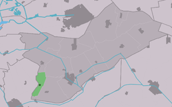 Location in Opsterland municipality | |
 Luxwoude Location in the Netherlands  Luxwoude Luxwoude (Netherlands) | |
| Coordinates: 52°59′48″N 5°58′50″E | |
| Country | |
| Province | |
| Municipality | |
| Area | |
| • Total | 5.07 km2 (1.96 sq mi) |
| Elevation | 0 m (0 ft) |
| Population (2021)[1] | |
| • Total | 430 |
| • Density | 85/km2 (220/sq mi) |
| Postal code | 8405[1] |
| Dialing code | 0513 |
The village was first mentioned in 1315 as Lukeswalde, and means the forest of Lucas (person). See also: Lucaswolde.[4] Luxwoude developed as a peat excavation village. It was home to 137 people in 1840.[5]
References
- "Kerncijfers wijken en buurten 2021". Central Bureau of Statistics. Retrieved 2 April 2022.
- "Postcodetool for 8405BP". Actueel Hoogtebestand Nederland (in Dutch). Het Waterschapshuis. Retrieved 2 April 2022.
- Kerncijfers wijken en buurten 2017 - CBS Statline
- "Luxwoude - (geografische naam)". Etymologiebank (in Dutch). Retrieved 2 April 2022.
- "Luxwoude". Plaatsengids (in Dutch). Retrieved 2 April 2022.
This Friesland location article is a stub. You can help Wikipedia by expanding it. |
Текст в блоке "Читать" взят с сайта "Википедия" и доступен по лицензии Creative Commons Attribution-ShareAlike; в отдельных случаях могут действовать дополнительные условия.
Другой контент может иметь иную лицензию. Перед использованием материалов сайта WikiSort.org внимательно изучите правила лицензирования конкретных элементов наполнения сайта.
Другой контент может иметь иную лицензию. Перед использованием материалов сайта WikiSort.org внимательно изучите правила лицензирования конкретных элементов наполнения сайта.
2019-2026
WikiSort.org - проект по пересортировке и дополнению контента Википедии
WikiSort.org - проект по пересортировке и дополнению контента Википедии