world.wikisort.org - Netherlands
Landerd (Dutch pronunciation: [ˈlɑndərt] (![]() listen)) is a former municipality within the province of North Brabant in the southern Netherlands. Since 2022 it has been part of the new municipality of Maashorst.
listen)) is a former municipality within the province of North Brabant in the southern Netherlands. Since 2022 it has been part of the new municipality of Maashorst.
Landerd | |
|---|---|
Former municipality | |
 Windmill in Reek | |
 Flag  Coat of arms | |
 Location of the former municipality of Landerd in North Brabant | |
| Coordinates: 51°42′N 5°40′E | |
| Country | Netherlands |
| Province | North Brabant |
| Municipality | Maashorst |
| Established | 1 January 1994 |
| Area | |
| • Total | 70.71 km2 (27.30 sq mi) |
| • Land | 70.35 km2 (27.16 sq mi) |
| • Water | 0.36 km2 (0.14 sq mi) |
| Elevation | 20 m (70 ft) |
| Population (January 2019)[3] | |
| • Total | 15,529 |
| • Density | 221/km2 (570/sq mi) |
| • Uden-Veghel | 175,119 |
| Time zone | UTC+1 (CET) |
| • Summer (DST) | UTC+2 (CEST) |
| Postcode | 5374–5375, 5410–5411 |
| Area code | 0486 |
| Website | www |
History
Landerd is the result of a merger between the formerly independent municipalities of Schaijk and Zeeland on 1 January 1994. Schaijk and Reek had merged earlier on 1 July 1942.
Population centres
Topography

Map of the former municipality of Landerd, 2015
Notable people
- Monique van de Ven (born 1952 in Zeeland) a Dutch actress and director[4]
- Tonnie Dirks (born 1961 in Zeeland) a Dutch former long distance runner, competed in the 1992 Summer Olympics
- Daphny van den Brand (born 1978 in Zeeland) a Dutch cyclo-cross, road bicycle and mountain bike racer.
- Thijs Ploegmakers (born 1980 in Schaijk) performs as Adaro, is a Dutch DJ.
Gallery
 Trefpunt - panoramio
 Reek (Landerd) Het Wapen van Reek
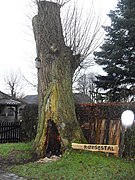 Kerststal - panoramio
 Reek (Landerd) Heijtmorgen
 Vos - panoramio


References
- "Kerncijfers wijken en buurten 2020" [Key figures for neighbourhoods 2020]. StatLine (in Dutch). CBS. 24 July 2020. Retrieved 19 September 2020.
- "Postcodetool for 5411EA". Actueel Hoogtebestand Nederland (in Dutch). Het Waterschapshuis. Archived from the original on 21 September 2013. Retrieved 29 May 2014.
- "Bevolkingsontwikkeling; regio per maand" [Population growth; regions per month]. CBS Statline (in Dutch). CBS. 1 January 2019. Retrieved 1 January 2019.
- IMDb Database retrieved 20 October 2019
External links
 Media related to Landerd at Wikimedia Commons
- Official website
Places adjacent to Landerd | ||||||||||||||||
|---|---|---|---|---|---|---|---|---|---|---|---|---|---|---|---|---|
| ||||||||||||||||
This North Brabant location article is a stub. You can help Wikipedia by expanding it. |
На других языках
[de] Landerd
Vorlage:Infobox Ort in den Niederlanden/Wartung/Typ falsch gesetzt- [en] Landerd
Текст в блоке "Читать" взят с сайта "Википедия" и доступен по лицензии Creative Commons Attribution-ShareAlike; в отдельных случаях могут действовать дополнительные условия.
Другой контент может иметь иную лицензию. Перед использованием материалов сайта WikiSort.org внимательно изучите правила лицензирования конкретных элементов наполнения сайта.
Другой контент может иметь иную лицензию. Перед использованием материалов сайта WikiSort.org внимательно изучите правила лицензирования конкретных элементов наполнения сайта.
2019-2026
WikiSort.org - проект по пересортировке и дополнению контента Википедии
WikiSort.org - проект по пересортировке и дополнению контента Википедии