world.wikisort.org - Netherlands
Kanis is a village in the Dutch province of Utrecht. It is a part of the municipality of Woerden, and lies about 4 km north of Woerden.
Kanis | |
|---|---|
Village | |
 | |
 Kanis Location in the Netherlands  Kanis Kanis (Netherlands) | |
| Coordinates: 52°7′29″N 4°53′30″E | |
| Country | Netherlands |
| Province | Utrecht (province) |
| Municipality | Woerden |
| Area | |
| • Total | 0.11 km2 (0.04 sq mi) |
| Population (2021)[1] | |
| • Total | 430 |
| • Density | 3,900/km2 (10,000/sq mi) |
| Time zone | UTC+1 (CET) |
| • Summer (DST) | UTC+2 (CEST) |
| Postal code | 3471[1] |
| Dialing code | 0348 |
The hamlet was first mentioned between 1839 and 1859 as "de Verkeerde Kanis herbg", and was the name of an inn. Kanis means basket with fish.[2] There is still a restaurant called De Kanis in the village, but it is not clear whether it is related to the original inn. In 1855, a Roman Catholic church was built in the village.[3]
Gallery
 Farm in Kanis
 Street view
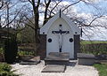 Crucifix on the cemetery
 Welcome to Kanis


References
- "Kerncijfers wijken en buurten 2021". Central Bureau of Statistics. Retrieved 26 March 2022.
two entries
- "Kanis - (geografische naam)". Etymologiebank (in Dutch). Retrieved 26 March 2022.
- "Kanis". Plaatsengids (in Dutch). Retrieved 26 March 2022.
| Wikimedia Commons has media related to Kanis. |
This Utrecht location article is a stub. You can help Wikipedia by expanding it. |
Текст в блоке "Читать" взят с сайта "Википедия" и доступен по лицензии Creative Commons Attribution-ShareAlike; в отдельных случаях могут действовать дополнительные условия.
Другой контент может иметь иную лицензию. Перед использованием материалов сайта WikiSort.org внимательно изучите правила лицензирования конкретных элементов наполнения сайта.
Другой контент может иметь иную лицензию. Перед использованием материалов сайта WikiSort.org внимательно изучите правила лицензирования конкретных элементов наполнения сайта.
2019-2026
WikiSort.org - проект по пересортировке и дополнению контента Википедии
WikiSort.org - проект по пересортировке и дополнению контента Википедии