world.wikisort.org - Netherlands
Kamperland is a village in the Dutch province of Zeeland. It is a part of the municipality of Noord-Beveland, and lies about 11 km northeast of Middelburg.
Kamperland | |
|---|---|
Village | |
 Church of Kamperland | |
 Kamperland Location in the province of Zeeland in the Netherlands  Kamperland Kamperland (Netherlands) | |
| Coordinates: 51°34′14″N 3°42′9″E | |
| Country | Netherlands |
| Province | Zeeland |
| Municipality | Noord-Beveland |
| Area | |
| • Total | 30.54 km2 (11.79 sq mi) |
| Elevation | 1.0 m (3.3 ft) |
| Population (2021)[1] | |
| • Total | 2,100 |
| • Density | 69/km2 (180/sq mi) |
| Time zone | UTC+1 (CET) |
| • Summer (DST) | UTC+2 (CEST) |
| Postal code | 4493[1] |
| Dialing code | 0113 |
History
The village was first mentioned in 976 as Campan, and means "land of Kampen", a former village which used to be located in the area,[3] and was lost in the flood of 1530. Kamperland is a road village which developed in the second half of the 18th century after the Heer Janszpolder was diked in 1699.[4]
Kamperland was home to 170 people in 1840.[5] The Dutch Reformed church is an aisleless church which was built in 1901. A little open tower and consistory were added in 1911.[4] The church was decommissioned in 1997, and is used as brasserie since 1998.[5]
From the 1970s onwards, a recreational zone developed near the harbour and along the Veerse Meer.[4] Kamperland used to be part of the municipality of Wissenkerke. In 1995, it was merged into Noord-Beveland.[5]
Gallery
 View on Kamperland
 Tour de France in Kamperland (2010)
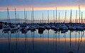 Marina of Kamperland
 Villa Kogelhof


References
- "Kerncijfers wijken en buurten 2021". Central Bureau of Statistics. Retrieved 20 April 2022.
- "Postcodetool for 4493AA". Actueel Hoogtebestand Nederland (in Dutch). Het Waterschapshuis. Retrieved 20 April 2022.
- "Kamperland - (geografische naam)". Etymologiebank (in Dutch). Retrieved 20 April 2022.
- Piet van Cruyningen & Ronald Stenvert (2003). Kamperland (in Dutch). Zwolle: Waanders. ISBN 90 400 8830 6. Retrieved 20 April 2022.
- "Kamperland". Plaatsengids (in Dutch). Retrieved 20 April 2022.
This article about a location in Zeeland is a stub. You can help Wikipedia by expanding it. |
Другой контент может иметь иную лицензию. Перед использованием материалов сайта WikiSort.org внимательно изучите правила лицензирования конкретных элементов наполнения сайта.
WikiSort.org - проект по пересортировке и дополнению контента Википедии