world.wikisort.org - Netherlands
Huis ter Heide is a village in the central Netherlands. It is located in the municipality of Zeist, Utrecht, about 2 km northeast of the centre of the town Zeist.[3]
Huis ter Heide | |
|---|---|
Village | |
 A chapel in Huis ter Heide | |
 | |
 Huis ter Heide Location in the Netherlands  Huis ter Heide Huis ter Heide (Netherlands) | |
| Coordinates: 52°6′39″N 5°15′23″E | |
| Country | Netherlands |
| Province | Utrecht |
| Municipality | Zeist |
| Area | |
| • Total | 1.73 km2 (0.67 sq mi) |
| Elevation | 9 m (30 ft) |
| Population (2021)[1] | |
| • Total | 1,285 |
| • Density | 740/km2 (1,900/sq mi) |
| Time zone | UTC+1 (CET) |
| • Summer (DST) | UTC+2 (CEST) |
| Postal code | 3712[1] |
| Dialing code | 030 |
| Major roads | N237, N238 |
History
The village was first mentioned in 1681 as 't Huys ter Heyde, and means "house on the heath" which is a reference to an inn.[4] Between 1652 and 1653, the main road from Utrecht to Amersfoort was built, and estates and villas were constructed along the road. The Dutch Reformed Church was built between 1858 and 1859[5] Between 1901 and 1941, there was railway stop in the village.[6] The first McDonald's Drive-in restaurant in the Netherlands is located in Huis ter Heide.
Gallery
 Tea house
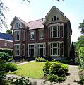 Village in Huis ter Heide
 McDonald's drive-in
 Office building


References
- "Kerncijfers wijken en buurten 2021". Central Bureau of Statistics. Retrieved 26 March 2022.
two entries
- "Postcodetool for 3712AA". Actueel Hoogtebestand Nederland (in Dutch). Het Waterschapshuis. Retrieved 26 March 2022.
- ANWB Topografische Atlas Nederland, Topografische Dienst and ANWB, 2005.
- "Huis ter Heide - (geografische naam)". Etymologiebank (in Dutch). Retrieved 26 March 2022.
- Ronald Stenvert & Chris Kolman (1996). "Huis ter Heide" (in Dutch). Zwolle: Waanders. ISBN 90 400 9757 7. Retrieved 26 March 2022.
- "halte Huis ter Heide". Stationsweb (in Dutch). Retrieved 26 March 2022.
| Wikimedia Commons has media related to Huis ter Heide, Utrecht. |
Authority control | |
|---|---|
| General |
|
| National libraries | |
This Utrecht location article is a stub. You can help Wikipedia by expanding it. |
Текст в блоке "Читать" взят с сайта "Википедия" и доступен по лицензии Creative Commons Attribution-ShareAlike; в отдельных случаях могут действовать дополнительные условия.
Другой контент может иметь иную лицензию. Перед использованием материалов сайта WikiSort.org внимательно изучите правила лицензирования конкретных элементов наполнения сайта.
Другой контент может иметь иную лицензию. Перед использованием материалов сайта WikiSort.org внимательно изучите правила лицензирования конкретных элементов наполнения сайта.
2019-2026
WikiSort.org - проект по пересортировке и дополнению контента Википедии
WikiSort.org - проект по пересортировке и дополнению контента Википедии