world.wikisort.org - Netherlands
Hazerswoude-Rijndijk is a Dutch village located in the province of South Holland. It is a part of the municipality of Alphen aan den Rijn, and lies about 5 km west of the village center.
Hazerswoude-Rijndijk | |
|---|---|
Village | |
 Nieuw Werklust, Rijksmonument number 514727 | |
 Hazerswoude-Rijndijk Location in the province of South Holland in the Netherlands  Hazerswoude-Rijndijk Location in the Netherlands | |
| Coordinates: 52°7′45″N 4°35′35″E | |
| Country | Netherlands |
| Province | South Holland |
| Municipality | Alphen aan den Rijn |
| Area | |
| • Total | 5.72 km2 (2.21 sq mi) |
| Elevation | −0.3 m (−1.0 ft) |
| Population (2021)[1] | |
| • Total | 5,440 |
| • Density | 950/km2 (2,500/sq mi) |
| Time zone | UTC+1 (CET) |
| • Summer (DST) | UTC+2 (CEST) |
| Postal code | 2394[1] |
| Dialing code | 071 |
Hazerswoude-Rijndijk is a peat excavation settlement which developed in the Middle Ages south of the Oude Rijn.[3]
The Catholic St Bernardus Church is a single aisled church built between 1854 and 1855.[3] The polder mill Groenendijkse Molen was built in 1627 as a wooden windmill. It was considered for replacement by a stone windmill several times. An electric pumping station was installed in 1959. In 1966, the windmill was bought by a foundation and restored to working order. It operates on a voluntary basis.[4]
Gallery
 St Bernardus Church
 Water tower
 Polder mill Groenendijkse Molen
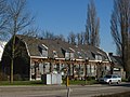 Houses in Hazerswoude-Rijndijk


References
- "Kerncijfers wijken en buurten 2021". Central Bureau of Statistics. Retrieved 2 May 2022.
- "Postcodetool for 2394AA". Actueel Hoogtebestand Nederland (in Dutch). Het Waterschapshuis. Retrieved 2 May 2022.
- Ronald Stenvert & Sabine Broekhoven (2004). "Hazerwoude-Rijndijk" (in Dutch). Zwolle: Waanders. ISBN 90 400 9034 3. Retrieved 2 May 2022.
- "Groenendijkse Molen". Molen database (in Dutch). Retrieved 2 May 2022.
This South Holland location article is a stub. You can help Wikipedia by expanding it. |
Другой контент может иметь иную лицензию. Перед использованием материалов сайта WikiSort.org внимательно изучите правила лицензирования конкретных элементов наполнения сайта.
WikiSort.org - проект по пересортировке и дополнению контента Википедии