world.wikisort.org - Netherlands
Graft-De Rijp (Dutch pronunciation: [ˌɣrɑvdəˈrɛip] (![]() listen)) is a former municipality in the Netherlands, in the province of North Holland. Since 2015 it has been a part of Alkmaar.
listen)) is a former municipality in the Netherlands, in the province of North Holland. Since 2015 it has been a part of Alkmaar.
Graft-De Rijp | |
|---|---|
Former municipality | |
 Traditional houses in De Rijp | |
 Flag  Coat of arms | |
 Location in North Holland | |
| Coordinates: 52°33′N 4°51′E | |
| Country | Netherlands |
| Province | North Holland |
| Municipality | Alkmaar |
| Established | 1 August 1970 |
| Area | |
| • Total | 21.76 km2 (8.40 sq mi) |
| • Land | 20.03 km2 (7.73 sq mi) |
| • Water | 1.73 km2 (0.67 sq mi) |
| Elevation | −2 m (−7 ft) |
| Population (January 2019)[3] | |
| • Total | data missing |
| Time zone | UTC+1 (CET) |
| • Summer (DST) | UTC+2 (CEST) |
| Postcode | 1483–1488, 1536 |
| Area code | 0299 |
| Website | www |
It is twinned with Chalfont St Giles in England.
Population centres
The municipality of Graft-De Rijp consisted of the following towns, villages and/or districts: De Rijp, Graft, Markenbinnen, Noordeinde, Oost-Graftdijk, Starnmeer, West-Graftdijk.
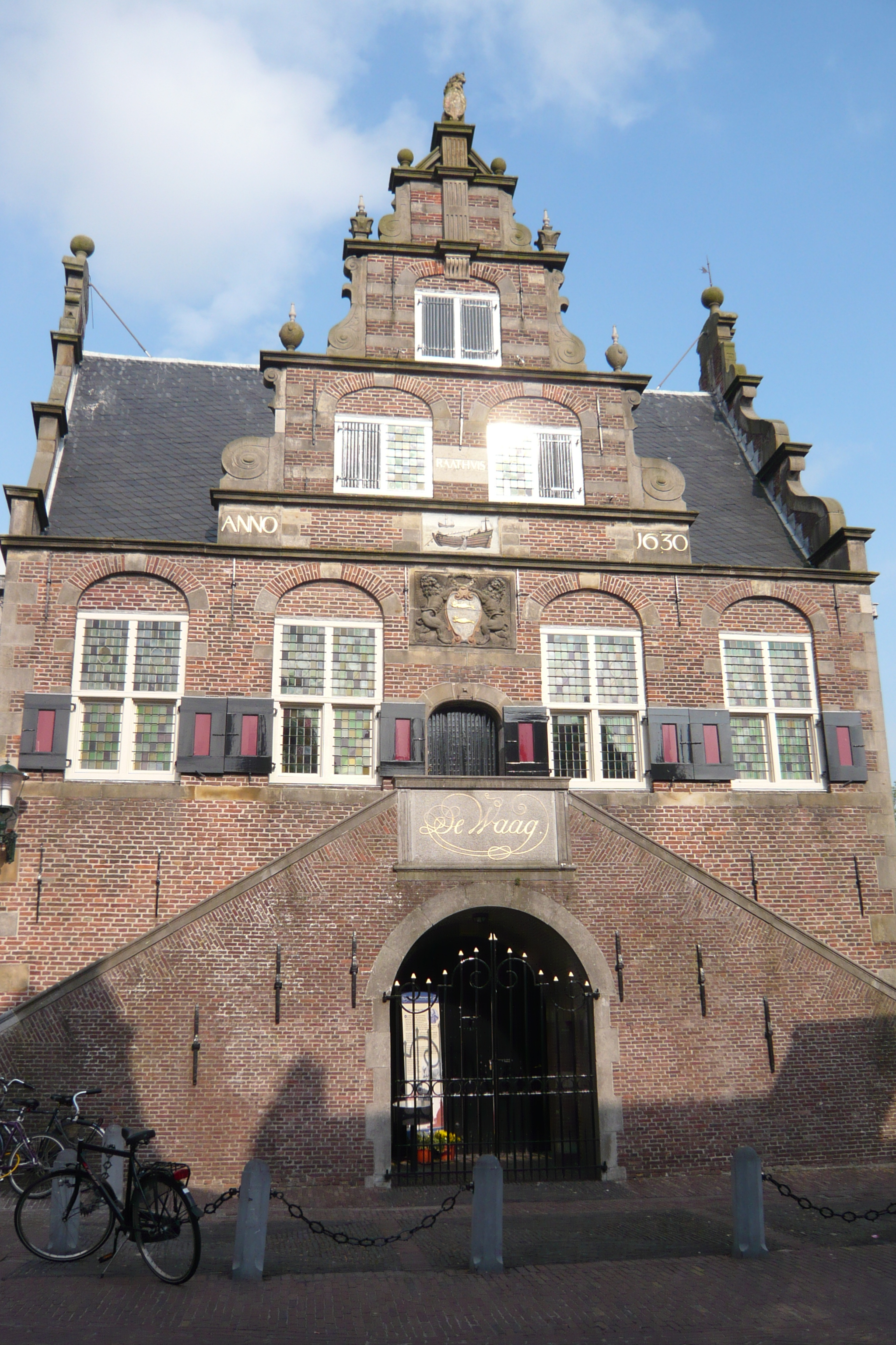
 Former weigh house and Town hall of De Rijp, designed by Jan Leeghwater in 1630
 Town Hall of Graft, built in 1613 in the style of Hendrick de Keyser

Local government
The municipal council of Graft-De Rijp consisted of 13 seats, which were divided as follows:
- CDA - 4 seats
- PvdA - 4 seats
- VVD - 4 seats
- Gemeentebelangen - 1 seat
References
- "Kerncijfers wijken en buurten 2020" [Key figures for neighbourhoods 2020]. StatLine (in Dutch). CBS. 24 July 2020. Retrieved 19 September 2020.
- "Postcodetool for 1483HA". Actueel Hoogtebestand Nederland (in Dutch). Het Waterschapshuis. Archived from the original on 21 September 2013. Retrieved 4 March 2014.
- "Bevolkingsontwikkeling; regio per maand" [Population growth; regions per month]. CBS Statline (in Dutch). CBS. 1 January 2019. Retrieved 1 January 2019.
External links
 Media related to Graft-De Rijp at Wikimedia Commons
- Official website
Places adjacent to Graft-De Rijp | ||||||||||||||||
|---|---|---|---|---|---|---|---|---|---|---|---|---|---|---|---|---|
| ||||||||||||||||
| Authority control |
|
|---|
This North Holland location article is a stub. You can help Wikipedia by expanding it. |
На других языках
- [en] Graft-De Rijp
[ru] Графт-Де Рейп
Графт-Де Рейп (нидерл. Graft-De Rijp) — бывшая община в провинции Северная Голландия, Нидерланды.Текст в блоке "Читать" взят с сайта "Википедия" и доступен по лицензии Creative Commons Attribution-ShareAlike; в отдельных случаях могут действовать дополнительные условия.
Другой контент может иметь иную лицензию. Перед использованием материалов сайта WikiSort.org внимательно изучите правила лицензирования конкретных элементов наполнения сайта.
Другой контент может иметь иную лицензию. Перед использованием материалов сайта WikiSort.org внимательно изучите правила лицензирования конкретных элементов наполнения сайта.
2019-2026
WikiSort.org - проект по пересортировке и дополнению контента Википедии
WikiSort.org - проект по пересортировке и дополнению контента Википедии