world.wikisort.org - Netherlands
Gaanderen is a village in the Dutch province of Gelderland. It is located in the municipality of Doetinchem. The number of inhabitants is around 5,575 (2020).[3]
Gaanderen | |
|---|---|
Village | |
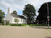
 The church in Gaanderen | |
 Flag  Coat of arms | |
 Gaanderen Location in the province of Gelderland in the Netherlands  Gaanderen Gaanderen (Netherlands) | |
| Coordinates: 51°55′41″N 6°20′41″E | |
| Country | Netherlands |
| Province | Gelderland |
| Municipality | Doetinchem |
| Area | |
| • Total | 9.15 km2 (3.53 sq mi) |
| Elevation | 15 m (49 ft) |
| Population (2021)[1] | |
| • Total | 5,575 |
| • Density | 610/km2 (1,600/sq mi) |
| Time zone | UTC+1 (CET) |
| • Summer (DST) | UTC+2 (CEST) |
| Postal code | 7011[1] |
| Dialing code | 0315 |
It was first mentioned around 1200 as de Gernere, and means "tapering land on a sandy ridge".[4]
Gaanderen was home to 482 people in 1840.[5] The St Martinus Church dates from 1913 and is a replacement of a 1854 church. The tower of the old church remained.[5]
Transportation
- Railway Station: Gaanderen
- Rijksweg Doetinchem - Terborg
Gallery
 Hoofdstraat 62, church
 Rekhemseweg 175
 Kerkstraat 45
 Bloemenweg 1
 Station Gaanderen


References
- "Kerncijfers wijken en buurten 2021". Central Bureau of Statistics. Retrieved 13 April 2022.
- "Postcodetool for 7011AA". Actueel Hoogtebestand Nederland (in Dutch). Het Waterschapshuis. Retrieved 13 April 2022.
- Kerncijfers Wijken en buurten_2020-1
- "Gaanderen - (geografische naam)". Etymologiebank (in Dutch). Retrieved 13 April 2022.
- "Gaanderen". Plaatsengids (in Dutch). Retrieved 13 April 2022.
| Wikimedia Commons has media related to Gaanderen. |
Текст в блоке "Читать" взят с сайта "Википедия" и доступен по лицензии Creative Commons Attribution-ShareAlike; в отдельных случаях могут действовать дополнительные условия.
Другой контент может иметь иную лицензию. Перед использованием материалов сайта WikiSort.org внимательно изучите правила лицензирования конкретных элементов наполнения сайта.
Другой контент может иметь иную лицензию. Перед использованием материалов сайта WikiSort.org внимательно изучите правила лицензирования конкретных элементов наполнения сайта.
2019-2026
WikiSort.org - проект по пересортировке и дополнению контента Википедии
WikiSort.org - проект по пересортировке и дополнению контента Википедии