world.wikisort.org - Netherlands
Burum (West Frisian language: Boerum) is a village in Noardeast-Fryslân municipality, Friesland in the Netherlands.
Burum
Boerum | |
|---|---|
Village | |
 NSO-ground station | |
 Flag  Coat of arms | |
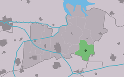 Location in the former Kollumerland municipality | |
 Burum Location in the Netherlands  Burum Burum (Netherlands) | |
| Coordinates: | |
| Country | |
| Province | |
| Municipality | Noardeast-Fryslân |
| Area | |
| • Total | 8.87 km2 (3.42 sq mi) |
| Elevation | 1.5 m (4.9 ft) |
| Population (2021)[1] | |
| • Total | 620 |
| • Density | 70/km2 (180/sq mi) |
| Postal code | 9851[1] |
| Dialing code | 0594 |
It is the site of a ground station of the Dutch Nationale SIGINT Organisatie (national signals intelligence service), which intercepts satellite communications.[3][4] Burum also provides reference signals for Enhanced Automatic Frequency Correction, which help calibrates satellite communications.[5]
It had a population of 606 in January 2017.[6]
History
The village was first mentioned in 1408 as Burum, and means neighbourhood.[7] Burum is a terp (artificial living mound) village. An output of the monastery of Gerkesklooster was established near the village. During the 13th or 14th century the area around Burum was poldered. The Dutch Reformed church was built in 1784 as a replacement of an medieval church.[8]
The grist mill Windlust was built in 1787 near Burum. In 2012, it burnt down and in 2014, a near identical new wind mill was built. The windmill is operation, but only on a voluntary basis.[9]
In 1840, Burum was home to 1,121 people.[10] In 1973, the satellite communication centre It Grutte Ear opened near Burum.[11] In 2014, the ground station of the Dutch national signals intelligence service was added to the site.[3]
Gallery
 Burum church
 Windmill Windlust
 School in Burum
 Farm in Burum


References
- "Kerncijfers wijken en buurten 2021". Central Bureau of Statistics. Retrieved 31 March 2022.
two entries
- "Postcodetool for 9851AA". Actueel Hoogtebestand Nederland (in Dutch). Het Waterschapshuis. Retrieved 31 March 2022.
- "Nationale SIGINT Organisatie." (Archive) Ministry of Defence. Retrieved on 13 June 2013.
- "NATIONAL PROGRAMMES FOR MASS SURVEILLANCE OF PERSONAL DATA IN EU MEMBER STATES AND THEIR COMPATIBILITY WITH EU LAW" (PDF). European Parliament. 2013. p. 75. Archived from the original (PDF) on November 7, 2013.
The signals location in Burum and the analysis location in Eibergen, currently operated by the NSO, will stay active.
- Holland, Ian D (2018). "MH370 Burst Frequency Offset Analysis and Implications on Descent Rate at End-of-Flight". IEEE Aerospace and Electronic Systems Magazine. 33 (2): 24–33. arXiv:1702.02432. doi:10.1109/MAES.2018.170048.
- Inwonertal en info 2017 Archived 2017-10-28 at the Wayback Machine - Kollumerland
- "Burum - (geografische naam)". Etymologiebank (in Dutch). Retrieved 31 March 2022.
- Ronald Stenvert & Sabine Broekhoven (2000). "Burum" (in Dutch). Zwolle: Waanders. ISBN 90 400 9476 4. Retrieved 31 March 2022.
- "Windlust". Molen database (in Dutch). Retrieved 31 March 2022.
- "Burum". Plaatsengids (in Dutch). Retrieved 31 March 2022.
- "Sateliet station geopend". Het Parool (in Dutch). 13 September 1973. Retrieved 31 March 2022.
Authority control | |
|---|---|
| General |
|
| National libraries | |
На других языках
[de] Burum (Niederlande)
Burum (Friesisch: Boerum) ist ein Dorf in der Gemeinde Noardeast-Fryslân der niederländischen Provinz Friesland an der östlichen Grenze Westfrieslands. Der Ortskern liegt nördlich des Provinciale weg 355 (siehe N355). 2020 zählte der Ort knapp 600 Einwohner. Zum Dorf gehören auch die Bauerschaften De Keegen und Scharnehuizen sowie die Ländereien des Zisterzienserinnenkloster Galilea.- [en] Burum, Friesland
Другой контент может иметь иную лицензию. Перед использованием материалов сайта WikiSort.org внимательно изучите правила лицензирования конкретных элементов наполнения сайта.
WikiSort.org - проект по пересортировке и дополнению контента Википедии