world.wikisort.org - Netherlands
Balgoij or Balgoy is a village in Gelderland, Netherlands, near the river Meuse. It belongs to the Wijchen municipality.
Balgoij | |
|---|---|
Village | |
 Tower of the former village church | |
 Balgoij Location in the Netherlands  Balgoij Balgoij (Netherlands) | |
| Coordinates: 51°46′49″N 5°42′50″E | |
| Country | Netherlands |
| Province | Gelderland |
| Municipality | Wijchen |
| Area | |
| • Total | 4.71 km2 (1.82 sq mi) |
| Elevation | 8 m (26 ft) |
| Population (2021)[1] | |
| • Total | 725 |
| • Density | 150/km2 (400/sq mi) |
| Time zone | UTC+1 (CET) |
| • Summer (DST) | UTC+2 (CEST) |
| Postal code | 6613[1] |
| Dialing code | 024 |
Until 1923, Balgoij was a separate municipality. In 1958, the hamlet of Keent was transferred to Oss in North Brabant due to the canalisation of the Maas.[3]
The village was first mentioned in 1172 as Balgoie, and means swelling of land near water.[4] In 1840, it was home to 406 people.[3]
Gallery
 Church in Balgoij
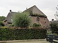
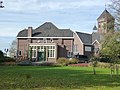 Former clergy house
 Villa in Balgoij


References
- "Kerncijfers wijken en buurten 2021". Central Bureau of Statistics. Retrieved 26 March 2022.
- "Postcodetool for 6613AA". Actueel Hoogtebestand Nederland (in Dutch). Het Waterschapshuis. Retrieved 26 March 2022.
- "Balgoij". Plaatsengids (in Dutch). Retrieved 26 March 2022.
- "Balgoij - (geografische naam)". Etymologiebank (in Dutch). Retrieved 26 March 2022.
| Wikimedia Commons has media related to Balgoy. |
This Gelderland location article is a stub. You can help Wikipedia by expanding it. |
Текст в блоке "Читать" взят с сайта "Википедия" и доступен по лицензии Creative Commons Attribution-ShareAlike; в отдельных случаях могут действовать дополнительные условия.
Другой контент может иметь иную лицензию. Перед использованием материалов сайта WikiSort.org внимательно изучите правила лицензирования конкретных элементов наполнения сайта.
Другой контент может иметь иную лицензию. Перед использованием материалов сайта WikiSort.org внимательно изучите правила лицензирования конкретных элементов наполнения сайта.
2019-2026
WikiSort.org - проект по пересортировке и дополнению контента Википедии
WikiSort.org - проект по пересортировке и дополнению контента Википедии