world.wikisort.org - Netherlands
Aerdt is a village in the Dutch province of Gelderland. It is in the municipality of Zevenaar, about 20 km northeast of the city of Nijmegen, close to the German border.
Aerdt | |
|---|---|
Village | |
 Church of Aerdt | |
 Aerdt Location in the Netherlands  Aerdt Aerdt (Netherlands) | |
| Coordinates: 51°53′36″N 6°5′1″E | |
| Country | Netherlands |
| Province | Gelderland |
| Municipality | Zevenaar |
| Area | |
| • Total | 4.48 km2 (1.73 sq mi) |
| Elevation | 13 m (43 ft) |
| Population (2021)[1] | |
| • Total | 820 |
| • Density | 180/km2 (470/sq mi) |
| Time zone | UTC+1 (CET) |
| • Summer (DST) | UTC+2 (CEST) |
| Postal code | 6913[1] |
| Dialing code | 0316 |
Until it became part of Rijnwaarden in 1985, Aerdt and neighbouring village Herwen constituted a separate municipality Herwen en Aerdt. In 2018 Aerdt became part of the municipality of Zevenaar.
History
The village was first mentioned in between 1294 and 1295 as Arde, and means earth / plowed field.[3] Aerdt developed as a dike village along the Oude Rijn. The tower of the Dutch Reformed Church was built between the 12th and 14th century and was enlarged in 1875. The church was restored between 1985 and 1989.[4] In 1840, it was home to 525 people.[5]
Gallery
 Dike shed
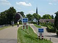 Welcome to Aerdt
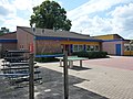 School in Aerdt
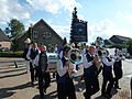 Drumming band


References
- "Kerncijfers wijken en buurten 2021". Central Bureau of Statistics. Retrieved 26 March 2022.
- "Postcodetool for 6913AA". Actueel Hoogtebestand Nederland (in Dutch). Het Waterschapshuis. Retrieved 26 March 2022.
- "Aerdt - (geografische naam)". Etymologiebank (in Dutch). Retrieved 26 March 2022.
- Ronald Stenvert & Sabine Broekhoven (2000). "Aerdt" (in Dutch). Zwolle: Waanders. ISBN 90 400 9406 3. Retrieved 26 March 2022.
- "Aerdt". Plaatsengids (in Dutch). Retrieved 26 March 2022.
This Gelderland location article is a stub. You can help Wikipedia by expanding it. |
Другой контент может иметь иную лицензию. Перед использованием материалов сайта WikiSort.org внимательно изучите правила лицензирования конкретных элементов наполнения сайта.
WikiSort.org - проект по пересортировке и дополнению контента Википедии