world.wikisort.org - Netherlands
Admiralenbuurt (Dutch pronunciation: [ɑtmiˈraːlənˌbyrt]) or Mecatorbuurt (Dutch pronunciation: [mɛrˈkaːtɔrˌbyrt]) is a neighbourhood of the West borough of Amsterdam, Netherlands. It was constructed in the 1920s. The neighbourhood is bisected by the Admiralengracht. From 1990-2010, it was part of the borough of De Baarsjes; in 2010, it became part of the borough of Amsterdam-West along with the rest of De Baarsjes.[1]
Admiralenbuurt | |
|---|---|
Neighbourhood of Amsterdam-West | |
 Mercatorplein | |
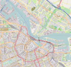  Admiralenbuurt Location in Amsterdam 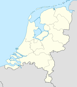 Admiralenbuurt Admiralenbuurt (Netherlands) | |
| Coordinates: 52°22′11.22″N 4°51′10.94″E | |
| Country | Netherlands |
| Province | North Holland |
| Municipality | Amsterdam |
| Borough | West |
| Time zone | CET (UTC+01) |
| • Summer (DST) | CEST (UTC+02) |
References
Neighbourhoods of Amsterdam | ||
|---|---|---|
| Centrum |
|  |
| Nieuw-West |
| |
| Noord |
| |
| Oost |
| |
| West |
| |
| Zuid |
| |
| Zuidoost |
| |
| Westpoort |
| |
| Weesp |
| |
Former boroughs: De Baarsjes - Geuzenveld-Slotermeer - Oost-Watergraafsmeer - Oud-West - Oud-Zuid - Slotervaart - Westerpark - Zeeburg - Zuideramstel | ||
 | This North Holland location article is a stub. You can help Wikipedia by expanding it. |
Текст в блоке "Читать" взят с сайта "Википедия" и доступен по лицензии Creative Commons Attribution-ShareAlike; в отдельных случаях могут действовать дополнительные условия.
Другой контент может иметь иную лицензию. Перед использованием материалов сайта WikiSort.org внимательно изучите правила лицензирования конкретных элементов наполнения сайта.
Другой контент может иметь иную лицензию. Перед использованием материалов сайта WikiSort.org внимательно изучите правила лицензирования конкретных элементов наполнения сайта.
2019-2026
WikiSort.org - проект по пересортировке и дополнению контента Википедии
WikiSort.org - проект по пересортировке и дополнению контента Википедии