world.wikisort.org - Nepal
Tadi is a Rural municipality located within the Nuwakot District of the Bagmati Province of Nepal. The municipality spans 69.80 square kilometres (26.95 sq mi) of area, with a total population of 17,932 according to a 2011 Nepal census.[1][2]
Tadi (RM)
तादी गाउँपालिका | |
|---|---|
Rural Municipality | |
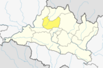
 Tadi (RM) Location  Tadi (RM) Tadi (RM) (Nepal) | |
| Coordinates: 27°55′16″N 85°18′27″E | |
| Country | |
| Province | Bagmati |
| District | Nuwakot |
| Wards | 6 |
| Established | 10 March 2017 |
| Government | |
| • Type | Rural Council |
| • Chairperson | Mr. Narayan Prasad Pandey |
| • Vice-chairperson | Mrs. Ishwari Upreti |
| • Term of office | (2017 - 2022) |
| Area | |
| • Total | 69.80 km2 (26.95 sq mi) |
| Population (2011) | |
| • Total | 17,932 |
| • Density | 260/km2 (670/sq mi) |
| Time zone | UTC+5:45 (Nepal Standard Time) |
| Headquarter | Kharanitar |
| Website | tadimun |
On March 10, 2017, the Government of Nepal restructured the local level bodies into 753 new local level structures.[3][4] The previous Urleni, Ralukadevi, Kharanitar, Samundradevi and Narjamandap VDCs were merged to form Tadi Rural Municipality. Tadi is divided into 6 wards, with Kharanitar declared the administrative center of the rural municipality.
References
- "District Corrected Last for RAJAPATRA" (PDF). www.mofald.gov.np. Retrieved 17 July 2018.
- "स्थानीय तहहरुको विवरण" [Details of the local level bodies]. www.mofald.gov.np/en (in Nepali). Ministry of Federal Affairs and Local Development. Retrieved 17 July 2018.
- "New local level structure comes into effect from today". www.thehimalayantimes.com. The Himalayan Times. 10 March 2017. Retrieved 17 July 2018.
- "New local level units come into existence". www.kathmandupost.ekantipur.com. 11 March 2017. Retrieved 18 July 2018.
External links
Nuwakot District | ||
|---|---|---|
Headquarters: Bidur | ||
| Municipalities |
|  |
| Rural municipalities |
| |
| Former VDCs |
| |
This article about a location in Bagmati Province of Nepal is a stub. You can help Wikipedia by expanding it. |
Текст в блоке "Читать" взят с сайта "Википедия" и доступен по лицензии Creative Commons Attribution-ShareAlike; в отдельных случаях могут действовать дополнительные условия.
Другой контент может иметь иную лицензию. Перед использованием материалов сайта WikiSort.org внимательно изучите правила лицензирования конкретных элементов наполнения сайта.
Другой контент может иметь иную лицензию. Перед использованием материалов сайта WikiSort.org внимательно изучите правила лицензирования конкретных элементов наполнения сайта.
2019-2026
WikiSort.org - проект по пересортировке и дополнению контента Википедии
WikiSort.org - проект по пересортировке и дополнению контента Википедии